Vining, Minnesota

Last updated
Vining
Vining, Minnesota.jpg
Buildings along Front Street.
Otter Tail County Minnesota Incorporated and Unincorporated areas Vining Highlighted.svg
Location of Vining, Minnesota
Coordinates: 46°15′43″N95°32′06″W / 46.26194°N 95.53500°W / 46.26194; -95.53500
CountryUnited States
State Minnesota
County Otter Tail
Founded1882
Incorporated1909
Area
[1]
  Total1.19 sq mi (3.08 km2)
  Land1.15 sq mi (2.98 km2)
  Water0.04 sq mi (0.10 km2)
Elevation
[2]
1,401 ft (427 m)
Population
 (2020) [3]
  Total62
  Estimate 
(2021) [4]
59
  Density53.91/sq mi (20.81/km2)
Time zone UTC-6 (CST)
  Summer (DST) UTC-5 (CDT)
ZIP code
56588
Area code 218
FIPS code 27-67216 [5]
GNIS feature ID2397145 [2]

Vining is a city in Otter Tail County, Minnesota, United States. The population was 62 at the 2020 census. [3]

Contents

History

Vining was platted in 1882. [6] A post office has been in operation at Vining since 1882. [7] Vining was incorporated in 1909. [6]

Nyberg Park, located on Front Street, features a collection of scrap metal sculptures created by Vining resident Ken Nyberg. [8]

Metal sculptures at Nyberg Park. NybergSculpturePark.jpg
Metal sculptures at Nyberg Park.

Geography

According to the United States Census Bureau, the city has a total area of 1.32 square miles (3.42 km2), of which 1.28 square miles (3.32 km2) is land and 0.04 square miles (0.10 km2) is water. [9]

Minnesota State Highway 210 serves as a main route in the community.

Demographics

Historical population
CensusPop.Note
1900 249
1910 212−14.9%
1920 24113.7%
1930 222−7.9%
1940 176−20.7%
1950 1802.3%
1960 136−24.4%
1970 121−11.0%
1980 87−28.1%
1990 84−3.4%
2000 68−19.0%
2010 7814.7%
2020 62−20.5%
2021 (est.)59 [4] −4.8%
U.S. Decennial Census [10]
2020 Census [3]

2010 census

As of the census of 2010, there were 78 people, 34 households, and 20 families living in the city. The population density was 60.9 inhabitants per square mile (23.5/km2). There were 43 housing units at an average density of 33.6 per square mile (13.0/km2). The racial makeup of the city was 91.0% White and 9.0% from two or more races. Hispanic or Latino of any race were 1.3% of the population.

There were 34 households, of which 17.6% had children under the age of 18 living with them, 44.1% were married couples living together, 8.8% had a female householder with no husband present, 5.9% had a male householder with no wife present, and 41.2% were non-families. 41.2% of all households were made up of individuals, and 23.5% had someone living alone who was 65 years of age or older. The average household size was 2.29 and the average family size was 3.00.

The median age in the city was 46.5 years. 20.5% of residents were under the age of 18; 11.5% were between the ages of 18 and 24; 17.8% were from 25 to 44; 21.7% were from 45 to 64; and 28.2% were 65 years of age or older. The gender makeup of the city was 52.6% male and 47.4% female.

2000 census

As of the census of 2000, there were 68 people, 32 households, and 20 families living in the city. The population density was 53.6 inhabitants per square mile (20.7/km2). There were 46 housing units at an average density of 36.3 per square mile (14.0/km2). The racial makeup of the city was 95.59% White, and 4.41% from two or more races.

There were 32 households, out of which 21.9% had children under the age of 18 living with them, 56.3% were married couples living together, 3.1% had a female householder with no husband present, and 37.5% were non-families. 37.5% of all households were made up of individuals, and 21.9% had someone living alone who was 65 years of age or older. The average household size was 2.13 and the average family size was 2.75.

In the city, the population was spread out, with 19.1% under the age of 18, 2.9% from 18 to 24, 25.0% from 25 to 44, 20.6% from 45 to 64, and 32.4% who were 65 years of age or older. The median age was 50 years. For every 100 females, there were 106.1 males. For every 100 females age 18 and over, there were 96.4 males.

The median income for a household in the city was $21,250, and the median income for a family was $41,875. Males had a median income of $26,667 versus $21,875 for females. The per capita income for the city was $17,866. There were no families and 9.4% of the population living below the poverty line, including no under eighteens and 11.8% of those over 64.

Notable person

Vining is the hometown of NASA astronaut Karen Nyberg. [11]

Related Research Articles

<span class="mw-page-title-main">Sale City, Georgia</span> Town in Georgia, United States

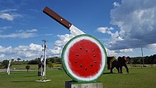
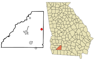
Sale City is a town in Mitchell County, Georgia, United States. The population was 354 at the 2020 census.

Rock Island Arsenal is a census-designated place (CDP) in Rock Island County, Illinois, United States. The population was 149 at the 2010 census. The island contains the Rock Island National Cemetery.

<span class="mw-page-title-main">Garber, Iowa</span> City in Iowa, United States

Garber is a city in Clayton County, Iowa, United States. The population was 76 at the time of the 2020 census, down from 103 in 2000.

<span class="mw-page-title-main">Merryville, Louisiana</span> Town in Louisiana, United States

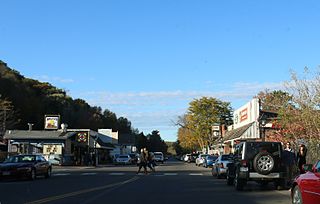
Merryville is a town in Beauregard Parish, Louisiana, United States. The population was 1,103 at the 2010 census. It is part of the DeRidder Micropolitan Statistical Area.

<span class="mw-page-title-main">Martin, Michigan</span> Village in Michigan, United States

Martin is a village in southeastern Allegan County in the U.S. state of Michigan. The population was 410 at the 2010 census.

<span class="mw-page-title-main">Ramsey, Minnesota</span> City in Minnesota, United States

Ramsey is a suburb 22 miles north-northwest of downtown Minneapolis in Anoka County, Minnesota, United States. The population was 27,646 at the 2020 census. It is a northwest suburb of the Twin Cities.

<span class="mw-page-title-main">Solway, Minnesota</span> City in Minnesota, United States

Solway is a city in Beltrami County, Minnesota, United States. The population was 96 at the 2010 census. Solway serves as a bedroom community for nearby Bemidji.

<span class="mw-page-title-main">Taylors Falls, Minnesota</span> City in Minnesota, United States

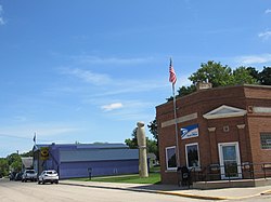
Taylors Falls is a city in Chisago County, Minnesota, United States, located at the junction of U.S. Highway 8 and Minnesota State Highway 95. The population was 1,055 at the 2020 census.

<span class="mw-page-title-main">Halma, Minnesota</span> City in Minnesota, United States

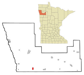
Halma is a city in Kittson County, Minnesota, United States. The population was 58 at the 2020 census.

<span class="mw-page-title-main">Deer Creek, Minnesota</span> City in Minnesota, United States

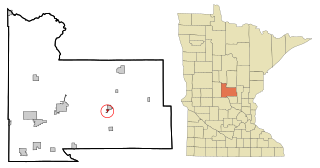
Deer Creek is a city in Otter Tail County, Minnesota, United States. The population was 330 at the 2020 census.

<span class="mw-page-title-main">Henning, Minnesota</span> City in Minnesota, United States

Henning is a city in Otter Tail County, Minnesota, United States. The population was 854 at the 2020 census.

<span class="mw-page-title-main">Ottertail, Minnesota</span> City in Minnesota, United States

Ottertail is a city in Otter Tail County, Minnesota, United States. The population was 629 at the 2020 census.

<span class="mw-page-title-main">Richville, Minnesota</span> City in Minnesota, United States

Richville is a city in Otter Tail County, Minnesota, United States. The population was 77 as of the 2020 census.

<span class="mw-page-title-main">Vergas, Minnesota</span> City in Minnesota, United States

Vergas is a city in northern Otter Tail County, Minnesota, United States. The population was 348 at the 2020 census.

<span class="mw-page-title-main">Kerrick, Minnesota</span> City in Minnesota, United States

Kerrick is a city in Pine County, Minnesota, United States. The population was 65 at the 2010 census.

<span class="mw-page-title-main">Beltrami, Minnesota</span> City in Minnesota, United States

Beltrami is a city in Polk County, Minnesota, United States and was named in honor of Giacomo Costantino Beltrami, an Italian exile, who traveled to the Red river and the upper Mississippi in 1823. Officially incorporated in 1902, there had been settlers in the area since 1870. It is part of the Grand Forks, ND-MN Metropolitan Statistical Area. The population was 88 at the 2020 census.

<span class="mw-page-title-main">Steen, Minnesota</span> City in Minnesota, United States

Steen is a city in Rock County, Minnesota, United States. The population was 180 at the 2010 census.

<span class="mw-page-title-main">Genola, Minnesota</span> City in Minnesota, United States

Genola is a city in Morrison County, Minnesota, United States. The population was 70 at the 2020 census.

<span class="mw-page-title-main">St. Anthony, Stearns County, Minnesota</span> City in Minnesota, United States

St. Anthony is a city in Stearns County, Minnesota, United States. The population was 86 at the 2010 census. It is part of the St. Cloud Metropolitan Statistical Area. Main routes include Minnesota State Highway 238, Stearns County Road 153, and Trobec Street.

<span class="mw-page-title-main">Minnesota Lake, Minnesota</span> City in Minnesota, United States

Minnesota Lake is a city in Blue Earth and Faribault counties in the State of Minnesota. The population was 661 at the 2020 census. The bulk of the city is in Faribault County; a small part extends into Blue Earth County.

References

  1. "2020 U.S. Gazetteer Files". United States Census Bureau. Retrieved July 24, 2022.
  2. 1 2 U.S. Geological Survey Geographic Names Information System: Vining, Minnesota
  3. 1 2 3 "Explore Census Data". United States Census Bureau . Retrieved May 8, 2022.
  4. 1 2 "City and Town Population Totals: 2020-2021". United States Census Bureau. June 24, 2022. Retrieved June 24, 2022.
  5. "U.S. Census website". United States Census Bureau . Retrieved January 31, 2008.
  6. 1 2 Upham, Warren (1920). Minnesota Geographic Names: Their Origin and Historic Significance. Minnesota Historical Society. p.  399.
  7. "Otter Tail County". Jim Forte Postal History. Retrieved July 28, 2015.
  8. "Taking life one sculpture at a time". Alexandria Echo Press. April 5, 2018. Retrieved July 27, 2021.
  9. "US Gazetteer files 2010". United States Census Bureau. Archived from the original on January 25, 2012. Retrieved November 13, 2012.
  10. "Census of Population and Housing". Census.gov. Retrieved June 4, 2015.
  11. "Astronaut Bio: Karen L. Nyberg (11/2013)". www.jsc.nasa.gov. 11 February 2015.

46°15′47″N95°32′13″W / 46.26306°N 95.53694°W / 46.26306; -95.53694