Dent, Minnesota

Last updated

Dent
DentMN-mainstreetbusinesses.jpg
Businesses on Dent's Main Street.
Otter Tail County Minnesota Incorporated and Unincorporated areas Dent Highlighted.svg
Location of Dent, Minnesota
Coordinates: 46°33′11″N95°43′08″W / 46.55306°N 95.71889°W / 46.55306; -95.71889
CountryUnited States
State Minnesota
County Otter Tail
Founded1903
IncorporatedSeptember 6, 1904
Area
[1]
  Total0.37 sq mi (0.95 km2)
  Land0.36 sq mi (0.94 km2)
  Water0.00 sq mi (0.01 km2)
Elevation
[2]
1,368 ft (417 m)
Population
 (2020) [3]
  Total173
  Estimate 
(2021) [4]
170
  Density477.90/sq mi (184.66/km2)
Time zone UTC-6 (CST)
  Summer (DST) UTC-5 (CDT)
ZIP code
56528
Area code 218
FIPS code 27-15724
GNIS feature ID2394517 [2]

Dent is a city in Otter Tail County, Minnesota, United States. The population was 173 at the 2020 census. [3]

Contents

History

A post office called Dent has been in operation since 1900. [5] Dent was platted in 1903, and was incorporated on September 6, 1904. [6] The name's origin is obscure; [7] some say it came from Henry Dent, a railroad official.[ citation needed ]

Sign welcoming visitors to Dent. DentMN-welcomesign.jpg
Sign welcoming visitors to Dent.

Geography

According to the United States Census Bureau, the city has an area of 0.38 square miles (0.98 km2), all land. [8]

The area is mainly flat, with several ponds and lakes surrounding the outskirts of downtown. Minnesota State Highway 108 serves as a main route in the community.

Demographics

Historical population
CensusPop.Note
1910 244
1920 221−9.4%
1930 2241.4%
1940 204−8.9%
1950 187−8.3%
1960 176−5.9%
1970 156−11.4%
1980 1677.1%
1990 1776.0%
2000 1928.5%
2010 1920.0%
2020 173−9.9%
2021 (est.)170 [4] −1.7%
U.S. Decennial Census [9]
2020 Census [3]

2010 census

As of the census of 2010, there were 192 people, 78 households, and 53 families living in the city. The population density was 505.3 inhabitants per square mile (195.1/km2). There were 88 housing units at an average density of 231.6 per square mile (89.4/km2). The racial makeup of the city was 95.3% White, 1.0% Native American, and 3.6% from two or more races. Hispanic or Latino of any race were 1.0% of the population.

There were 78 households, out of which 29.5% had children under the age of 18 living with them, 52.6% were married couples living together, 10.3% had a female householder with no husband present, 5.1% had a male householder with no wife present, and 32.1% were non-families. 26.9% of all households were made up of individuals, and 7.6% had someone living alone who was 65 years of age or older. The average household size was 2.46 and the average family size was 2.92.

The median age in the city was 38.3 years. 25.5% of residents were under the age of 18; 8.3% were between the ages of 18 and 24; 22.4% were from 25 to 44; 29.2% were from 45 to 64; and 14.6% were 65 years of age or older. The gender makeup of the city was 45.8% male and 54.2% female.

2000 census

As of the census of 2000, there were 194 people, 77 households, and 49 families living in the city. The population density was 501.0 inhabitants per square mile (193.4/km2). There were 80 housing units at an average density of 208.7 per square mile (80.6/km2). The racial makeup of the city was 100.00% White.

There were 77 households, out of which 33.8% had children under the age of 18 living with them, 57.1% were married couples living together, 3.9% had a female householder with no husband present, and 35.1% were non-families. 32.5% of all households were made up of individuals, and 14.3% had someone living alone who was 65 years of age or older. The average household size was 2.49 and the average family size was 3.18.

In the city, the population was spread out, with 28.6% under the age of 18, 5.7% from 18 to 24, 30.2% from 25 to 44, 20.3% from 45 to 64, and 15.1% who were 65 years of age or older. The median age was 37 years. For every 100 females, there were 93.9 males. For every 100 females age 18 and over, there were 104.5 males.

The median income for a household in the city was $30,938, and the median income for a family was $34,167. Males had a median income of $27,321 versus $15,417 for females. The per capita income for the city was $12,024. About 3.7% of families and 12.9% of the population were below the poverty line, including 14.1% of those under the age of eighteen and 20.7% of those 65 or over.

Related Research Articles

<span class="mw-page-title-main">Garfield, Minnesota</span> City in Minnesota, United States

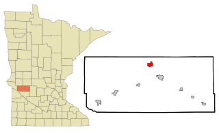
Garfield is a city in Douglas County, Minnesota, United States. The population was 349 at the 2020 census.

<span class="mw-page-title-main">Nelson, Minnesota</span> City in Minnesota, United States

Nelson is a city in Douglas County, Minnesota, United States. The population was 182 at the 2020 census.

<span class="mw-page-title-main">Lake Bronson, Minnesota</span> City in Minnesota, United States

Lake Bronson is a city in Kittson County, Minnesota, United States. The population was 178 at the 2020 census. Lake Bronson State Park is nearby.

<span class="mw-page-title-main">Bluffton, Minnesota</span> City in Minnesota, United States

Bluffton is a city in Otter Tail County, Minnesota, United States, along the Leaf River. The population was 210 at the 2020 census.

<span class="mw-page-title-main">Deer Creek, Minnesota</span> City in Minnesota, United States

Deer Creek is a city in Otter Tail County, Minnesota, United States. The population was 330 at the 2020 census.

<span class="mw-page-title-main">Elizabeth, Minnesota</span> City in Minnesota, United States

Elizabeth is a city in Otter Tail County, Minnesota, United States. The population was 168 at the 2020 census.

<span class="mw-page-title-main">Erhard, Minnesota</span> City in Minnesota, United States

Erhard is a city in Otter Tail County, Minnesota, United States. The population was 132 at the 2020 census.

<span class="mw-page-title-main">Henning, Minnesota</span> City in Minnesota, United States

Henning is a city in Otter Tail County, Minnesota, United States. The population was 854 at the 2020 census.

<span class="mw-page-title-main">Ottertail, Minnesota</span> City in Minnesota, United States

Ottertail is a city in Otter Tail County, Minnesota, United States. The population was 629 at the 2020 census.

<span class="mw-page-title-main">Villard, Minnesota</span> City in Minnesota, United States

Villard is a city in Pope County, Minnesota, United States. The population was 225 at the 2020 census.

<span class="mw-page-title-main">Orr, Minnesota</span> City in Minnesota, United States

Orr is a city in Saint Louis County, Minnesota, United States. The population was 211 at the 2020 census.

<span class="mw-page-title-main">Lake Henry, Minnesota</span> City in Minnesota, United States

Lake Henry is a city in Stearns County, Minnesota, United States. The population was 103 at the 2010 census. It is part of the St. Cloud Metropolitan Statistical Area.

<span class="mw-page-title-main">Clontarf, Minnesota</span> City in Minnesota, United States

Clontarf is a city in Swift County, Minnesota, United States. The population was 164 at the 2010 census.

<span class="mw-page-title-main">Campbell, Minnesota</span> City in Minnesota, United States

Campbell is a city in Wilkin County, Minnesota, United States. The population was 164 at the 2020 census. It is part of the Wahpeton, ND-MN Micropolitan Statistical Area.

<span class="mw-page-title-main">Minnesota City, Minnesota</span> City in Minnesota, United States

Minnesota City is a city in Winona County, Minnesota, United States. The population was 202 at the 2020 census.

<span class="mw-page-title-main">Fifty Lakes, Minnesota</span> City in Minnesota, United States

Fifty Lakes is a city in Crow Wing County, Minnesota, United States. The population was 387 at the 2010 census. It is part of the Brainerd Micropolitan Statistical Area.

<span class="mw-page-title-main">Minnesota Lake, Minnesota</span> City in Minnesota, United States

Minnesota Lake is a city in Blue Earth and Faribault counties in the State of Minnesota. The population was 661 at the 2020 census. The bulk of the city is in Faribault County; a small part extends into Blue Earth County.

<span class="mw-page-title-main">Dennison, Minnesota</span> City in Minnesota, United States

Dennison is a city in Goodhue and Rice counties in the U.S. state of Minnesota. The population was 212 at the 2010 census. Most of Dennison is in Goodhue County, with only a small part that extends into Rice County.

<span class="mw-page-title-main">Ormsby, Minnesota</span> City in Minnesota, United States

Ormsby is a city in Martin and Watonwan counties in the U.S. state of Minnesota. The population was 131 at the 2010 census.

<span class="mw-page-title-main">Minneiska, Minnesota</span> City in Minnesota, United States

Minneiska is a city in Wabasha and Winona counties in the U.S. state of Minnesota. The population was 111 at the 2010 census.

References

  1. "2020 U.S. Gazetteer Files". United States Census Bureau. Retrieved July 24, 2022.
  2. 1 2 U.S. Geological Survey Geographic Names Information System: Dent, Minnesota
  3. 1 2 3 "Explore Census Data". United States Census Bureau . Retrieved May 6, 2022.
  4. 1 2 "City and Town Population Totals: 2020-2021". United States Census Bureau. June 24, 2022. Retrieved June 24, 2022.
  5. "Otter Tail County". Jim Forte Postal History. Archived from the original on March 2, 2016. Retrieved July 28, 2015.
  6. Upham, Warren (1920). Minnesota Geographic Names: Their Origin and Historic Significance. Minnesota Historical Society. p.  393.
  7. Moyer, Armond; Moyer, Winifred (1958). The origins of unusual place-names. Keystone Pub. Associates. p. 141.
  8. "US Gazetteer files 2010". United States Census Bureau. Archived from the original on January 25, 2012. Retrieved November 13, 2012.
  9. United States Census Bureau. "Census of Population and Housing" . Retrieved September 10, 2013.