The Mizo people, historically recorded as the Lushais, are an ethnic group native to the state of Mizoram in India and neighbouring states of Northeast India. The majority of Mizos outside of India reside in the town of Kalay in Myanmar, making up 55% of the town's population. They speak the Tibeto-Burman language of Mizo, the official language and lingua franca of Mizoram. The state has one of the highest literacy rates in India, at more than 90%.

Mamit district is one of the eleven districts of Mizoram state in India.
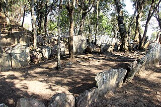
Champhai district is one of the eleven districts of Mizoram state in India. The district is bounded on the north by Churachandpur district of Manipur state, on the west by Saitual and Serchhip districts, and on the south and east by Myanmar. The district occupies an area of 3,185.83 km2 (1,230.06 sq mi). Champhai town is the administrative headquarters of the district.
Hnahlan is a border town in the Champhai Rural Development Block of Champhai district of Mizoram state in India.
Zote is a village in Champhai block of Champhai District, Mizoram state, India.
Samthang is a village in the Champhai district of Mizoram, India. It is located in the Khawbung R.D. Block.
Sângthankima is a humanitarian and social worker in Mizoram, India. He is the founder of Thutak Nunpuitu Team (TNT), a voluntary organisation, which runs the largest charitable institution in Mizoram. His institution, a registered society since 1991 under the Firms and Societies in India, started as a rehabilitation society for alcoholics in Champhai town. With donation of a plot of land in Aizawl city, it expanded into an orphanage with formal school, health centre, and sanatorium. In addition to more than a dozen of awards for his social service, Sangthankima has received an honorary doctorate (D.H.L.) from Rangoon's Methodist Bible College in 2008, Achievers Award 2013 For NGO, Mother Teresa Awards for Social Justice in 2014, and the Mizo Award of 2014.
North Khawbung is a village located in Champhai district of Mizoram, India. It is located in the Champhai R.D. Block.
Lianpui is a village in the Champhai district of Mizoram, India. It is located in the Khawbung R.D. Block.
Khankawn is a village in the Champhai district of Mizoram, India. It is located in the Khawbung R.D. Block.
E. Chawngtui is a village in the Champhai district of Mizoram, India. It is located in the Khawbung R.D. Block.
Zawngtetui is a village in the Champhai district of Mizoram, India. It is located in the Khawbung rural development block.

Zokhawthar is a border town in the Champhai district of Mizoram state of India.
Mizoram is a state in the northeast of India. Mizoram is considered by many as a beautiful place due to its landscape and pleasant climate. There have been many attempts to increase revenue through tourism but many potential tourists find the lack of amenities to be a hurdle. However, the State continues to promote itself and many projects have been initiated. The tourism ministry continues to maintain or upgrade its tourist lodges throughout the state. Foreign tourists are required to obtain an 'inner line permit' under the special permit before visiting. The permit can be obtained from Indian missions abroad for a limited number of days or direct from Mizoram Government authorities within India. The state is rich in bird diversity, which has the potentiality to make it a major birding destination. Mizoram is a stronghold for Mrs. Hume's pheasant. There is also a rare record of the wild water buffalo from the state. There are several past records of the Sumatran rhinoceros from Mizoram, then Lushai Hills. The small population of wild elephants can be seen in Ngengpui and Dampa Sanctuaries.
Leisenzo is a village in the Champhai district of Mizoram, India. It is located in the Khawbung R.D. Block.
South Khawbung is a village in the Champhai district of Mizoram, India. It is located in the Khawbung R.D. Block.
Khuangleng is a village in the Champhai district of Mizoram, India. It is located in the Khawbung R.D. Block.
Bulfekzawl is a village in the Champhai district of Mizoram, India. It is located in the Khawbung R.D. Block.
Leithum is a village in the Champhai district of Mizoram, India. It is located in the Khawbung R.D. Block.
New Dungtlang is a village in the Champhai district of Mizoram, India. It is located in the Khawbung R.D. Block.


