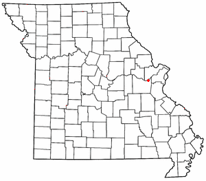
Boonville Correctional Center (BCC) is located at 1216 East Morgan Street in Boonville, Missouri. It is a minimum security (C-2 state penitentiary housing approximately 1,316 male inmates, predominantly young first offenders.

House Springs is an unincorporated community in Jefferson County, Missouri, United States. It is located just off Route 30, at the intersection with Routes MM and W near Byrnes Mill.
Labadie is an unincorporated community in Franklin County, Missouri, United States. It is located approximately three miles north of Gray Summit. The community is named after Sylvester L'Abaddie, a hunter who was killed by a bear in nearby Labaddie's Cave. A county history published in 1968, however, records that he "died peacefully in his bed in his 70th year, on July 25, 1849, at his home on Olive Street in St. Louis." Labadie post office was established June 7, 1855. Labaddie Creek enters the Missouri River here, and this was the location of Labaddie Station of the Missouri Pacific Railroad.

This is a list of properties and historic districts in Missouri on the National Register of Historic Places. There are NRHP listings in all of Missouri's 114 counties and the one independent city of St. Louis.

This list is of the properties and historic districts that are designated on the National Register of Historic Places or that were formerly so designated, in Hennepin County, Minnesota; there are 169 entries as of November 2018. A significant number of these properties are a result of the establishment of Fort Snelling, the development of water power at Saint Anthony Falls, and the thriving city of Minneapolis that developed around the falls. Many historic sites outside the Minneapolis city limits are associated with pioneers who established missions, farms, and schools in areas that are now suburbs in that metropolitan area.

This is a complete list of National Register of Historic Places listings in Ramsey County, Minnesota. It is intended to be a complete list of the properties and districts on the National Register of Historic Places in Ramsey County, Minnesota, United States. The locations of National Register properties and districts for which the latitude and longitude coordinates are included below, may be seen in an online map.

The Sanford F. Conley House is a historic home located at Columbia, Missouri. It is an ornate 19th century residence in the Italianate architectural style. Built in 1868 as a residence for the Conley family. The house is near the University of Missouri campus. After being added to the National Register of Historic Places in 1973 the house was purchased by the university and houses the school's "excellence in teaching" program.

The Harry S. Truman Farm Home, also known as the Solomon Young Farm, is a historic farm property at 12301 Blue Ridge Blvd in Grandview, Missouri. The farm property, first developed in the 1860s, was the residence of future U.S. president Harry S. Truman from 1906 to 1917. The house is part of Harry S. Truman National Historic Site, and is a designated National Historic Landmark.

This is a list of the National Register of Historic Places listings in Rice County, Minnesota. It is intended to be a complete list of the properties and districts on the National Register of Historic Places in Rice County, Minnesota, United States. The locations of National Register properties and districts for which the latitude and longitude coordinates are included below, may be seen in an online map.

This is a list of the National Register of Historic Places listings in Stearns County, Minnesota. It is intended to be a complete list of the properties and districts on the National Register of Historic Places in Stearns County, Minnesota, United States. The locations of National Register properties and districts for which the latitude and longitude coordinates are included below, may be seen in an online map.
This is a list of the National Register of Historic Places listings in Brown County, Minnesota. It is intended to be a complete list of the properties and districts on the National Register of Historic Places in Brown County, Minnesota, United States. The locations of National Register properties and districts for which the latitude and longitude coordinates are included below, may be seen in an online map.

Van Meter State Park is a public recreation area on the Missouri River in Saline County, Missouri. The state park consists of 1,105 acres (447 ha) of hills, ravines, fresh water marsh, fens, and bottomland and upland forests in an area known as "the Pinnacles." The park has several archaeological sites, a cultural center, and facilities for camping, hiking, and fishing. It is managed by the Missouri Department of Natural Resources.

This is a list of the National Register of Historic Places listings in Winona County, Minnesota. It is intended to be a complete list of the properties and districts on the National Register of Historic Places in Winona County, Minnesota, United States. The locations of National Register properties and districts for which the latitude and longitude coordinates are included below, may be seen in an online map.

This is a list of the National Register of Historic Places listings in Wabasha County, Minnesota. It is intended to be a complete list of the properties and districts on the National Register of Historic Places in Wabasha County, Minnesota, United States. The locations of National Register properties and districts for which the latitude and longitude coordinates are included below, may be seen in an online map.

This is a list of the National Register of Historic Places listings in Rock County, Minnesota. It is intended to be a complete list of the properties and districts on the National Register of Historic Places in Rock County, Minnesota, United States. The locations of National Register properties and districts for which the latitude and longitude coordinates are included below, may be seen in an online map.

The John W. Boone House, also known as the Stuart P. Parker Funeral Home, is a historic home located at Columbia, Missouri. It was built about 1890, and is a two-story frame house that measures roughly 46 feet by 45 feet. It was the home of ragtime musician John William 'Blind' Boone. The home, which is owned by the City of Columbia, had fallen into a state of severe disrepair, but is now under restoration

This is a list of the National Register of Historic Places listings in Faribault County, Minnesota. This is intended to be a complete list of the properties and districts on the National Register of Historic Places in Faribault County, Minnesota, United States. The locations of National Register properties and districts for which the latitude and longitude coordinates are included below, may be seen in an online map.

The Missouri State Teachers Association Building is a historic building located at Columbia, Missouri. It was built in 1927 and houses the Missouri State Teachers Association Headquarters. The building is located on South 6th Street on the University of Missouri campus and is a two-story, Tudor Revival style brick building. It was the first building in the United States built specifically to house a state teachers association. A historical marker on the site commemorates the lands former tenant "Columbia College," the forerunner of the University of Missouri.

Belspring is a census-designated place (CDP) in Pulaski County, Virginia, United States, located at an elevation of 1,778 feet (542 m) above sea level. It has the ZIP Code 24058 and the area code 540. The population of the CDP was 256 at the 2010 Census.


