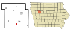
Wall Lake, Iowa | |
---|---|
Motto: City of Energy | |
Coordinates: 42°16′16″N95°5′30″W / 42.27111°N 95.09167°W | |
Country | United States |
State | Iowa |
County | Sac |
Area | |
• Total | 1.15 sq mi (2.97 km2) |
• Land | 1.15 sq mi (2.97 km2) |
• Water | 0.00 sq mi (0.00 km2) |
Elevation | 1,257 ft (383 m) |
Population (2020) | |
• Total | 755 |
• Density | 659.39/sq mi (254.48/km2) |
Time zone | UTC-6 (Central (CST)) |
• Summer (DST) | UTC-5 (CDT) |
ZIP code | 51466 |
Area code | 712 |
FIPS code | 19-82020 |
GNIS feature ID | 0462614 |
Website | http://www.walllake.com |
Wall Lake is a city in Sac County, Iowa, United States. The population was 755 at the time of the 2020 census. [2]
Wall Lake was platted in 1877. [3] The city took its name from nearby Wall Lake. [4]
Wall Lake is located at 42°16′16″N95°5′30″W / 42.27111°N 95.09167°W (42.271141, -95.091724). [5]
According to the United States Census Bureau, the city has a total area of 1.23 square miles (3.19 km2), all land. [6]
Year | Pop. | ±% |
---|---|---|
1880 | 208 | — |
1890 | 439 | +111.1% |
1900 | 659 | +50.1% |
1910 | 561 | −14.9% |
1920 | 737 | +31.4% |
1930 | 749 | +1.6% |
1940 | 762 | +1.7% |
1950 | 753 | −1.2% |
1960 | 812 | +7.8% |
1970 | 936 | +15.3% |
1980 | 892 | −4.7% |
1990 | 875 | −1.9% |
2000 | 841 | −3.9% |
2010 | 819 | −2.6% |
2020 | 755 | −7.8% |
Source: "U.S. Census website". United States Census Bureau . Retrieved March 29, 2020. and Iowa Data Center Source: |
As of the census of 2020, [8] there were 755 people, 325 households, and 186 families residing in the city. The population density was 659.1 inhabitants per square mile (254.5/km2). There were 354 housing units at an average density of 309.0 per square mile (119.3/km2). The racial makeup of the city was 96.7% White, 0.1% Black or African American, 0.0% Native American, 0.0% Asian, 0.1% Pacific Islander, 0.9% from other races and 2.1% from two or more races. Hispanic or Latino persons of any race comprised 1.6% of the population.
Of the 325 households, 23.7% of which had children under the age of 18 living with them, 42.8% were married couples living together, 4.9% were cohabitating couples, 29.2% had a female householder with no spouse or partner present and 23.1% had a male householder with no spouse or partner present. 42.8% of all households were non-families. 37.5% of all households were made up of individuals, 21.2% had someone living alone who was 65 years old or older.
The median age in the city was 47.4 years. 24.9% of the residents were under the age of 20; 3.6% were between the ages of 20 and 24; 19.1% were from 25 and 44; 22.9% were from 45 and 64; and 29.5% were 65 years of age or older. The gender makeup of the city was 48.2% male and 51.8% female.
As of the census [9] of 2010, there were 819 people, 335 households, and 217 families living in the city. The population density was 665.9 inhabitants per square mile (257.1/km2). There were 366 housing units at an average density of 297.6 per square mile (114.9/km2). The racial makeup of the city was 99.8% White, 0.1% Asian, and 0.1% from two or more races. Hispanic or Latino of any race were 0.1% of the population.
There were 336 households, of which 26.9% had children under the age of 18 living with them, 54.9% were married couples living together, 7.2% had a female householder with no husband present, 2.7% had a male householder with no wife present, and 35.2% were non-families. 32.8% of all households were made up of individuals, and 17.3% had someone living alone who was 65 years of age or older. The average household size was 2.25 and the average family size was 2.84.
The median age in the city was 49.3 years. 22.3% of residents were under the age of 18; 3.9% were between the ages of 18 and 24; 20.1% were from 25 to 44; 25.2% were from 45 to 64; and 28.6% were 65 years of age or older. The gender makeup of the city was 45.9% male and 54.1% female.
As of the census [10] of 2000, there were 841 people, 322 households, and 216 families living in the city. The population density was 776.2 inhabitants per square mile (299.7/km2). There were 338 housing units at an average density of 311.9 per square mile (120.4/km2). The racial makeup of the city was 98.22% White, 0.12% African American, 0.12% Native American, 0.12% Asian, and 1.43% from two or more races. Hispanic or Latino of any race were 0.12% of the population.
There were 326 households, out of which 30.4% had children under the age of 18 living with them, 57.1% were married couples living together, 6.8% had a female householder with no husband present, and 32.9% were non-families. 30.1% of all households were made up of individuals, and 20.2% had someone living alone who was 65 years of age or older. The average household size was 2.40 and the average family size was 3.00.
Age spread: 23.9% under the age of 18, 8.4% from 18 to 24, 21.6% from 25 to 44, 20.2% from 45 to 64, and 25.8% who were 65 years of age or older. The median age was 42 years. For every 100 females, there were 92.0 males. For every 100 females age 18 and over, there were 82.9 males.
The median income for a household in the city was $33,125, and the median income for a family was $38,750. Males had a median income of $27,386 versus $19,375 for females. The per capita income for the city was $15,390. About 7.2% of families and 11.0% of the population were below the poverty line, including 15.8% of those under age 18 and 8.3% of those age 65 or over.
The city is served by the East Sac County Community School District. [11] It was a part of the Wall Lake Community School District until July 1, 1996, when it merged into the Wall Lake View Auburn School District. That in turn merged into East Sac County on July 1, 2011. [12]
Winthrop is a city in Buchanan County, Iowa, United States. The population was 823 at the time of the 2020 census.
Lakeside is a city in Buena Vista County, Iowa, United States. The population was 700 at the time of the 2020 census. It is the most densely populated city in Iowa.
Allison is a city in, and the county seat of, Butler County, Iowa, United States. The population was 966 at the 2020 census. Allison is home to the Butler County Fair. The city was named for U.S. Senator William B. Allison in 1881.
Lewis is a city in Cass County, Iowa, United States, along the East Nishnabotna River. The population was 357 at the time of the 2020 census.
Marcus is a city in Cherokee County, Iowa, United States. The population was 1,079 at the time of the 2020 census.
Okoboji is a city in Dickinson County, Iowa, United States, along the eastern shore of West Okoboji Lake in the Iowa Great Lakes region. At the time of the 2020 census, its population was 768.
Spirit Lake is a city in Dickinson County, Iowa, United States. The population was 5,439 at the 2020 census. It is the county seat of Dickinson County.
Coulter is a city in Franklin County, Iowa, United States. The population was 219 at the 2020 census.
Randall is a city in Hamilton County, Iowa, United States. The population was 154 at the time of the 2020 census.
Monmouth is a city in Jackson County, Iowa, United States. The population was 129 at the time of the 2020 census.
Rolfe is a city in Pocahontas County, Iowa, United States. The population was 509 at the time of the 2020 census.
Auburn is a city in Sac County, Iowa, United States. The population was 265 at the 2020 census.
Lake View is a city in Sac County, Iowa, United States. The population was 1,113 in the 2020 census, a decline from the 1,278 population in 2000.
Sac City is a city in and the county seat of Sac County, Iowa, United States, located just southwest of the eastern intersection of U.S. Routes 20 and 71 in the rolling hills along the valley of the North Raccoon River. The city is one of 45 designated Main Street Iowa communities through the Main Street Iowa development program. The population was 2,063 in the 2020 census, a decline from the population of 2,368 in 2000.
Smithland is a city in Woodbury County, Iowa, United States. It is part of the Sioux City, IA–NE–SD Metropolitan Statistical Area. The population was 181 at the time of the 2020 census.
Twin Lakes is a city in Freeborn County, Minnesota, United States, near Albert Lea. The population was 134 at the 2020 census.
Minnetonka Beach is a community in Hennepin County, Minnesota, United States. The population was 539 at the 2010 census.
West Union is a city in Todd County, Minnesota, United States. The population was 92 at the 2020 census.
Lake Andes is a city in, and the county seat of, Charles Mix County, South Dakota, United States. The population was 710 at the 2020 census.
Clear Lake is a city in and the county seat of Deuel County, South Dakota, United States. The population was 1,218 at the 2020 census.