West Coast, Singapore

Last updated
West Coast
Subzone of Clementi Planning Area
Name transcription(s)
   Chinese 西海岸
   Pinyin Xī Hǎi Án
   Malay Pantai Barat
   Tamil மேற்கு கடலோர
Clementi West New Town (West Coast), Singapore - 20100322.jpg
Coordinates: 1°18′58.6″N103°45′18.3″E / 1.316278°N 103.755083°E / 1.316278; 103.755083
CountryFlag of Singapore.svg  Singapore
Population
 (2019) [1]
  Total6,240

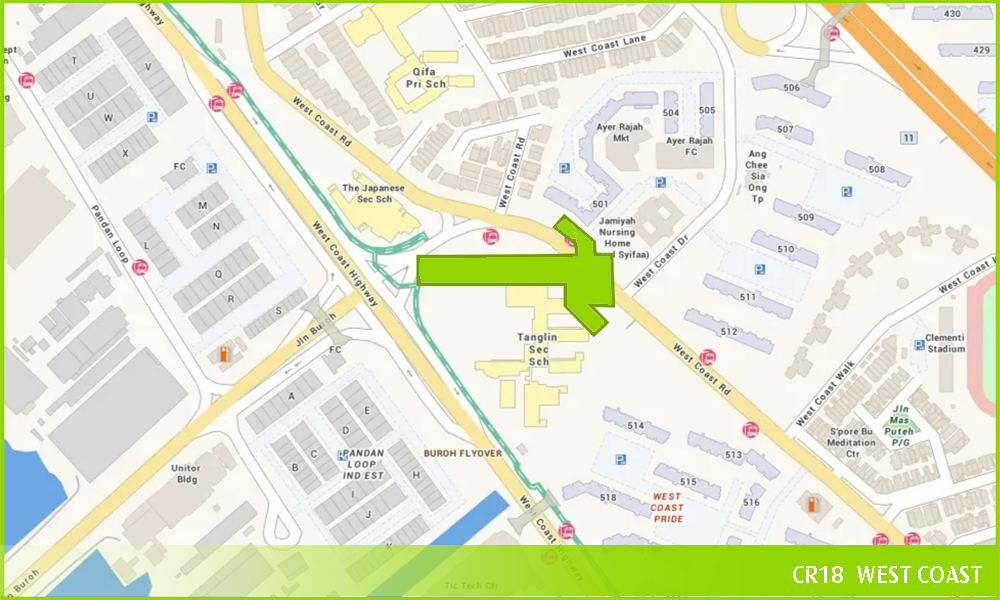
West Coast is a subzone located in the town of Clementi, the western part of Singapore. The subzone currently lies in the West Coast GRC.

Contents

History

West Coast was created out of reclaimed land in the 1970s. Despite both being created out of reclaimed land, the east became a recreational area but the west was filled with industries. The western part of West Coast is largely industrial but the eastern and central parts of the area are mostly filled with private housing along with a single HDB estate. [2]

Amenities

Commercial Facilities

Few amenities exist in the vicinity of private houses and condominiums along West Coast, such as Clementiwoods and Terra Hill. [3] However, a town centre exists in the heart of the HDB housing estate. It consists of two-storey shophouses on Jalan Mas Puteh, Ayer Rajah Food Centre, Ayer Rajah Market, West Coast Community Centre, [4] the Ang Chee Sia Ong Temple, Wu Tai Shan Temple (五台山佛公寺), West Coast Recreational Centre and the well-known West Coast Market Square. West Coast Plaza (formerly known as Ginza Plaza) lies across the market. There are also Buddhist centres like Singapore Buddhist Meditation Centre and Jayamangala Buddhist Vihara in the town.

During weekends, people from other parts of Clementi and the private housing sectors of West Coast will patronise the town centre, which makes it very prosperous and busy. Its hawker centre offers a nice variety of food and popular stalls include the ones selling carrot cake, nasi lemak and satay.

Block 613 at West Coast. Block 613 Clementi West Street 1, Singapore - 20070528.jpg
Block 613 at West Coast.

Transport & Accessibility

SBS Transit Service 143 along West Coast Road. SBS9815H.jpg
SBS Transit Service 143 along West Coast Road.

West Coast is well connected with an array of road networks. There are two parallel primary roads which serve West Coast: West Coast Road and West Coast Highway. Ayer Rajah Expressway is located along the northern boundary of Clementi West. Jalan Buroh and Penjuru Road are located towards the western end of West Coast, where Pandan is located.

West Coast is also connected by a diverse network of public transportation. SBS Transit services 30, 51, 175, 196, 197, 198 SMRT services 176, 188, 189, 963 and Tower Transit services 78, 97, 143, 282, 285 travels through or loops around West Coast and many of the mentioned bus services links West Coast to Clementi MRT station as well as Clementi Bus Interchange.

Recreation

Aerial panorama of the West Coast portion of the Singapore Strait and the Pasir Panjang Port Terminal. Shot in 2016. Aerial panorama of the Singapore Strait and the Pasir Panjang Port Terminal.jpg
Aerial panorama of the West Coast portion of the Singapore Strait and the Pasir Panjang Port Terminal. Shot in 2016.
Aerial panorama of West Coast Park, shot 2016 Aerial panorama of West Coast Park, shot 2016.jpg
Aerial panorama of West Coast Park, shot 2016

There is a wide variety of sports and recreational facilities around West Coast. Clementi Stadium hosts a football field and running track. Squash courts and bowling facilities(West Bowl) can be found at West Coast Recreational Centre. West Coast Park and Clementi Woods Park also hold facilities for cycling and a dog run for pups to play. There are also several fitness corners throughout West Coast.

Enjoyment is also another important factor. Children playgrounds are commonly in HDB estates, as well as an array of bizarre adventure playgrounds that can be found in West Coast Park.

Education

There are several primary and secondary schools throughout West Coast, but the subzone does not have Junior Colleges and Polytechnics. And also due to the large population of international citizens in West Coast, two international schools had been set up. As of 2008, there are 4 former schools which have since either merged, named changed, moved or closed down.

Primary Schools includes:

Secondary Schools includes:

Japanese Schools includes:

International Schools:

Former Schools:

Politics

Currently, West Coast is a part of West Coast ward within the West Coast GRC, its current MP is S Iswaran. [8]

West Coast Group Representation Constituency. West Coast Group Representation Constituency locator map.png
West Coast Group Representation Constituency.

Related Research Articles

<span class="mw-page-title-main">Woodlands, Singapore</span> Planning Area and Regional Centre in North Region, Singapore

Woodlands is a planning area and residential town located in the North of Singapore. As of 2019, the town has a population of 254,733. It is the densest planning area and is the regional centre for the North Region of the country.

<span class="mw-page-title-main">Clementi, Singapore</span> Planning Area and HDB Town in West Region, Singapore

Clementi is a planning area and residential town located at the easternmost fringe of the West Region of Singapore. The town borders Bukit Batok to the north, Bukit Timah to the northeast, Queenstown to the east and Jurong East to the west.

<span class="mw-page-title-main">Pasir Ris</span> Planning Area and HDB Town in East Region ----, Singapore

Pasir Ris is a planning area and residential town located in the East Region of Singapore. It is bordered by Tampines and Paya Lebar to the south, Sengkang to the southwest and Changi to the east. The planning area also shares riverine boundary with Punggol to the west, separated by the Serangoon River, as well as having a maritime boundary with the North-Eastern Islands planning area, across the Straits of Johor.

<span class="mw-page-title-main">Kallang</span> Planning Area and HDB Town in Central Region ----, Singapore

Kallang is a planning area and residential town located in the Central Region of Singapore.

<span class="mw-page-title-main">Tampines</span> Planning area and regional centre in East Region, Singapore

Tampines is the regional centre and second-most populous planning area of the East Region of Singapore. With a population of 259,900 living across its five subzones, it is the third-most populous planning area in Singapore, according to the Singapore Cencus of Population 2020. It is home to approximately 5% of Singapore's population. Tampines is bordered to the west by Bedok and Paya Lebar, to the north by Pasir Ris, to the east by Changi, and to the south by the Straits of Singapore. Situated in the historical region of Tanah Merah, its present-day terrain is particularly flat due to the large-scale sand quarrying in the 1960s.

<span class="mw-page-title-main">Bukit Batok</span> Planning Area and HDB Town in West Region ----, Singapore

Bukit Batok, often abbreviated as Bt Batok, is a planning area and matured residential town located along the eastern boundary of the West Region of Singapore. Bukit Batok statistically ranks in as the 25th largest, the 12th most populous and the 11th most densely populated planning area in the Republic. It is bordered by six other planning areas - Choa Chu Kang to the North, northeast and northwest, Cashew to the northeast and east, Clementi to the south, Bukit Timah to the southeast, Jurong East to the southwest and Tengah to the west.

<span class="mw-page-title-main">Queenstown, Singapore</span> Planning Area and HDB Town in Central Region ----, Singapore

Queenstown is a planning area and satellite residential town situated on the south-westernmost fringe of the Central Region of Singapore. It borders Bukit Timah to the north, Tanglin to the northeast, Bukit Merah to the east and southeast, as well as Clementi to the northwest and west. Its southern and southwesternmost limits are bounded by the Pandan Strait.

<span class="mw-page-title-main">Bukit Merah</span> Planning Area and HDB Town in Central Region ----, Singapore

Bukit Merah, also known as Redhill, is a planning area and new town situated in the southernmost part of the Central Region of Singapore. the planning area borders Tanglin to the north, Queenstown to the west and the Downtown Core, Outram and Singapore River planning areas of the Central Area to the east.

<span class="mw-page-title-main">Jurong East</span> Planning Area and Regional Centre in West Region, Singapore

Jurong East is a planning area and residential town located in the West Region of Singapore. It borders Jurong West and Boon Lay to the west, Clementi to the east, Tengah and Bukit Batok to the north and Selat Jurong to the south.

<span class="mw-page-title-main">Boon Lay</span> Place in Singapore

Boon Lay is a neighbourhood located in the town of Jurong West in the West Region of Singapore. Its borders very roughly correspond to the URA subzone of Boon Lay Place, situated within the Jurong West Planning Area.

<span class="mw-page-title-main">Jurong West</span> Planning Area and HDB Town in West Region ----, Singapore

Jurong West is a planning area and residential town located in the West Region of Singapore. Jurong West shares boundaries with Tengah in the north, Jurong East in the east, Boon Lay and Pioneer in the south, and Western Water Catchment in the west.

<span class="mw-page-title-main">Yunnan, Singapore</span> Place in Singapore

Yunnan is a sub located in the town of Jurong West in the West Region of Singapore.

Taman Jurong is a residential precinct in Jurong West, Singapore. It is one of the oldest residential precincts in Singapore and a division of Jurong GRC, with the area's HDB flats under the management of Jurong-Clementi Town Council and Tharman Shanmugaratnam as the area's MP.

Teban Gardens is a residential precinct located in Jurong East, Singapore. Immediately north of Pandan Reservoir, it comprises exclusively public housing built by the JTC Corporation and Housing and Development Board.

SAFTI is a subzone of the Jurong West planning area of Singapore. It is home to the Pasir Laba Camp. It is also the training ground and a live-firing area for Singapore Armed Forces known as SAFTI Live Firing Area which is west of Pasir Laba Camp.

<span class="mw-page-title-main">Commonwealth, Singapore</span> Subzone of Queenstown Planning Area in Singapore

Commonwealth is a subzone of Queenstown, located in the central-western part of Singapore. It is named after the Commonwealth of Nations. Commonwealth consists of Housing and Development Board flats, and there is one primary school and a secondary school in the area, New Town Primary School and Queensway Secondary School. SBS Transit Bus Services 32, 51, 93, 100, 105, 111, 122, 123, 145, 147, 153, 186, 195, 196, 198, SMRT Buses Services 61, 961/961M & 970 and Tower Transit Singapore Service 855 passes through this area. The nearest Mass Rapid Transit station is Commonwealth MRT station. Amenities in the area include Blessed Sacrament Church, Faith Methodist Church, Masjid Mujahidin Mosque, Queenstown Community Centre, Queenstown Lutheran Church, Ridout Tea Garden, Shuang Long Shan Wu Shu Ancestral Hall, Sri Muneeswaran Temple and Tanglin Halt Food Centre and Market.

Wenya is a subzone of Jurong West, Singapore.

The Clementi Police Division is one of the seven land divisions of the Singapore Police Force. Clementi Division covers about 70 square kilometres in the South-Western part of Singapore, which includes Jurong Island, Sentosa Island and the popular Holland Village. Nearly half a million people live in the area under Clementi Division, mostly in Tanjong Pagar GRC, West Coast GRC, Hong Kah GRC, Holland -Bukit Panjang GRC, Jurong GRC, and Ayer Rajah Constituency and Bukit Timah Constituency.

Bukit Timah Single Member Constituency(SMC) was a single member constituency in Bukit Timah, Singapore. It was formerly known as Bukit Timah Constituency before 1988.

References

  1. "Population Trends, 2019" (PDF). Singapore Department Of Statistics. Retrieved January 25, 2020.
  2. "An intro to Singapore West Coast District & West Coast Area".
  3. "Terra Hill Condo | New Freehold Condo at Pasir Panjang". Terra Hill | Freehold Condo at Yew Siang Rd, Pasir Panjang. Retrieved 2022-10-08.
  4. "onePA - West Coast CC". onePA. Retrieved 2019-03-11.
  5. "WEST COAST CAMPUS." (Archive) The Japanese School Singapore. Retrieved on 8 January 2014.
  6. http://www.citizenpartner.org/heritage/researchFindings.jsp?catname=Yusof%20Ishak%20Secondary%20School#34 [ dead link ]
  7. "Updates - Merger Schools". School Information Service (SIS). Ministry of Education. Retrieved 27 June 2016.
  8. "MPs of West Coast GRC". West Coast Town Council. Archived from the original on 2008-03-20. Retrieved 2011-08-25.