Westport, Indiana | |
---|---|
Coordinates: 39°10′36″N85°34′29″W / 39.17667°N 85.57472°W | |
Country | United States |
State | Indiana |
County | Decatur |
Township | Sand Creek |
Area | |
• Total | 1.16 sq mi (3.01 km2) |
• Land | 1.15 sq mi (2.98 km2) |
• Water | 0.01 sq mi (0.03 km2) |
Elevation | 801 ft (244 m) |
Population (2020) | |
• Total | 1,393 |
• Density | 1,211.30/sq mi (467.55/km2) |
Time zone | UTC-5 (EST) |
• Summer (DST) | UTC-5 (EST) |
ZIP code | 47283 |
Area code | 812 |
FIPS code | 18-83276 [3] |
GNIS feature ID | 2397736 [2] |
Website | http://www.westportindiana.org |
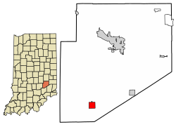
Westport is a town located in Sand Creek Township, Decatur County, Indiana. The population was 1,379 at the 2010 census. A covered bridge, built in 1880, is located about 1.5 miles east of town.
Westport was laid out in March 1836. Simeon Sharp and Hockersmith Merryman were the founders of Westport when 20 lots were laid out based around a center point at the intersection of Main and Poplar Streets. [4] The Westport post office was established in 1839, but first spelled West Port. [5]
According to the 2010 census, Westport has a total area of 1.333 square miles (3.45 km2), of which 1.32 square miles (3.42 km2) (or 99.02%) is land and 0.013 square miles (0.03 km2) (or 0.98%) is water. [6]
Census | Pop. | Note | %± |
---|---|---|---|
1880 | 212 | — | |
1890 | 452 | 113.2% | |
1900 | 614 | 35.8% | |
1910 | 675 | 9.9% | |
1920 | 709 | 5.0% | |
1930 | 637 | −10.2% | |
1940 | 644 | 1.1% | |
1950 | 658 | 2.2% | |
1960 | 833 | 26.6% | |
1970 | 1,170 | 40.5% | |
1980 | 1,450 | 23.9% | |
1990 | 1,478 | 1.9% | |
2000 | 1,515 | 2.5% | |
2010 | 1,379 | −9.0% | |
2020 | 1,393 | 1.0% | |
U.S. Decennial Census [7] |
As of the census [8] of 2010, there were 1,379 people, 548 households, and 369 families living in the town. The population density was 1,044.7 inhabitants per square mile (403.4/km2). There were 653 housing units at an average density of 494.7 per square mile (191.0/km2). The racial makeup of the town was 98.5% White, 0.1% African American, 0.2% Native American, 0.1% Asian, and 1.1% from two or more races. Hispanic or Latino of any race were 0.9% of the population.
There were 548 households, of which 34.7% had children under the age of 18 living with them, 48.0% were married couples living together, 14.8% had a female householder with no husband present, 4.6% had a male householder with no wife present, and 32.7% were non-families. 27.7% of all households were made up of individuals, and 11.1% had someone living alone who was 65 years of age or older. The average household size was 2.52 and the average family size was 3.08.
The median age in the town was 36.4 years. 27.6% of residents were under the age of 18; 8.3% were between the ages of 18 and 24; 26.1% were from 25 to 44; 23.8% were from 45 to 64; and 14.1% were 65 years of age or older. The gender makeup of the town was 48.5% male and 51.5% female.
As of the census [3] of 2000, there were 1,515 people, 606 households, and 426 families living in the town. The population density was 1,142.7 inhabitants per square mile (441.2/km2). There were 659 housing units at an average density of 497.0 per square mile (191.9/km2). The racial makeup of the town was 99.21% White, 0.07% Native American, 0.07% Asian, 0.20% from other races, and 0.46% from two or more races. Hispanic or Latino of any race were 0.20% of the population.
There were 606 households, out of which 35.1% had children under the age of 18 living with them, 54.8% were married couples living together, 9.6% had a female householder with no husband present, and 29.7% were non-families. 26.2% of all households were made up of individuals, and 10.6% had someone living alone who was 65 years of age or older. The average household size was 2.50 and the average family size was 3.00.
In the town, the population was spread out, with 27.6% under the age of 18, 7.9% from 18 to 24, 30.6% from 25 to 44, 21.5% from 45 to 64, and 12.4% who were 65 years of age or older. The median age was 33 years. For every 100 females, there were 94.0 males. For every 100 females age 18 and over, there were 92.5 males.
The median income for a household in the town was $37,500, and the median income for a family was $47,826. Males had a median income of $31,890 versus $27,621 for females. The per capita income for the town was $18,298. About 6.5% of families and 10.5% of the population were below the poverty line, including 16.7% of those under age 18 and 3.0% of those age 65 or over.
It is in Decatur County Community Schools. [9]
Trinity is a town in Morgan County, Alabama, United States. It is included in the Decatur Metropolitan Area and the Huntsville-Decatur Combined Statistical Area. As of the 2020 census, the population of the town was 2,526, up from 2,095 in 2010. It was incorporated in 1901.
Monroe is a town in Washington and Monroe townships, Adams County, Indiana, United States. The population of the town was 945 residents at the 2019 census. Adams Central Community Schools is located in Monroe.
Milford is a town in Decatur County, Indiana, United States.
Millhousen is a town in Marion Township, Decatur County, Indiana, United States. The population was 149 at the 2020 census.
St. Paul or Saint Paul is a small town on the border of Decatur and Shelby counties in the U.S. state of Indiana. The population was 1,031 at the 2010 census.
Stilesville is a town in Franklin Township, Hendricks County, Indiana, United States. The population was 316 at the 2010 Census.
Knightstown is a town in Wayne Township, Henry County, Indiana, adjacent to Rush County, along the Big Blue River. The population was 2,182 at the 2010 census. It is approximately thirty-two miles east of Indianapolis.
Winfield is a town in Winfield Township, Lake County, Indiana. The population was 2,298 at the time of the 2000 census, 4,383 in 2010, and 5,987 in 2019. The town was incorporated in 1993 in order to keep the residents from being annexed by other neighboring communities. Prior to that time it had been part of Winfield Township as an unincorporated town. Winfield is named for General Winfield Scott. The town is served by the Crown Point post office and addresses in Winfield share the Crown Point ZIP code.
River Forest is a town in Anderson Township, Madison County, Indiana, United States. It is part of the Indianapolis–Carmel–Anderson metropolitan statistical area. The population was 26 at the 2020 census.
Woodlawn Heights is a town in Anderson Township, Madison County, Indiana, United States. It is part of the Indianapolis–Carmel–Anderson metropolitan statistical area. The population was 91 at the 2020 census.
Bethany is a town in Clay Township, Morgan County, in the U.S. state of Indiana. The population was 95 at the 2020 census.
Paragon is a town in Ray Township, Morgan County, in the U.S. state of Indiana. The population was 556 at the 2020 census, down from 659 in 2010.
Clear Lake is a town located in the northeast corner of Steuben County, Indiana, in Clear Lake Township. As such, is the northeasternmost community in the State of Indiana. The population was 339 at the 2010 census.
Weldon is a city in Clarke and Decatur counties of the U.S. state of Iowa. The population was 136 at the time of the 2020 census.
Decatur is a town in and the county seat of Newton County, Mississippi. The population was 1,841 at the 2010 census. This town is named after war hero Stephen Decatur Jr.
Westport is a town in western Brown County, South Dakota, United States. The population was 88 at the 2020 census.
Sandwich is a village and census-designated place (CDP) in the town of Sandwich in Barnstable County, Massachusetts, United States. The population was 2,962 at the 2010 census, out of a total of 20,675 people in the town of Sandwich.
Hustisford is a town in Dodge County, Wisconsin, United States. The population was 1,379 at the 2000 census. Most of the town residents live in the village of Hustisford, within the town.
New Point is a town in Salt Creek Township, Decatur County, Indiana, United States. The population was 331 at the 2010 census.
Winterport is a town in Waldo County, Maine, United States. The population was 3,817 at the 2020 census. The Winterport Historic District, extending several blocks along Main Street, was listed on the National Register of Historic Places in 1975.