
The Southside is the part of Dublin city that lies south of the River Liffey. It is an informal but commonly used term. In comparison to the city's Northside, it has historically been regarded as wealthier and more privileged, with several notable exceptions.
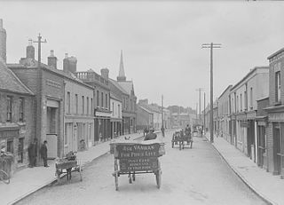
Rathfarnham is a southside suburb of Dublin, Ireland in County Dublin. It is south of Terenure, east of Templeogue, and is in the postal districts of Dublin 14 and 16. It is between the local government areas of Dún Laoghaire–Rathdown and South Dublin.
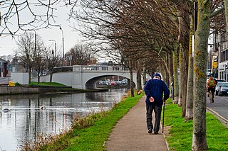
Harold's Cross is an affluent urban village and inner suburb on the south side of Dublin, Ireland in the postal district D6W. The River Poddle runs through it, though largely in an underground culvert, and it holds a major cemetery, Mount Jerome, and Our Lady's Hospice.
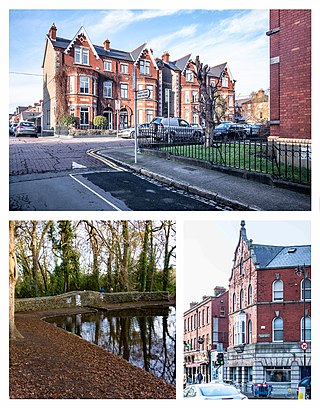
Terenure, originally called Roundtown, is a middle class suburb of Dublin in Ireland. It is located in the city's D6 and D6W postal districts. The population of all electoral divisions labelled as Terenure was 17,972 as of the 2022 census.

Knocklyon is a suburb of the city of Dublin, located in South Dublin, Ireland. Unlike many Dublin suburbs, Knocklyon was not developed around a village; rather it largely consists of modern housing, with a number of old cottages and farmhouses along Knocklyon Road attesting to the area's rural past.

Rathgar is a suburb of Dublin, Ireland. Originally a village, which from 1862 was part of the township of Rathmines and Rathgar, it was absorbed by the growing city and became a suburb in 1930. It lies about three kilometres south of the city centre.
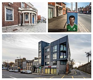
Inchicore is a suburb of Dublin, Ireland. Located approximately 5 kilometres (3.1 mi) west of the city centre, Inchicore was originally a small village separate from Dublin. The village developed around Richmond Barracks and Inchicore railway works, before being incorporated into the expanding city bounds. Inchicore is a largely residential area and is home to the association football club St Patrick's Athletic FC.
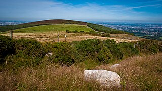
Kilmashogue or Kilmashoge is a mountain in Dún Laoghaire–Rathdown county in Ireland. It is 408 metres high and forms part of the group of hills in the Dublin Mountains which comprises Two Rock, Three Rock, Kilmashogue and Tibradden Mountains. The forest plantation on its northern slope, which is composed mainly of Sitka spruce, Scots pine and beech, is a habitat for Sika deer, hares, rabbits and foxes. A number of prehistoric monuments can be found on the slopes of the mountain.
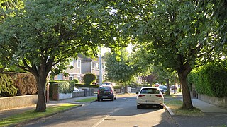
Ballyroan is a suburban area within Rathfarnham, County Dublin, Ireland. It lies at the foot of the Dublin mountains, alongside Ballyboden, Butterfield, Knocklyon, Old Orchard, and Scholarstown. The townland of Ballyroan crosses civil parish and barony boundaries with roughly 114 acres of the historical townland in the civil parish of Tallaght in the barony of Uppercross, and nearly 10 acres in the civil parish of Rathfarnham in the barony of Rathdown. The modern suburb of Ballyroan has extended somewhat beyond the traditional townland boundaries.

Ballyboden is a locality within the suburb of Rathfarnham, County Dublin, at the foot of the Dublin Mountains between Whitechurch, Ballyroan and Knocklyon. It is in the local government area of South Dublin, and is a townland in the civil parish of Rathfarnham in the barony of Uppercross.

Firhouse is an outer suburb of Dublin, in the county of South Dublin, in the south of the traditional County Dublin in Ireland. It developed from a rural village by the River Dodder, with a second settlement, Upper Fir-house, nearby. It is just outside the M50 orbital motorway, and in the postal district of Dublin 24. It is adjacent to Knocklyon, Ballycullen, and Tallaght. In the historic divisions of local administration, Firhouse is in the civil parish of Tallaght and the barony of Uppercross.
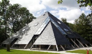
Larch Hill International Scout and Guide Centre is the national campsite, and administrative and training headquarters, of Scouting Ireland. It was previously owned by Scouting Ireland (CSI), one of the two scout organisations which merged to form Scouting Ireland.

Rockbrook is a small area, once site of a small settlement, now semi-suburban, in County Dublin, Ireland. It is in the local government area of South Dublin.

Tibradden Mountain is a mountain in County Dublin in the Republic of Ireland. Other former names for the mountain include "Garrycastle" and "Kilmainham Begg". It is 467 metres high and is the 561st-highest mountain in Ireland. It forms part of the group of hills in the Dublin Mountains which comprises Two Rock, Three Rock, Kilmashogue and Tibradden Mountains. The views from the summit encompass Dublin to the north, Two Rock to the east and the Wicklow Mountains to the south and west.

Whitechurch is a townland, monastic site, and civil parish in County Kildare, Ireland. It is situated between Straffan and Kill, near the M7 motorway.

Two Rock is a mountain in Dún Laoghaire–Rathdown, Ireland. It is 536 metres high and is the 382nd highest mountain in Ireland. It is the highest point of the group of hills in the Dublin Mountains which comprises Two Rock, Three Rock, Kilmashogue and Tibradden Mountains. The mountain takes its name from the two granite tors that lie to the south-east of the summit. From the summit, which is called Fairy Castle, there are views of much of the Dublin area from Tallaght to Howth to the north while Bray Head, Killiney Hill, the Great Sugar Loaf and the Wicklow Mountains are visible to the south. The summit area is mostly shallow bog while ferns and gorse cover the lower slopes. The mountain is also an important habitat for red grouse.
Wanderers are a Gaelic Athletic Association club located in Ballyboden, Dublin, Ireland.
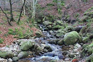
The Owendoher River is a small river in southern County Dublin, Ireland, the largest tributary of the River Dodder, and a part of the River Liffey system.
Cruagh is a civil parish in the barony of Uppercross in South Dublin, Ireland. It contains the townlands of Cruagh, Killakee, Tibradden, Glendoo, Newtown, Jamestown, Woodtown and Orlagh. It is situated south of Ballyboden on the R116 regional road.
Whitechurch is a village and townland in County Cork, Ireland, about 11 km north of Cork city. It forms part of the Dáil constituency of Cork North Central. As of the 2022 census, Whitechurch village had a population of 719 people. The village is in a civil parish of the same name.


