Related Research Articles

A tornado watch is a statement issued by weather forecasting agencies to advise the public that atmospheric conditions in a given region may lead to the development of tornadoes within the region over a period of several hours. In addition to the potential for tornado development, thunderstorms that develop within the watch area may contain large hail, straight-line winds, intense rainfall and/or flooding that pose a similar damage risk as the attendant tornado threat.
The National Weather Service (NWS) is an agency of the United States federal government that is tasked with providing weather forecasts, warnings of hazardous weather, and other weather-related products to organizations and the public for the purposes of protection, safety, and general information. It is a part of the National Oceanic and Atmospheric Administration (NOAA) branch of the Department of Commerce, and is headquartered in Silver Spring, Maryland, within the Washington metropolitan area. The agency was known as the United States Weather Bureau from 1891 until it adopted its current name in 1970.

A small craft advisory is a type of wind warning issued by the National Weather Service in the United States. In Canada a similar warning is issued by Environment Canada. It is issued when winds have reached, or are expected to reach within 12 hours, a speed marginally less than gale force. A Small Craft Advisory may also be issued when sea or lake ice exists that could be hazardous to small boats.
A winter storm warning is a hazardous weather statement issued by Weather Forecast Offices (WFO) of the National Weather Service (NWS) in the United States to alert the public that a winter storm is occurring or is about to occur in the area, usually within 36 hours of the storm's onset.
A winter storm watch is issued by the National Weather Service of the United States when there is a possibility of heavy snow or potential of significant ice accumulations, without meeting a specific other winter criteria. The watch is typically issued 12 to 48 hours before the storm's expected arrival in the given area. The criteria for this watch can vary from place to place, which is true with other winter weather warning and advisories.
This article describes severe weather terminology used by the National Weather Service (NWS) in the United States, a government agency operating within the Department of Commerce as an arm of the National Oceanic and Atmospheric Administration (NOAA).
A lake effect snow warning is a bulletin issued by the National Weather Service in the United States to warn of heavy snowfall accumulations that are imminent from convective snow generated by very cold airmass passing over unfrozen lakes. The criteria for amounts may vary significantly over different county warning areas. On October 2, 2017, some National Weather Service Forecast Offices discontinued issuing the Lake Effect Snow Warning, and consolidated it with the Winter Storm Warning. On October 15, 2018, the National Weather Service discontinued issuing Lake Effect Snow Warnings nationwide all together, and all offices consolidated it with the Winter Storm Warning. Lake effect snow warnings were reinstated for the 2019–20 winter season.
This article describes severe weather terminology used by the Meteorological Service of Canada, a branch within Environment and Climate Change Canada. The article primarily describes various weather warnings, and their criteria. Related weather scales and general weather terms are also addressed in this article. Some terms are specific to certain regions.

In weather forecasting in the United States, "particularly dangerous situation" (PDS) is the wording used by the National Weather Service to convey special urgency in watch or warning messages for unusually extreme and life-threatening severe weather. It is used in the format "This is a particularly dangerous situation..." at the discretion of the issuing forecaster. A watch or warning bearing the phrase is referred to as a PDS watch or PDS warning.

A blizzard warning is a hazardous weather statement issued by Weather Forecast Offices (WFO) of the National Weather Service (NWS) in the United States, which indicates heavy snowfall accompanied by sustained winds or frequent gusts of 35 mph (56 km/h) or greater are forecast to occur for a minimum of three hours. A blizzard tends to reduce visibilities to 1⁄4 mile (400 m) or less.
A blizzard watch was a bulletin issued by the National Weather Service of the United States which meant winds greater than 35 miles per hour, mixed with falling or blowing snow, and visibilities of 1⁄4 mile (0.4 km) or less is forecast for a period of 3 hours or more. A blizzard watch was issued 12 to 48 hours before an expected blizzard event. As the forecast solidifies, a blizzard watch would be either downgraded to a winter storm warning or winter weather advisory for blowing snow or upgraded to a blizzard warning.
A Special Weather Statement is a form of weather advisory. Special Weather Statements are issued by the National Weather Service of the United States (NWS) and the Meteorological Service of Canada (MSC). There are no set criteria for special weather statements in either country.
A weather warning generally refers to an alert issued by a meteorological agency to warn citizens of approaching dangerous weather. A weather watch, on the other hand, typically refers to an alert issued to indicate that conditions are favorable for the development of dangerous weather patterns, although the dangerous weather conditions themselves are not currently present.
A cold weather advisory is a hazardous weather statement issued by Weather Forecast Offices (WFO) of the National Weather Service (NWS) in the United States to alert the public that temperatures or wind chills are forecast to reach values low enough that it poses a threat to human health and life if adequate protection is not taken against hypothermia and frostbite. The exact criteria meriting the issuance of an advisory vary from state to state, and areas prone to colder temperatures will often require colder temperatures/wind chills before issuing an advisory.
A wind chill warning was a hazardous weather statement previously issued by both local forecast offices of the National Weather Service (NWS) in the United States and by the Meteorological Service of Environment and Climate Change Canada (ECCC) when wind chills were forecast to reach values low enough for residents and travelers to be susceptible to life-threatening medical conditions or death associated with accelerated body heat loss. In both Canada and the United States, the "wind chill warning" has been replaced with the "extreme cold warning."
A Hazardous Seas Watch is issued by the National Weather Service of the United States when there is an increased threat of high wave heights and/or wave steepness values reach a certain criteria, but the occurrence, timing, and/or location are still uncertain, though the area of concern is known. The criteria are set by the local forecast offices. It is normally accompanied with strong winds, and occasionally even cyclonic activity. Such tall waves can pose a serious threat to vessels that do not seek shelter, as well as vehicles and property very close to concerned waters.
An extreme cold warning is a weather warning issued by Environment and Climate Change Canada (ECCC) and by the United States' National Weather Service (NWS) to inform the public about active or imminent severe cold temperatures in their local region.

The 2020–21 North American winter was the most significant winter season to affect North America in several years, and the costliest on record, with a damage total of at least $33.35 billion. The season featured six storms ranking on the Regional Snowfall Index scale (RSI), with four storms ranking as at least a Category 3. Most of the winter's damage and fatalities occurred due to a historic and major cold wave in mid-February. Several other significant events occurred, including a crippling early-season ice storm in the Southern Plains, a powerful nor'easter in mid-December, another major nor'easter in early February, two major and widespread winter storms in mid-February, and a major blizzard in the Rocky Mountains in mid-March. The winter-related events were responsible for at least 358 fatalities, making it the deadliest season since 1992–93. A La Niña pattern influenced much of the winter in North America.
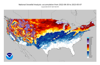
The 2022–23 North American winter was an unusually warm winter for the east and an unusually cold winter for the west in North America, as it occurred across the continent from late 2022 to early 2023. The winter season in North America began at the winter solstice, which occurred on December 21, 2022, and it ended at the March equinox, which occurred on March 20, 2023. The first day of meteorological winter began on December 1 and unofficially ended on February 28; winter storms may still occur outside of these limits.
An extreme cold watch is a weather watch issued by the United States' National Weather Service (NWS) to inform the public that "dangerously cold air, with or without wind, is possible." The extreme cold watch is a 'step' below the "extreme cold warning."
References
- ↑ Glasgow, MT National Weather Service Forecast Office. "Winter Weather Watches, Warnings and Advisories". Montana Winter Weather Awareness Week. Retrieved 18 May 2011.
- ↑ National Weather Service. "Wind Chill Watch". Iowa Environmental Mesonet NWS Product Archive. Retrieved 18 May 2011.
- ↑ Michael Musher, National Weather Service Public Affairs. "National Weather Service Revises Watch, Warning and Advisory Products". News Around NOAA. Archived from the original on 2024-10-07. Retrieved 2024-10-10.
- ↑ Blaise Keller. "Beyond the Barometer: Changes coming to wind chill alerts". Wisconsin State Journal. Archived from the original on 2024-10-08. Retrieved 2024-10-10.