Related Research Articles
A winter storm warning is a hazardous weather statement issued by Weather Forecast Offices (WFO) of the National Weather Service (NWS) in the United States to alert the public that a winter storm is occurring or is about to occur in the area, usually within 36 hours of the storm's onset.
A winter weather advisory is a hazardous weather statement issued by Weather Forecast Offices (WFO) of the National Weather Service in the United States when one or more types of winter precipitation—snow, rain and snow mixed, freezing rain, sleet, graupel, etc.—presenting a hazard, but not expected to produce accumulations meeting storm warning criteria, are forecast within 36 hours of the expected onset of precipitation or are occurring in the advisory's coverage area.
A blowing snow advisory was issued by the National Weather Service of the United States when wind driven snow reduces surface visibility and possibly hampers traveling. Blowing snow may be falling snow, or snow that has already accumulated but is picked up and blown by strong winds. This advisory was discontinued beginning with the 2008–09 winter storm season, replaced by the winter weather advisory for snow and blowing snow. However, if the storm is judged to be dangerous by local forecasters, a winter storm warning for heavy snow and blowing snow may be issued.
A winter storm watch is issued by the National Weather Service of the United States when there is a possibility of heavy snow or potential of significant ice accumulations, without meeting a specific other winter criteria. The watch is typically issued 12 to 48 hours before the storm's expected arrival in the given area. The criteria for this watch can vary from place to place, which is true with other winter weather warning and advisories.
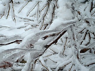
An ice storm warning is a hazardous weather statement issued by the Weather Forecast Offices of the National Weather Service in the United States which indicates that freezing rain produces a significant and possibly damaging accumulation of ice on surfaces. The criteria for this warning vary from state to state, but typically an ice storm warning will be issued any time more than 1⁄4 inch (6.4 mm) of ice at peak is expected to accumulate in an area, else a freezing rain or drizzle advisory is issued; in some areas, the criterion is 1⁄2 inch (13 mm) instead.

This article describes severe weather terminology used by the National Weather Service (NWS) in the United States. The NWS, a government agency operating as an arm of the National Oceanic and Atmospheric Administration (NOAA) branch of the United States Department of Commerce (DoC), defines precise meanings for nearly all of its weather terms.
A lake effect snow warning is a bulletin issued by the National Weather Service in the United States to warn of heavy snowfall accumulations that are imminent from convective snow generated by very cold airmass passing over unfrozen lakes. The criteria for amounts may vary significantly over different county warning areas. On October 2, 2017, some National Weather Service Forecast Offices discontinued issuing the Lake Effect Snow Warning, and consolidated it with the Winter Storm Warning. On October 15, 2018, the National Weather Service discontinued issuing Lake Effect Snow Warnings nationwide all together, and all offices consolidated it with the Winter Storm Warning. Lake effect snow warnings were reinstated for the 2019–20 winter season.
A snow squall warning is a bulletin issued by Environment Canada's Meteorological Service of Canada and the National Weather Service in the United States to warn population of two types of snow events reducing visibility in blowing snow: lake effectsnow squalls and frontal snow squalls.
A particularly dangerous situation (PDS) tag is enhanced wording first used by the Storm Prediction Center (SPC), a national guidance center of the United States National Weather Service, for tornado watches and eventually expanded to use for other severe weather watches and warnings by local NWS forecast offices. It is issued at the discretion of the forecaster composing the watch or warning and implies that there is an enhanced risk of very severe and life-threatening weather, usually a major tornado outbreak or a long-lived, extreme derecho event, but possibly another weather hazard such as an exceptional flash flood or wildfire.

A blizzard warning is a hazardous weather statement issued by Weather Forecast Offices (WFO) of the National Weather Service (NWS) in the United States, which indicates heavy snowfall accompanied by sustained winds or frequent gusts of 35 mph (56 km/h) or greater are forecast to occur for a minimum of three hours. A blizzard tends to reduce visibilities to 1⁄4 mile (400 m) or less. A Severe Blizzard Warning is a variation issued in some cases of winds above 45 mph (72 km/h) and temperatures below 10 °F (−12 °C). Most local weather offices will activate and broadcast the SAME alarm tone on relevant NOAA Weather Radio stations for both varieties of warning. When the Wireless Emergency Alerts system was launched in 2012, blizzard warnings were initially sent as alerts to mobile phones; this practice was discontinued in November 2013.
A blizzard watch was a bulletin issued by the National Weather Service of the United States which meant winds greater than 35 miles per hour, mixed with falling or blowing snow, and visibilities of 1⁄4 mile (0.4 km) or less is forecast for a period of 3 hours or more. A blizzard watch was issued 12 to 48 hours before an expected blizzard event. As the forecast solidifies, a blizzard watch would be either downgraded to a winter storm warning or winter weather advisory for blowing snow or upgraded to a blizzard warning.
A freeze warning is a warning issued by the National Weather Service when sub-freezing temperatures are expected in the next 36 hours. This can occur with or without frost. When a freeze warning is issued in the fall, that will usually signify the end of the growing season, as sub-freezing temperatures will usually kill remaining crops. Farmers and gardeners should take action to protect or harvest their herbaceous plants if a freeze warning is issued. A freeze warning is issued several hours after a freeze watch if a freeze continues to be expected. It shouldn’t be much of difference from what you’re already used to for the season as there aren’t many “sudden” freezes..
In National Weather Service (NWS) terminology, a Hazardous Weather Outlook is a weather statement issued to provide information of potential severe weather events within the next seven days. The outlook may include information about potential severe thunderstorms, heavy rain or flooding, winter weather, extremes temperatures.
A lake effect snow watch was a bulletin issued by the National Weather Service in the United States to warn of heavy snowfall amounts that will be possible from convective snow generated by cold air masses passing over unfrozen lakes. The criteria for amounts may vary over different county warning areas.
A freezing rain advisory was an advisory issued by the National Weather Service in the United States when freezing rain or freezing drizzle was expected to cause significant inconveniences, but did not meet warning criteria.
A wind chill advisory is a hazardous weather statement issued by Weather Forecast Offices (WFO) of the National Weather Service (NWS) in the United States to alert the public that wind chills are forecast to reach values low enough that it poses a threat to human health and life if adequate protection is not taken against hypothermia and frostbite. The exact criteria meriting the issuance of an advisory varies from state to state, and areas prone to colder temperatures will often require the wind chill to be lower before issuing an advisory.
A wind chill watch is issued by the National Weather Service of the United States when the wind chill could reach dangerous levels within the next 12 to 48 hours. The exact definition required to issue a watch varies from state to state or from National Weather Service county warning areas to another, but if forecasters believe conditions are favorable for life-threatening wind chills meeting local criteria, a watch will be issued. People going outside should plan to protect themselves against hypothermia and frostbite.
A wind chill warning is a hazardous weather statement issued by local forecast offices of the National Weather Service (NWS) in the United States and previously by the Meteorological Service of Environment and Climate Change Canada (ECCC) when wind chills are forecast to reach values low enough for residents and travelers to be susceptible to life-threatening medical conditions or death associated with accelerated body heat loss.
A Heavy Freezing Spray Watch is issued by the National Weather Service of the United States when there is an increased risk of a heavy spray event that meets the necessary criteria, but the occurrence, timing, and/or location are still uncertain, though the area where it may happen is predicted. A watch will be issued when forecasters expect freezing water droplets to be able to start icing and accumulate on sea vessels or near-sea vehicles at rates of 2 cm per hour or greater. This accumulation must be caused by an "appropriate combination of cold water, wind, sub-freezing air temperature, and vessel movement."
A Freezing Spray Advisory is issued by the National Weather Service of the United States to warn sea vessels and sometimes road vehicles near the shoreline that accumulation of freezing water droplets and icing due to a combination of cold suspended droplets, wind, and cold air, so vessel movement is possible, however, accumulations are not expected to reach rates of 2 cm per hour, or else a heavy freezing spray watch, warning or a specific notice would be issued.
References
- ↑ National Weather Service. "Heavy Freezing Spray Warning". Glossary - National Weather Service. Retrieved 1 June 2011.
- ↑ National Weather Service. "Heavy Freezing Spray Warning" . Retrieved 5 January 2015.