Related Research Articles

A tsunami is a series of waves in a water body caused by the displacement of a large volume of water, generally in an ocean or a large lake. Earthquakes, volcanic eruptions and other underwater explosions above or below water all have the potential to generate a tsunami. Unlike normal ocean waves, which are generated by wind, or tides, which are in turn generated by the gravitational pull of the Moon and the Sun, a tsunami is generated by the displacement of water from a large event.

A tsunami warning system (TWS) is used to detect tsunamis in advance and issue the warnings to prevent loss of life and damage to property. It is made up of two equally important components: a network of sensors to detect tsunamis and a communications infrastructure to issue timely alarms to permit evacuation of the coastal areas. There are two distinct types of tsunami warning systems: international and regional. When operating, seismic alerts are used to instigate the watches and warnings; then, data from observed sea level height are used to verify the existence of a tsunami. Other systems have been proposed to augment the warning procedures; for example, it has been suggested that the duration and frequency content of t-wave energy is indicative of an earthquake's tsunami potential.

The Pacific Tsunami Warning Center (PTWC) is one of two tsunami warning centers that are operated by NOAA in the United States. Headquartered on Ford Island, HI, the PTWC is part of an international tsunami warning system (TWS) program and serves as the operational center for TWS of the Pacific issuing bulletins and warnings to participating members and other nations in the Pacific Ocean area of responsibility. It is also the regional (local) warning center for the State of Hawaii. The other tsunami warning center is the National Tsunami Warning Center (NTWC) in Palmer, Alaska, serving all coastal regions of Canada and the United States except Hawaii, the Caribbean Sea and the Gulf of Mexico.

The 1946 Aleutian Islands earthquake occurred near the Aleutian Islands, Alaska on April 1, 1946. The shock had a moment magnitude (Mw ) of 8.6, a tsunami magnitude Mt of 9.3, and a surface-wave magnitude (Ms ) of only 7.4, and a maximum Mercalli intensity of VI (Strong). It resulted in 165–173 casualties and over $26 million in damage. The seafloor along the fault was elevated, triggering a Pacific-wide tsunami with multiple destructive waves at heights ranging from 45–138 ft (14–42 m). The tsunami obliterated the Scotch Cap Lighthouse on Unimak Island, Alaska among others, and killed all five lighthouse keepers. Despite the destruction to the Aleutian Island Unimak, the tsunami had almost an imperceptible effect on the Alaskan mainland.

This article describes severe weather terminology used by the Meteorological Service of Canada, a branch within Environment and Climate Change Canada. The article primarily describes various weather warnings, and their criteria. Related weather scales and general weather terms are also addressed in this article. Some terms are specific to certain regions.

A teletsunami is a tsunami that originates from a distant source, defined as more than 1,000 km (620 mi) away or three hours' travel from the area of interest, sometimes travelling across an ocean. All teletsunamis have been generated by major earthquakes such as the 1755 Lisbon earthquake, 1960 Valdivia earthquake, 1964 Alaska earthquake, 2004 Indian Ocean earthquake, and 2021 South Sandwich Islands earthquakes.
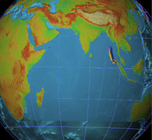
The 2009 Samoa earthquake and tsunami took place on 29 September 2009 in the southern Pacific Ocean adjacent to the Kermadec-Tonga subduction zone. The submarine earthquake occurred in an extensional environment and had a moment magnitude of 8.1 and a maximum Mercalli intensity of VI (Strong). It was the largest earthquake of 2009. The earthquake initiated with a normal-faulting event with a magnitude of 8.1. Within two minutes of the earthquake rupture, two large magnitude 7.8 earthquakes occurred on the subduction zone interface. The two magnitude 7.8 earthquakes had a combined magnitude equivalent to 8.0. The event can be considered a doublet earthquake.

The 2010 Chile earthquake and tsunami occurred off the coast of central Chile on Saturday, 27 February at 03:34 local time, having a magnitude of 8.8 on the moment magnitude scale, with intense shaking lasting for about three minutes. It was felt strongly in six Chilean regions that together make up about 80 percent of the country's population. According to the United States Geological Survey (USGS) the cities experiencing the strongest shaking—VIII (Severe) on the Mercalli intensity scale (MM)—were Concepción, Arauco, and Coronel. According to Chile's Seismological Service, Concepción experienced the strongest shaking at MM IX (Violent). The earthquake was felt in the capital Santiago at MM VII or MM VIII. Tremors were felt in many Argentine cities, including Buenos Aires, Córdoba, Mendoza, and La Rioja. Tremors were felt as far north as the city of Ica in southern Peru.
Although National Oceanic and Atmospheric Administration (NOAA) scientists at the Pacific Tsunami Warning Center (PTWC) in Hawaii eventually issued warnings of a possible tsunami from the large earthquake off Sumatra, the waves outran notification systems at jet speeds of 500 mph (804 km/h), catching hundreds of thousands of people unaware. The following is a timeline of the 2004 Indian Ocean earthquake. All times are Coordinated Universal Time (UTC), on Sunday, 26 December 2004.

The National Tsunami Warning Center (NTWC) forms part of an international tsunami warning system (TWS). It serves as the operations center for all coastal regions of Canada and the United States, except Hawaii, the Caribbean, and the Gulf of Mexico. Headquartered in Palmer, Alaska, it is operated by the National Oceanic and Atmospheric Administration (NOAA).
The 2012 Indian Ocean earthquakes were magnitude 8.6 and 8.2 Mw undersea earthquakes that struck near the Indonesian province of Aceh on 11 April at 15:38 local time. Initially, authorities feared that the initial earthquake would cause a tsunami and warnings were issued across the Indian Ocean; however, these warnings were subsequently cancelled. These were unusually strong intraplate earthquakes and the largest strike-slip earthquake ever recorded.
An earthquake off the coast of Samar occurred on August 31, 2012, at 20:47 local time in the Philippines. The populated islands of Visayas were struck by an earthquake of magnitude Mw 7.6. The earthquake occurred at a depth of 45 km. A tsunami warning was announced within the Pacific area and was lifted after two hours. The Philippine archipelago is located in the Pacific Ring of Fire, where earthquakes and volcanic activity are common.
The 2012 Haida Gwaii earthquake occurred just after 8:04 p.m. PDT on October 27. The shock had a moment magnitude of 7.8 and a maximum Mercalli Intensity of V (Moderate). The earthquake's epicentre was on Moresby Island of the Haida Gwaii archipelago. This was the second largest Canadian earthquake ever recorded by a seismometer, after the 1949 Queen Charlotte Islands earthquake, about 135 kilometres (84 mi) away. One person died due to a car crash related to the tsunami in Oahu, Hawaii.
The 2014 Iquique earthquake struck off the coast of Chile on 1 April, with a moment magnitude of 8.2, at 20:46 local time. The epicenter of the earthquake was approximately 95 kilometres (59 mi) northwest of Iquique. The mainshock was preceded by a number of moderate to large shocks and was followed by a large number of moderate to very large aftershocks, including a M7.7 event on 3 April. The megathrust earthquake triggered a tsunami of up to 2.11 metres (6.9 ft) that hit Iquique at 21:05 local time. Similar-sized tsunamis were also reported to have hit the coasts of Pisagua and Arica.
The 2014 Aleutian Islands earthquake occurred on 23 June at 11:53 HDT (UTC-9) with a moment magnitude of 7.9 and a maximum Mercalli intensity of VIII (Severe). The shock occurred in the Aleutian Islands – part of the US state of Alaska – 19 miles (31 km) southeast of Little Sitkin Island.

On January 23, 2018, at 00:31 AKST, an earthquake occurred in the Gulf of Alaska near Kodiak Island. The earthquake, measured at 7.9 on the Mw scale, was approximately 280 kilometers (170 mi) southeast of Kodiak and happened at a depth of 25 kilometers (16 mi).
The 2021 Kermadec Islands earthquakes were a series of earthquakes with magnitudes of 8.1 and 7.4 that occurred at 19:28:31 UTC on 4 March 2021. The epicentres were located southeast of Raoul Island in the Kermadec Islands, part of the New Zealand outlying islands. The main magnitude 8.1 earthquake was preceded by a magnitude 7.4 foreshock and followed by a magnitude 6.1 aftershock. A separate, unrelated magnitude 7.3 earthquake occurred off the coast of the North Island of New Zealand, approximately 900 km to the south, several hours before the main quakes. More than a dozen aftershocks exceeded magnitude 6.

An earthquake occurred off the coast of the Alaska Peninsula on July 28, 2021, at 10:15 p.m. local time. The large megathrust earthquake had a moment magnitude of 8.2 according to the United States Geological Survey (USGS). A tsunami warning was issued by the National Oceanic and Atmospheric Administration (NOAA) but later cancelled. The mainshock was followed by a number of aftershocks, including three that were of magnitude 5.9, 6.1 and 6.9 respectively.
A tsunami advisory means that a tsunami with potential for strong currents or waves dangerous to those in or very near the water is expected or occurring. There may be flooding of beach and harbor areas. Stay out of the water and away from beaches and waterways. Follow instructions from local officials.
References
- ↑ "Tsunami Preparedness" (PDF). National Weather Service . Retrieved January 12, 2022.
 This article incorporates text from this source, which is in the public domain .
 - ↑ Bulletin: Tsunami Message Number 1: 257 AM HST Fri Aug 31 2012 (Report). Pacific Tsunami Warning Center. August 31, 2012. Archived from the original on December 28, 2018. Retrieved January 12, 2022.