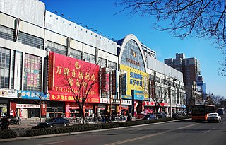
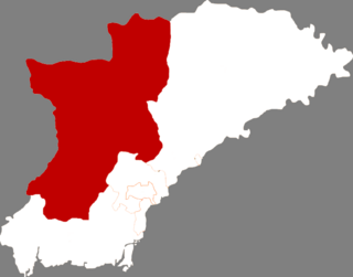
Mancheng District is a district of west-central Hebei province,China,in the eastern foothills of the Taihang Mountains. It is administratively part of Baoding prefecture-level city,of which the Mancheng is a northwestern suburb.

Gongzhuling is a county-level city under the administration of Changchun. It is located in central Jilin province of Northeast China,halfway between Siping and Changchun,along the main railway line in the Northeast. Major employers in the city include Jilin Academy of Agricultural Sciences,located on the north side of the railway and several factories which manufacture auto parts. There is major military presence in the area,including a PLA base and a military airport.

Renqiu is a county-level city in Hebei province,China. It is located 79 kilometres (49 mi) northwest of the prefecture-level city of Cangzhou,which administers it,and 104 kilometres (65 mi) southwest of Tianjin. It is the location of North China Oil Field.

Yuci District is a district in Jinzhong,Shanxi,China.

Beipiao is a city in Chaoyang prefecture,Liaoning province,in Northeast China. It has a population of 202,807. The main industry in the area is coal mining. With vertical shafts of almost 1000m,these are some of the deepest coal mines in China. The coal produced is used for coking. Daheishan National Forest Park is located in the northwestern part of Beipiao city.

The city of Xinmin is a county-level city of Liaoning Province,Northeast China,under the administration of the prefecture-level city of Shenyang. It contains the westernmost point of and is by far the most spacious of the county-level divisions of Shenyang City. Xinmin borders Faku County to the northeast,Shenbei New Area and Yuhong District to the east,Tiexi District to the southeast,and Liaozhong County to the south;it also borders the prefecture-level cities of Jinzhou to the west and Fuxin to the northwest.

Lichuan is a county-level city of the Enshi Tujia and Miao Autonomous Prefecture,in southwestern Hubei province,People's Republic of China,located 52 kilometres (32 mi) west of Enshi City,the prefecture seat. It borders Chongqing Municipality to the southwest,west,and north. It has approximately 870,000 inhabitants.

Yu County,also known by its Chinese name Yuxian,is a county under the jurisdiction of the prefecture-level city of Zhangjiakou in northwestern Hebei province,China. Yuzhou (蔚州镇) is the county seat.
Botou is a county-level city in Hebei province,People's Republic of China,under the jurisdiction of Cangzhou prefecture-level city.
Songtao Miao Autonomous County is an autonomous county in the northeast of Guizhou province,China,bordering Chongqing to the north and Hunan province to the east. It is under the administration of the prefecture-level city of Tongren.

Yangyuan County is a county in Zhangjiakou Prefecture,Hebei Province,China.

Fengrun District is a district of the city of Tangshan,Hebei province,People's Republic of China.

Fengnan District is a district of Tangshan,Hebei,China on the coast of the Bo Sea and bordering Tianjin to the west.
Qian'an is a county-level city in the northeast of Hebei province,China. It is under the administration of Tangshan City.

Gaobeidian is a county-level city in central Hebei province,People's Republic of China. It is under the administration of Baoding Prefecture-level city. Gaobeidian has 4 subdistricts,6 towns,and 4 townships,and a total of 442 villages. It is 82 kilometres (51 mi) south of Beijing and 68 kilometres (42 mi) north of Baoding.

Lingyuan is a city in the west of Liaoning province in Northeast China,bordering Hebei province and Inner Mongolia. It is under the administration of Chaoyang City,which lies 94 kilometres (58 mi) to the east-northeast.

Chaoyang County is a county of northwestern Liaoning province,China. It is under the administration of Chaoyang city.

Dengta is a city in east-central Liaoning province in Northeast China. It is located in between Liaoyang,which oversees Dengta and lies 22 kilometers (14 mi) to the southwest,and Shenyang,the provincial capital which lies nearly double that distance to the northeast.

Fengcheng is a city in the southeast of Liaoning Province in Northeast China. Administratively,it is a county-level city under the administration of Dandong,the downtown of which lies 45 kilometres (28 mi) southeast of the city.

Beizhen is a city in west-central Liaoning province of Northeast China. It is under the administration of Jinzhou City.


