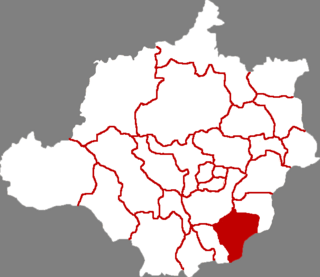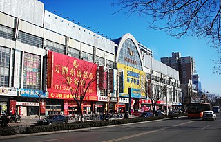
Shahe is a county-level city in the prefecture-level city of Xingtai,in the southern part of Hebei province,China.

Renqiu is a county-level city in Hebei province,China. It is located 79 kilometres (49 mi) northwest of the prefecture-level city of Cangzhou,which administers it,and 104 kilometres (65 mi) southwest of Tianjin. It is the location of North China Oil Field.

Linxi County is a county in the south of Hebei Province,China,bordering Shandong to the south and east. It is the southernmost county-level division of the prefecture-level city of Xingtai,and is located in its southeast corner. It has a population of 320,000 residing in an area of 542 km2 (209 sq mi).

Yongchang County is a county located in the southern half of the prefecture-level city of Jinchang in north-central Gansu province,China,bordering Qinghai to the south. It has been associated with the historical Liqian and Fanhe counties. The village of Zhelaizhai,located in Jiaojiazhuang township,has been the subject of international academic and media attention for its potential connection to Sino-Roman relations.

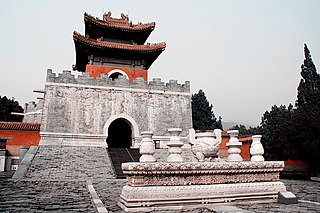
Zunhua is a county-level city in the northeast of Hebei province,China,bordering Tianjin to the west. It is under the administration of the prefecture-level city of Tangshan. Historic sites include the Eastern Qing Tombs.

Guyuan County is a county under the administration of Zhangjiakou,Hebei,People's Republic of China. It was once part of the province of Chahar,and now borders Inner Mongolia. The area of the city is 2,621 square kilometres (1,012 sq mi),and the population as of 2004 is 230,000. Bordering county-level divisions are Fengning Manchu Autonomous County to the east,Chicheng County and Chongli District to the south,Zhangbei and Kangbao counties to the west,and,in Inner Mongolia,Taibus Banner,Zhenglan Banner and Duolun County to the north. It is a primarily mountainous county in northern Hebei,and thus has a cold climate with long,bitter winters and mild summers.

Yi County or Yixian is a county in Hebei province of China,administratively under the jurisdiction of the prefecture-level city of Baoding. It has an area of 2,538 km2 (980 sq mi).

Li County or Lixian is a county under the jurisdiction of Baoding prefecture-level city,Hebei,China.

Yu County,also known by its Chinese name Yuxian,is a county under the jurisdiction of the prefecture-level city of Zhangjiakou in northwestern Hebei province,China. Yuzhou (蔚州镇) is the county seat.

Yi County or Yixian is a county in west-central Liaoning Province,China,and is under the administration of the prefecture-level city of Jinzhou. Fengguo Temple,dating from 1020,is located in the county seat.
Botou is a county-level city in Hebei province,People's Republic of China,under the jurisdiction of Cangzhou prefecture-level city.

Xian County or Xianxian is a county in the east of Hebei province of China. It is under the administration of the prefecture-level city of Cangzhou.

Feixi County is a county of Anhui Province,East China,it is under the administration of the prefecture-level city of Hefei,the capital of Anhui. The county has an area of 2,053.19 km2 (792.74 sq mi) and a population of 858,895 inhabitants.

Pingshan County,Hebei is a county of Hebei Province,North China,bordering Shanxi province to the west. It is under the administration of the prefecture-level city of Shijiazhuang,the provincial capital.

Huai'an County is a county in the northwest of Hebei,China. It is under the administration of Zhangjiakou City.

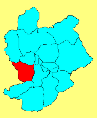
Wanquan is a district of the city of Zhangjiakou,in the northwest of Hebei province,China,located just to the southwest of Zhangjiakou's urban core. It was the site of the Battle of the Badger's Mouth Pass,one of the major campaigns in the Mongol–Jin War

Fengrun District is a district of the city of Tangshan,Hebei province,People's Republic of China.

Fengnan District is a district of Tangshan,Hebei,China on the coast of the Bo Sea and bordering Tianjin to the west.

Xinhe is a county in the south of Hebei province,China,located on the Fuyang River (滏阳河),which is part of the Hai River watershed. It is under the administration of the prefecture-level city of Xingtai,with a population of 170,000 residing in an area of 366 km2 (141 sq mi). The county is served by G20 Qingdao–Yinchuan Expressway and China National Highway 308.

Liaoyang County is a county in east-central Liaoning province in Northeast China. It is under the administration of Liaoyang City,located in between the urban area of Liaoyang City and Anshan City.


