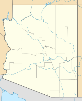
Yuma is a city in and the county seat of Yuma County, Arizona, United States. The city's population was 93,064 at the 2010 census, up from the 2000 census population of 77,515.
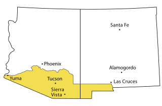
Southern Arizona is a region of the United States comprising the southernmost portion of the State of Arizona. It sometimes goes by the name Gadsden or Baja Arizona, which means "Lower Arizona" in Spanish.

The Arizona Historical Society (AHS) is a non-profit organization whose mission is to connect people through the power of Arizona's history. It does this through four regional divisions. Each division has a representative museum. The statewide divisions are as follows: Southern Arizona Division in Tucson, the Central Arizona Division in Tempe, the Northern Arizona Division in Flagstaff, and the Rio Colorado Division in Yuma. It was founded in 1884.

The Juan Bautista de Anza National Historic Trail is a 1,210-mile (1,950 km) trail extending from Nogales on the U.S.-Mexico border in Arizona, through the California desert and coastal areas in Southern California and the Central Coast region to San Francisco. The trail commemorates the 1775–1776 land route that Spanish commander Juan Bautista de Anza took from the Sonora y Sinaloa Province of New Spain in Colonial Mexico through to Las Californias Province. The goal of the trip was to establish a mission and presidio on the San Francisco Bay. The trail was an attempt to ease the course of Spanish colonization of California by establishing a major land route north for many to follow. It was used for about five years before being closed by the Quechan (Yuma) Indians in 1781 and kept closed for the next 40 years. It is a National Historic Trail administered by the National Park Service and was also designated a National Millennium Trail.

Fort Yuma was a fort in California located in Imperial County, across the Colorado River from Yuma, Arizona. It was on the Butterfield Overland Mail route from 1858 until 1861 and was abandoned May 16, 1883, and transferred to the Department of the Interior. The Fort Yuma Indian School and the Saint Thomas Yuma Indian Mission now occupy the site. It is one of the "associated sites" listed as Yuma Crossing and Associated Sites on the National Register of Historic Places in the Yuma Crossing National Heritage Area. In addition, it is registered as California Historical Landmark #806.

Yuma Crossing is a site in Arizona and California that is significant for its association with transportation and communication across the Colorado River. It connected New Spain and Las Californias in the Spanish Colonial period in and also during the Western expansion of the United States. Features of the Arizona side include the Yuma Quartermaster Depot and Yuma Territorial Prison. Features on the California Side include Fort Yuma, which protected the area from 1850 to 1885.
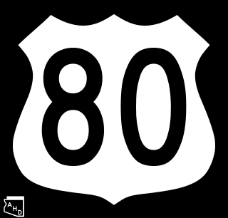
U.S. Route 80 (US 80) also known as the Ocean-to-Ocean Highway, the Broadway of America and the Jefferson Davis Memorial Highway was a major transcontinental highway that existed in the U.S. state of Arizona from November 11, 1926, to October 6, 1989. At its peak, US 80 traveled from the California border in Yuma to the New Mexico state line near Lordsburg. US 80 was an important highway in the development of Arizona's car culture. Like its northern counterpart, US 66, the popularity of travel along US 80 helped lead to the establishment of many unique road side businesses and attractions, including many iconic motor hotels and restaurants. US 80 was a particularly long highway, reaching a length of almost 500 miles (800 km) within the state of Arizona alone for most of the route's existence.
In the history of the American frontier, overland trails were built by pioneers throughout the 19th century and especially between 1829 and 1870 as an alternative to sea and railroad transport. These immigrants began to settle much of North America west of the Great Plains as part of the mass overland migrations of the mid-19th century. Settlers emigrating from the eastern United States were spurred by various motives, among them religious persecution and economic incentives, to move to destinations in the far west via routes including the Oregon, California, and Mormon Trails. After the end of the Mexican–American War in 1849, vast new American conquests again enticed mass immigration. Legislation like the Donation Land Claim Act and significant events like the California Gold Rush further lured people to travel overland to the west.

Port Isabel was a seaport established on Port Isabel Slough in 1865 during the American Civil War in Sonora, Mexico in the mouth of the Colorado River on the Gulf of California. It was founded to support the increased river traffic caused by the gold rush that began in 1862 on the Colorado River and the Yuma Quartermaster Depot newly established in 1864 to support the Army posts in the Arizona Military District. The slough was discovered in 1865 by the Captain W. H. Pierson of the schooner Isabel, that first used the slough to transfer its cargo to steamboats safe from the tidal bore of the Colorado River. Shortly afterward Port Isabel was established 3 miles up the slough and replaced Robinson's Landing as the place where cargo was unloaded in the river from seagoing craft on to flat bottomed steamboats of the Colorado River and carried up to Fort Yuma and points further north on the river.

The Mohave War was an armed conflict between the Mohave people and the United States from 1858 to 1859. With the California Gold Rush of 1849, thousands of American settlers headed west through Mohave country and into California. The influx of migrants passing through, combined with simple misunderstandings, led to conflict. Fort Mohave on the Arizona side of the Colorado River was built for operations against the Mohave and was the second American military post established on the river after Fort Yuma. Eventually advantages in weaponry and tactics brought the Mohave and their allies to surrender. After the signing of a peace treaty in 1859, the Mohave no longer opposed the United States through warfare. The peace also ended a long guerrilla war between the Mohave and the Maricopa of south central Arizona.

Southern Emigrant Trail, also known as the Gila Trail, the Kearny Trail, Southern Trail and the Butterfield Stage Trail, was a major land route for immigration into California from the eastern United States that followed the Santa Fe Trail to New Mexico during the California Gold Rush. Unlike the more northern routes, pioneer wagons could travel year round, mountain passes not being blocked by snows, however it had the disadvantage of summer heat and lack of water in the desert regions through which it passed in New Mexico Territory and the Colorado Desert of California. Subsequently, it was a route of travel and commerce between the eastern United States and California. Many herds of cattle and sheep were driven along this route and it was followed by the San Antonio-San Diego Mail Line in 1857–1858 and then the Butterfield Overland Mail from 1858–1861.
George Alonzo Johnson (1824–1903) 49er, entrepreneur, and California politician.

Vallecito, in San Diego County, California, is an oasis of cienegas and salt grass along Vallecito Creek and a former settlement on the edge of the Colorado Desert in the Vallecito Valley. Its Spanish name is translated as "little valley". Vallecito was located at the apex of the gap in the Carrizo Badlands created by Carrizo Creek and its wash in its lower reach, to which Vallecito Creek is a tributary. The springs of Vallecito, like many in the vicinity, are a product of the faults that run along the base of the Peninsular Ranges to the west.
Steamboats on the Colorado River operated from the river mouth at the Colorado River Delta on the Gulf of California in Mexico, up to the Virgin River on the Lower Colorado River Valley in the Southwestern United States from 1852 until 1909, when the construction of the Laguna Dam was completed. The shallow draft paddle steamers were found to be the most economical way to ship goods between the Pacific Ocean ports and settlements and mines along the lower river, putting in at landings in Sonora state, Baja California Territory, California state, Arizona Territory, New Mexico Territory, and Nevada state. They remained the primary means of transportation of freight until the advent of the more economical railroads began cutting away at their business from 1878 when the first line entered Arizona Territory.
Jaeger's Ferry was a major river ferry at the Yuma Crossing of the Colorado River in the 1850s until 1862, 1 mile below Fort Yuma.
General Jesup was a side-wheel paddle-steamer, named for General Thomas Jesup then Quartermaster General of the United States Army, and was the second steamboat launched on the Colorado River, in 1854.
Benjamin Minturn Hartshorne (1826–1900) was a California businessman who immigrated during the California Gold Rush. He was involved in Sacramento River and Colorado River steamboats as well as maritime shipping.
Olive City, or Olivia, was a short-lived town, steamboat landing, and ferry crossing on the Colorado River in what was then Yuma County, Arizona Territory, from 1863 to 1866. It was located on the Arizona bank of the Colorado River, 1 mile above its rival Mineral City and 1/2 mile above the original site of Ehrenberg, Arizona, 3 miles southwest of the location of La Paz. The GNIS location of Olive City (historical) is indicated as being in La Paz County, Arizona, but its coordinates in the present-day now put it across the river just within Riverside County, California. Olive City was named after Olive Oatman who had been, with her sister, survivors of the massacre of her family and a captive of the Yavapai until purchased from them by the Mohave who they lived with for several years.
George A. Johnson & Company was a partnership between three men who pioneered navigation on the Colorado River. Benjamin M. Hartshorne, George Alonzo Johnson and Alfred H. Wilcox. The George A. Johnson & Company was formed in the fall of 1852, and was reorganized as the Colorado Steam Navigation Company in 1869.