Zoar is a village in Tuscarawas County, Ohio, United States. The population was 169 at the 2010 census. The community was founded in 1817 by Radical Pietists as a utopian Christian community, which survived until 1898.

Zoar is a census-designated place (CDP) and unincorporated community in Menominee County, Wisconsin, United States. The population was 107 at the 2020 census. Zoar is located along Wisconsin Highway 47, approximately 3 miles (4.8 km) northwest of Neopit. Situated within traditional Menominee territory, it is known in the Menominee language as Saqnawehnaen, a name which refers to a fork in a stream.

Zoar is an unincorporated community in northern Hamilton Township, Warren County, Ohio, United States. It is located on the 3C Highway about one mile east of Hopkinsville and three miles west of Morrow in Virginia Military District Military Survey 1546.

Kannaland Municipality is a local municipality located within the Garden Route District Municipality in the Western Cape province of South Africa. The municipal area is situated in the western part of the Little Karoo and includes the towns of Ladismith, Calitzdorp and Zoar. As of 2011 it has a population of 24,767. Its municipality code is WC041.

Zoara, the biblical Zoar, previously called Bela, was one of the five "cities of the plain" – a pentapolis at that time of Abram or Abraham named later, it was a highly fertile valley apparently located along the lower Jordan Valley and the Dead Sea plain and mentioned in the Book of Genesis. It was said to have been spared the "brimstone and fire" which destroyed Sodom and Gomorrah in order to provide a refuge for Lot and his daughters. It is mentioned by Josephus; by Ptolemy ; and by Eusebius and Saint Jerome in the Onomasticon.

Wolraad Woltemade was a Cape Dutch dairy farmer, who died while rescuing sailors from the wreck of the ship De Jonge Thomas in Table Bay on 1 June 1773. The story was reported by the Swedish naturalist Carl Peter Thunberg who was in South Africa as a surgeon for the Vereenigde Oostindische Compagnie at the time.

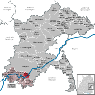
Rottenacker is a village in the district of Alb-Donau in Baden-Württemberg in Germany.

Zoar Valley is an area of deep gorges along the Main and South branches of Cattaraugus Creek in western New York, United States. The valley is located along the border of Erie County and Cattaraugus County, roughly between the villages of Gowanda to the west and Springville to the east.
Zoar State Forest is a state forest located in King William County, Virginia, near the town of Aylett. It is used to grow timber and agricultural crops, maintain habitat for various species of wildlife, and to provide educational and recreational opportunities. All state forests are managed by the VDOF for multiple-use purposes, including watershed protection, recreation, timber production, fishing, and applied forest research. The state forests are self-supporting. In addition, one-fourth of all income is returned to King William County. Income is received from the sale of forest products.
Aylett is an unincorporated community in King William County, Virginia, United States. It is located where Virginia State Route 360 crosses the Mattaponi River. William Aylett and his family had several prominent warehouses and mills in the area.
Seweweekspoortpiek is a peak in the Western Cape, South Africa. It is the highest mountain in the Cape Fold Belt and the highest point in the Western Cape province. Along with its western neighbour, Du Toits Peak, it qualifies as an Ultra and these are the only two in the country.
Zoar is an unincorporated community located in Sussex County, Delaware, United States.

Zoar is a hamlet in the town of Collins in Erie County, New York, United States. Though it is in Collins, mail is postmarked to the Gowanda ZIP code of 14070. It is located on the northern side of Zoar Valley.

The Zoar Trail is a 6.5-mile (10.5 km) Blue-Blazed hiking trail "system" in the lower Housatonic River valley in Fairfield County and is entirely in the Sandy Hook section of Newtown in the lower block of Paugussett State Forest.

Lake Zoar is a reservoir on the Housatonic River in the U.S. state of Connecticut. It was formed by the completion of the Stevenson Dam, which flooded an area of Oxford and Stevenson named "Pleasantvale" or "Pleasant Vale". "Connecticut's Lakes Reflect Our History, Present". Retrieved 2018-04-02. The towns of Monroe, Newtown, Oxford, and Southbury border Lake Zoar. The name Zoar originates from corner of Newtown and Monroe that once called itself Zoar after the Biblical city Zoara near the Dead Sea.

Zoar Strict Baptist Chapel is a Strict Baptist place of worship in the hamlet of Lower Dicker in the English county of East Sussex. Founded in 1837 and originally known as The Dicker Chapel, the "large and impressive" Classical/Georgian-style building stands back from a main road in a rural part of East Sussex. The 800-capacity building included a schoolroom and stables when built, and various links exist between people and pastors associated with the chapel and other Strict Baptist and Calvinistic causes in the county, which is "particularly well endowed with [such] chapels".

Amaliënstein is a former mission station of the Berlin Missionary Society, 22 km east of Ladismith, on the road to Calitzdorp. Named after Amalie von Stein, benefactress of German missions. The church complex was completed in 1853.
Zoar is an unincorporated community in Pike and Dubois counties, in the U.S. state of Indiana.

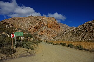
Seweweekspoort is a mountain pass located along the R323 regional route running from Zoar and Laingsburg in the western Little Karoo region of South Africa's Western Cape province. The highest point in the Western Cape, Seweweekspoort Peak, is located close to the pass. The pass and surrounding area is a popular tourist attraction due to the diversity of local flora and the geology of the surrounding mountains.


