Burgenland is the easternmost and least populous state of Austria. It consists of two statutory cities and seven rural districts, with a total of 171 municipalities. It is 166 km (103 mi) long from north to south but much narrower from west to east. The region is part of the Centrope Project. The name of Burgenland was invented/coined in 1922, after its territories became part of Austria.

Somogy is an administrative county in present Hungary, and also in the former Kingdom of Hungary.

Krassó-Szörény was an administrative county (comitatus) of the historic Kingdom of Hungary. Its territory is now mostly located in south-western Romania, with one very small part which is located in Serbia. The capital of the county was Lugos.

Jamena is a village located in the municipality of Šid, Srem District, Vojvodina, Serbia. As of 2011 census, it has a population of 950 inhabitants. It is the only place in Serbia that borders both Croatia and Bosnia and Hercegovina forming a geographic salient.

Veliki Gaj is a village located in the Plandište municipality, in the South Banat District of Serbia. It is situated in the Autonomous Province of Vojvodina. According to the 2002 census, the population of the village was 790 people, of whom 670 were ethnic Serbs (84.81%).
Erdut is a village and a municipality in eastern Croatia some 37 km east of the major city of Osijek. Lying on the border with neighbouring Serbia, it was the site of the signing of the 1995 Erdut Agreement, which initiated the UNTAES transitional administration over the Eastern Slavonia, Baranja and Western Syrmia.

Tovarnik is a municipality in the Vukovar-Syrmia County in Croatia next to the border with Serbia with the town of Šid and the village of Ilinci on the other side of the border. According to the 2001 census, there are 2,775 inhabitants, 91.06% which are Croats. The municipality is part of Syrmia. It is the birthplace of great Croatian poet Antun Gustav Matoš. Tovarnik is underdeveloped municipality which is statistically classified as the First Category Area of Special State Concern by the Government of Croatia.

Bácsszőlős is a village and municipality in Bács-Kiskun county, in the Southern Great Plain region of southern Hungary.
Tiszabecs is a village in Szabolcs-Szatmár-Bereg County, in the Northern Great Plain region of eastern Hungary.

Goričan is a municipality in Međimurje County, Croatia.

Potony is a village in Somogy County, Hungary.

Gyékényes is a village in Somogy county, Hungary next to the Croatian border. Its train station serves as an important crossing point into Croatia.
Szentborbás is the southernmost village of Somogy county, Hungary. Krancsevicza-puszta is part of the village.
Lispeszentadorján is a village of 334 people in Hungary. It lies in the southern part of the Zala hills, close to the Slovenian and Croatian borders. The distance to Budapest is approx. 254 km (158 mi) by car.

Aranyosgadány is a village in central Baranya County, Pécs District, in southern Hungary. It is located in the western Baranya Hills. It was established in 1941 with the merger of the settlements of Keménygadány and Pécsaranyos. Its population at the 2011 Census was 355.
The 1st Army Group was a Royal Yugoslav Army formation mobilised prior to the German-led Axis invasion of Yugoslavia in April 1941 during World War II. It consisted of the 4th Army, 7th Army, and the 1st Cavalry Division, which was the army group reserve. It was responsible for the defence of northwestern Yugoslavia, with the 4th Army defending the eastern sector along the Yugoslav–Hungarian border, and the 7th Army defending the western sector along the borders with Germany and Italy. Like all Yugoslav formations at the time, the 1st Army Group had serious deficiencies in both mobility and firepower as well as internal friction among the different ethnic groups, particularly between Serbs and Croats.

The 4th Army was a Royal Yugoslav Army formation mobilised prior to the German-led Axis invasion of the Kingdom of Yugoslavia during World War II. It was drawn from the peacetime 4th Army District. When mobilised, it consisted of three divisions, a brigade-strength detachment, one horse cavalry regiment and one independent infantry regiment. It formed part of the 1st Army Group, and was responsible for defending a large section of the Yugoslav–Hungarian border, being deployed behind the Drava river between Varaždin and Slatina. Like all Yugoslav formations at the time, the 4th Army had serious deficiencies in both mobility and firepower.
The 42nd Infantry Division Murska was an infantry formation of the Royal Yugoslav Army that formed part of the 4th Army during the German-led Axis invasion of the Kingdom of Yugoslavia in April 1941. It did not have a corresponding divisional district in peacetime, and was raised at the time of mobilisation. Like all Yugoslav infantry divisions of the time, it was a very large and unwieldy formation which was almost entirely reliant on animal transport for mobility, and also lacked modern arms and sufficient ammunition. Commanded by Divizijski đeneral Borisav Ristić, it was largely manned by Croat troops, many of whom saw the Germans as potential liberators from Serbian oppression.
The 27th Infantry Division Savska was an infantry formation of the Royal Yugoslav Army that formed part of the 4th Army during the German-led invasion of Yugoslavia by the Axis powers in April 1941. It was raised from the Savska divisional district, and like all Yugoslav infantry divisions of the time, was a very large and unwieldy formation almost entirely reliant on animal transport for mobility. Commanded by Divizijski đeneral August Marić, the division was largely made up of ethnic Croat troops, many of whom saw the Germans as potential liberators from Serbian oppression during the interwar period. It also lacked modern arms and sufficient ammunition.

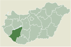
Csurgó is a district in south-western part of Somogy County, Hungary. Csurgó is also the name of the town where the district seat is located. The district is in the Southern Transdanubia Statistical Region.