Pulau Ketam is an island located off the coast of Port Klang, Selangor, Malaysia. The island is in the intertidal zone and the chief vegetation is mangrove.

Çaybaşı, formerly Çilader, is a town and district of Ordu Province in the Black Sea region of Turkey. According to the 2000 census, population of the district is 15,372 of which 4,810 live in the town of Çaybaşı. The district covers an area of 165 km2 (64 sq mi), and the town lies at an elevation of 440 m (1,444 ft).

Tŕnie is a village and municipality of the Zvolen District in the Banská Bystrica Region of Slovakia.
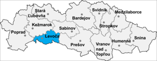
Ordzovany is a village and municipality in Levoča District in the Prešov Region of central-eastern Slovakia.

Highway 316 is a highway in the Canadian province of Saskatchewan. It runs from Highway 16 near Clavet to Highway 5. Highway 316 is about 17 km (11 mi.) long. This area is an industrial commercial area along Highway #316 which extends from Clavet north to the PCS Patience Lake Mine which is just 10 miles from the city of Saskatoon. Highway 316 is a primary weight highway, and also runs near the Canadian National Railway line which goes from Saskatoon through Clavet. In 1941, the Canadian Pacific Railway ran from Saskatoon through Cheviot and on south eastward.

Qaravəlli is a village in the Ismailli Rayon of Azerbaijan.
Səlimoba is a village in the Khachmaz Rayon of Azerbaijan. The village forms part of the municipality of Yalama.

Obojnia is a village in the administrative district of Gmina Zaleszany, within Stalowa Wola County, Podkarpackie Voivodeship, in south-eastern Poland.

Mroczki is a village in the administrative district of Gmina Wiśniew, within Siedlce County, Masovian Voivodeship, in east-central Poland.
Tomaszewo is a village in the administrative district of Gmina Ostrowite, within Słupca County, Greater Poland Voivodeship, in west-central Poland.
Przęsin is a village in Gmina Miastko, Bytów County, Pomeranian Voivodeship, in northern Poland, on the border with West Pomeranian Voivodeship. It lies approximately 21 kilometres (13 mi) south-west of Bytów and 69 km (43 mi) south-west of Gdańsk.
Bình Sơn is a commune (xã) and village in Luc Nam District, Bắc Giang Province, in northeastern Vietnam.
Kapıkaya Dam is a dam in Turkey. The development was backed by the Turkish State Hydraulic Works.

Tabelot is a village and rural commune in Niger. As of 2011, the commune had a total population of 32,431 people.

Grejač is a village in the municipality of Aleksinac, Serbia. According to the 2002 census, the village has a population of 696 people.
Kamenica is a village in the municipality of Aleksinac, Serbia. According to the 2002 census, the village has a population of 103 people.
Đake is a village in the municipality of Kuršumlija, Serbia. According to the 2002 census, the village has a population of 83 people.
Bašabulići is a village in the municipality of Novo Goražde, Republika Srpska, Bosnia and Herzegovina.
Rlica is a village in the municipality of Kruševac, Serbia. According to the 2002 census, the village has a population of 41 people.
Donja Omašnica is a village in the municipality of Trstenik, Serbia. According to the 2002 census, the village has a population of 708 people.
