Captree, New York

Last updated

Captree, New York
USA New York location map.svg
Red pog.svg
Captree
Usa edcp location map.svg
Red pog.svg
Captree
Coordinates: 40°38′24″N73°15′29″W / 40.64000°N 73.25806°W / 40.64000; -73.25806
CountryUnited States
State New York
County Suffolk
Towns Islip
Babylon
Area
[1]
  Total2.80 sq mi (7.24 km2)
  Land1.62 sq mi (4.19 km2)
  Water1.18 sq mi (3.05 km2)
Elevation
5 ft (2 m)
Population
 (2020)
  Total48
  Density29.68/sq mi (11.46/km2)
Time zone UTC-5 (Eastern (EST))
  Summer (DST) UTC-4 (EDT)
ZIP Code
11702
Area code(s) 631 / 934
FIPS code 36-12402
GNIS feature ID2805097 [2]

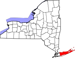
Captree is a census-designated place (CDP) in the towns of Islip and Babylon in Suffolk County, New York, United States. It occupies Captree Island in Great South Bay, as well as the east end of Jones Beach Island to the south, comprising Captree State Park. It was first listed as a CDP prior to the 2020 census. [2] Prior to that it was part of the Oak Beach–Captree CDP.

The community is in southwestern Suffolk County, on two islands that lie between Long Island to the north and Fire Island to the south. The eastern two-thirds of the CDP are in the town of Islip, while the one-third of the CDP that occupies the portion of Captree Island west of the Robert Moses Causeway is in the town of Babylon. The Robert Moses Causeway connects Captree and Jones Beach islands with West Islip, 6 miles (10 km) to the north on Long Island. Ocean Parkway runs west from Captree through Oak Beach and Gilgo, leading 14 miles (23 km) to Jones Beach State Park. To the south, the Fire Island Inlet Bridge leads 1 mile (1.6 km) to Robert Moses State Park on Fire Island.

Demographics

Historical population
CensusPop.Note
2020 48
U.S. Decennial Census [3]

Related Research Articles

<span class="mw-page-title-main">Suffolk County, New York</span> County in New York, United States

Suffolk County is the easternmost county in the U.S. state of New York. It comprises the eastern two-thirds of Long Island, bordered to its west by Nassau County, to its east by Gardiners Bay and the Atlantic Ocean, to its north by Long Island Sound, and to its south by Great South Bay.

<span class="mw-page-title-main">Gilgo-Oak Beach-Captree, New York</span> Census-designated place in New York, United States

Gilgo-Oak Beach-Captree, frequently just called Oak Beach, was a census-designated place (CDP) in Suffolk County, New York within the Town of Babylon. The population was 333 at the 2000 census.

<span class="mw-page-title-main">West Islip, New York</span> Hamlet and census-designated place in New York, United States

West Islip is a hamlet and CDP founded in 1683, located in the Town of Islip, in Suffolk County, New York, United States. Situated on the South Shore of Long Island, the population of the CDP was 27,048 at the time of the 2020 census.

<span class="mw-page-title-main">Babylon (village), New York</span> Village in New York, United States

Babylon is a village in Suffolk County, New York. The population was 12,166 at the 2010 census. It is located approximately 25 miles (40 km) from New York City at the Queens border and approximately 33 miles (53 km) from Manhattan.

<span class="mw-page-title-main">Babylon, New York</span> Town in New York, United States

The Town of Babylon is one of ten towns in Suffolk County, New York, United States. Its population was 218,223 as of the 2020 census. Parts of Jones Beach Island, Captree Island and Fire Island are in the southernmost part of the town. It borders Nassau County to the west and the Atlantic Ocean to the south. At its westernmost point, it is about 20 miles (32 km) from New York City at the Queens border, and about 30 miles (48 km) from Manhattan. The village of Babylon is also within the town.

<span class="mw-page-title-main">Islip, New York</span> Town in New York, United States

Islip is a town in Suffolk County, New York, United States, on the south shore of Long Island. The population was 335,543 at the 2010 census, making it the fourth most populous city or town in the state.

<span class="mw-page-title-main">Robert Moses State Park</span> State park in New York, United States

Robert Moses State Park - Long Island is a 875-acre (3.54 km2) state park in southern Suffolk County, New York. The park lies on the western end of Fire Island, one of the central barrier islands off the southern coast of Long Island, and is known for its five-mile (8.0 km) stretch of beaches on the Atlantic Ocean. The park is accessible from Long Island by the Robert Moses Causeway across Great South Bay.

<span class="mw-page-title-main">Jones Beach Island</span>

Jones Beach Island is one of the outer barrier islands off the southern coast of Long Island in the U.S. state of New York.

<span class="mw-page-title-main">Fire Island</span> Island in New York

Fire Island is the large center island of the outer barrier islands parallel to the South Shore of Long Island, in the U.S. state of New York.

<span class="mw-page-title-main">Robert Moses Causeway</span>

The Robert Moses Causeway is an 8.10-mile-long (13.04 km) parkway in Suffolk County, New York on Long Island. It is named for the master builder and urban planner Robert Moses. The parkway, originally known as the Captree Causeway, connects West Islip on Long Island to the barrier beach islands, such as Captree Island, Jones Beach Island, and the western tip of Fire Island, to the south. It is designated New York State Route 908J (NY 908J), an unsigned reference route. Except south of NY 27A, the road, like most parkways in New York State, is limited to non-commercial traffic.

<span class="mw-page-title-main">Captree State Park</span> State park in New York, United States

Captree State Park is a 340-acre (1.4 km2) state park located in the towns of Babylon and Islip in Suffolk County, New York, United States. The park is located south of Captree Island on the easternmost end of Jones Beach Island, and overlooks the Fire Island Inlet and the westernmost section of Fire Island.

<span class="mw-page-title-main">Ocean Parkway (Long Island)</span>

The Ocean Parkway is a 15.59-mile (25.09 km) parkway that traverses Jones Beach Island between Jones Beach State Park and Captree State Park on Long Island, New York, in the United States. It begins at the southern terminus of the Meadowbrook State Parkway and heads east across Jones Beach Island, intersecting the south end of the Wantagh State Parkway before ending just past the southern terminus of the Robert Moses Causeway. The highway is designated New York State Route 909D (NY 909D), an unsigned reference route.

<span class="mw-page-title-main">New York's 2nd congressional district</span> U.S. House district for New York

New York's 2nd congressional district is a congressional district for the United States House of Representatives along the South Shore of Long Island, New York. It includes southwestern Suffolk County and a small portion of southeastern Nassau County. The district is currently represented by Republican Andrew Garbarino.

<span class="mw-page-title-main">Outer Barrier</span> String of barrier islands dividing Long Island from the Atlantic Ocean

The Outer Barrier, also known as the Long Island and New York City barrier islands, refers to the string of barrier islands that divide the lagoons south of Long Island, New York from the Atlantic Ocean. These islands include Long Beach Barrier Island, Barnum Island, Jones Beach Island, Fire Island and Westhampton Island. The outer barrier extends 75 miles (121 km) along the South Shore of Long Island, from the Rockaway Peninsula in New York City to the east end of Shinnecock Bay in Suffolk County.

<span class="mw-page-title-main">Oak Beach, New York</span>

Oak Beach is a small community and census-designated place located near the eastern end of Jones Beach Island, a barrier island between the Atlantic Ocean and the Great South Bay of Long Island. The community is part of the village of Babylon in Suffolk County, New York, United States. The eastern part, the Oak Island Beach Association, is gated, whereas the western part is not. The Oak Beach CDP was first listed prior to the 2020 census. Prior to that the community was part of the Oak Beach–Captree census-designated place.

<span class="mw-page-title-main">Fire Island Inlet</span>

Fire Island Inlet is an inlet on the south shore of Long Island, New York.

<span class="mw-page-title-main">Great South Bay Bridge</span> Bridge

The Great South Bay Bridge is a bridge on the southwest side of Suffolk County, New York, on Long Island. It connects the Robert Moses Causeway from Long Island's mainland over the Great South Bay, connecting to Captree and Jones Beach islands. It serves as access via the Robert Moses Causeway to both of the downstream crossings, the State Boat Channel Bridge and the Fire Island Inlet Bridge, also leading visitors and on-lookers to either the Fire Island Lighthouse or the Robert Moses State Park.

<span class="mw-page-title-main">State Boat Channel Bridge</span> Bridge

The State Boat Channel Bridge is a bascule bridge (drawbridge) in Suffolk County, New York, United States. It crosses over the Long Island New York State Boat Channel connecting Captree Island and Jones Beach Island on Robert Moses Causeway in the Oak Beach–Captree area within the town of Babylon.

<span class="mw-page-title-main">Gilgo, New York</span> Hamlet and census-designated place in New York, United States

Gilgo is a hamlet and census-designated place (CDP) in the Town of Babylon in Suffolk County, New York, United States. The population was 131 at the 2010 census.

<span class="mw-page-title-main">Oak Beach–Captree, New York</span> Census-designated place in New York, United States

Oak Beach–Captree, frequently just called Oak Beach, was a census-designated place (CDP) in the town of Babylon in Suffolk County, New York, United States. The population was 286 at the 2010 census.

References

  1. "ArcGIS REST Services Directory". United States Census Bureau. Retrieved September 20, 2022.
  2. 1 2 "Captree Census Designated Place". Geographic Names Information System . United States Geological Survey, United States Department of the Interior.
  3. "Census of Population and Housing". Census.gov. Retrieved June 4, 2016.