Chiengi District

Last updated
Chiengi District
Chiengi District, Zambia 2022.png
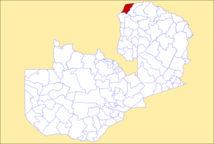
District location in Zambia
CountryFlag of Zambia.svg  Zambia
Province Luapula Province
Capital Chiengi
Population
 (2000)
  Total83,824
Time zone UTC+2 (CAT)

Chiengi District with headquarters at Chiengi is the smallest and most northerly district in the Luapula Province of Zambia and was carved out of Nchelenge District after Zambia's independence. As of the 2010 Zambian Census, the district had a population of 109,147 people. [1] Most of its population live in fishing villages along the 70 km (approx.) of the north-east shore of Lake Mweru which lies within the district. The largest settlement is Puta, 5 km south of Chiengi town, named after Chief Puta. The district is bounded by the DR Congo border in the north, Kaputa District in the east and the Kalungwishi River in the south. [2]

The eastern edge of the district is a hilly wilderness, partly in the Mweru Wantipa National Park. The hills have always been known for their wildlife, early colonial officers sustained themselves through hunting. The district commissioner's residence had wooden bars on the verandah so that the officer could sit there in the evening while lions roamed through the settlement. [3] Elephants used to be seen on the dambo below the boma, but most of the population in the district have been killed by poachers. [4]

Chiengi District today is undeveloped and suffers from a lack of infrastructure. The main road is of gravel construction and is frequently cut by rains and collapsing bridges; there is no telephone or television service although plans are in hand for a satellite link, subject to securing adequate funding. [5]

Related Research Articles

This article is about the transport in Zambia.

Lake Mweru Lake in Zambia

Lake Mweru is a freshwater lake on the longest arm of Africa's second-longest river, the Congo. Located on the border between Zambia and Democratic Republic of the Congo, it makes up 110 kilometres (68 mi) of the total length of the Congo, lying between its Luapula River (upstream) and Luvua River (downstream) segments.

This article deals with the disputed area on the borders of the Democratic Republic of the Congo and Zambia, in Luapula Province.

Luapula River

The Luapula River is a section of Africa's second-longest river, the Congo. It is a transnational river forming for nearly all its length part of the border between Zambia and the DR Congo. It joins Lake Bangweulu to Lake Mweru and gives its name to the Luapula Province of Zambia.

Lake Mweru Wantipa Lake and swamp system in northern Zambia

Lake Mweru Wantipa or Mweru-wa-Ntipa meaning "muddy lake" is a lake and swamp system in the Northern Province of Zambia. It has been regarded in the past as something of mystery, displaying fluctuations in water level and salinity which were not entirely explained by variation in rainfall levels; it has been known to dry out almost completely. This is compounded by its remoteness and it not receiving the same attention from geographers and geologists as its larger and more accessible neighbours, Lake Tanganyika, 25 km east, and Lake Mweru, 40 km west, with which its name is sometimes confused.

Rhodesia (region) Historical region in southern Africa

Rhodesia is a historical region in southern Africa whose formal boundaries evolved between the 1890s and 1980. Demarcated and named by the British South Africa Company (BSAC), which governed it until the 1920s, it thereafter saw administration by various authorities. It was bisected by a natural border, the Zambezi. The territory to the north of the Zambezi was officially designated Northern Rhodesia by the company, and has been Zambia since 1964; that to the south, which the company dubbed Southern Rhodesia, became Zimbabwe in 1980. Northern and Southern Rhodesia were sometimes informally called "the Rhodesias".

Kafue Place in Lusaka Province, Zambia

Kafue is a town in the Lusaka Province of Zambia and it lies on the north bank of the Kafue River, after which it is named. It is the southern gateway to the central Zambian plateau on which Lusaka and the mining towns of Kabwe and the Copperbelt are located. It is located on the T2 Road.

Mbala is Zambia’s most northerly large town and seat of Mbala District, occupying a strategic location close to the border with Tanzania and controlling the southern approaches to Lake Tanganyika, 40 km by road to the north-west, where the port of Mpulungu is located. It had a population of about 20,000 in 2006. Under the name Abercorn, Mbala was a key outpost in British colonial control of this part of south-central Africa. It is headquarters of an administrative district of the Northern Province.

<span class="mw-page-title-main">Northern Province, Zambia</span> Province of Zambia

Northern Province is one of Zambia's ten provinces. It covers approximately one sixth of Zambia in land area. The provincial capital is Kasama. The province is made up of 12 districts, namely Kasama District, Chilubi District, Kaputa District, Luwingu District, Mbala District, Mporokoso District, Mpulungu District, Mungwi District, Nsama District, Lupososhi District, Lunte District and Senga Hill District. Currently, only Kasama and Mbala have attained municipal council status, while the rest are still district councils. It is widely considered to be the heartland of the Bemba, one of the largest tribes in Zambia.

Nchelenge is a town in the Luapula Province of northern Zambia, lying on the south eastern shore of Lake Mweru. It is contiguous with Kashikishi, and they are sometimes referred to as Nchelenge-Kashikishi. Nchelenge is the administrative centre for the Zambian part of Lake Mweru, being the seat of the district government and branches of national agencies, while Kashikishi is the market and fisheries centre.

Mansa, Zambia City in Luapula, Zambia

Mansa is the capital of the Luapula Province of Zambia, and headquarters of Mansa District. It takes its name from the local Chief Mansa and the small Mansa River which flows west to the Luapula River. During British rule the city was named Fort Rosebery.

<span class="mw-page-title-main">Luapula Province</span> Province of Zambia

Luapula Province is one of Zambia's ten provinces located in the northern part of the country. Luapula Province is named after the Luapula River and its capital is Mansa. As per the 2010 Zambian census, the Province had a population of 991,927, which accounted for 7.57 per cent of the total Zambian population.

<span class="mw-page-title-main">Congo Pedicle</span> Southern protrusion of Congo into Zambia

The Congo Pedicle is the southeast salient of the Katanga Province of the Democratic Republic of Congo, which divides neighbouring Zambia into two lobes. In area, the pedicle is similar in size to Wales or New Jersey. 'Pedicle' is used in the sense of 'a little foot'. 'Congo Pedicle' or 'the Pedicle' is also used to refer to the Congo Pedicle road which crosses it.

Water transport and the many navigable inland waterways in Zambia have a long tradition of practical use except in parts of the south. Since draught animals such as oxen were not heavily used, water transport was usually the only alternative to going on foot until the 19th Century. The history and current importance of Zambian waterways, as well as the types of indigenous boats used, provide information on this important aspect of Zambian economy.

Kafulwe is a fishing village on Lake Mweru in the Luapula Province of Zambia, situated just north of the mouth of the Kalungwishi River, and 3 km west of the Nchelenge-Chiengi road. The population of the area is increased considerably by temporary fishing camps on the white sandy beaches when kapenta, a small sardine-like fish is in season. Some of the fish is transported across the lake for sale in the DR Congo and some is trucked south to the Copperbelt.

Chiengi

Chiengi or Chienghospital historic colonial boma of the British Empire in central Africa and today is a settlement in the Luapula Province of Zambia, and headquarters of Chiengi District. Chiengi is in the north-east corner of Lake Mweru, and at the foot of wooded hills dividing that lake from Lake Mweru Wantipa, and overlooking a dambo stretching northwards from the lake, where the Chiengi rivulet flows down from the hills.

<span class="mw-page-title-main">Chilubi District</span> District in Northern Province, Zambia

Chilubi District with headquarters at Chilubi is located in Northern Province, Zambia. It covers the north-east Lake Bangweulu and Bangweulu Wetlands containing several islands including Chilubi Island, and some of the mainland northeast of the lake. As of the 2000 Zambian Census, the district had a population of 66,338 people.

The biomes and ecoregions in the ecology of Zambia are described, listed and mapped here, following the World Wildlife Fund's classification scheme for terrestrial ecoregions, and the WWF freshwater ecoregion classification for rivers, lakes and wetlands. Zambia is in the Zambezian region of the Afrotropical biogeographic realm. Three terrestrial biomes are well represented in the country . The distribution of the biomes and ecoregions is governed mainly by the physical environment, especially climate.

Lusaka–Mongu Road Road in Zambia

The Lusaka–Mongu Road of Zambia runs 580 km from the capital, Lusaka, to Mongu, capital of the Western Province. It connects that province to the rest of the country, as well as being one of two routes to the south-west extremity of North-Western Province. It also serves as the main highway of the western half of Central Province. The entire route from Lusaka to Mongu is designated as the M9 Road.

Bwile people

The Bwile people are an ethnic group that live in the Democratic Republic of the Congo (DRC) and Zambia around the northern part of Lake Mweru.

References

  1. "Districts of Zambia". Statoids. Retrieved February 12, 2010.
  2. Google Earth
  3. Mr Justice J B Thomson: "Memories of Abandoned Bomas No. 8: Chiengi". Northern Rhodesia Journal , Vol II, No. 6 (1954), pp67−77.
  4. Camerapix: "Spectrum Guide to Zambia." Camerapix International Publishing, Nairobi, 1996.
  5. The Times of Zambia online: "Chienge district still lagging behind" by Austin Kalumba Archived September 27, 2007, at the Wayback Machine . Website accessed 22 April 2007. Quote: "The major hindrance has been the bad road which can only be likened to the notorious 1970’s Hell Run."

https://www.daily-mail.co.zm/?p=27404

Coordinates: 8°28′58″S28°56′05″E / 8.4828°S 28.9347°E / -8.4828; 28.9347