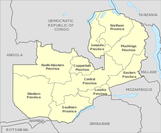
Zambia is divided into ten provinces. The provinces are further subdivided into districts. The Provincial Administration is headed by a Provincial Minister, who is appointed by the President, and is responsible for overseeing the implementation of government policies and coordinating the activities of various government departments within the province. The Provincial Minister is supported by a Provincial Permanent Secretary, who handles the day-to-day administration. Each province has a Provincial Development Coordinating Committee (PDCC) that plays a key role in development planning and coordinating projects within the province.

Copperbelt Province is a province in Zambia which covers the mineral-rich Copperbelt, and farming and bush areas to the south. It was the backbone of the Northern Rhodesian economy during British colonial rule and fuelled the hopes of the immediate post-independence period, but its economic importance was severely damaged by a crash in global copper prices in 1973. The province adjoins the Haut-Katanga province of the Democratic Republic of the Congo, which is similarly mineral-rich.

Kapiri Mposhi is a Zambian town and the seat of the Kapiri Mposhi District in Central Province. Located north of Lusaka, it stands on the Great North Road and is significant for the railway connection between the Zambia Railways line from Kitwe to Lusaka and the western terminus of the Tanzania-Zambia Railway Authority from Dar es Salaam since 1976.
Mufulira is a town in the Copperbelt Province of Zambia. Mufulira means "Place of Abundance and Peace". The town developed around the Mufulira Copper Mine in the 1930s. The town also serves as the administrative capital of Mufulira District.

Luanshya is a town in Zambia, in the Copperbelt Province near Ndola. It has a population of 117,579. The town is situated in an area which was under Chief Mushili of the Lamba people.

The ten provinces of Zambia are divided into a total of 116 districts as of 2018.

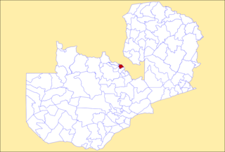
Chibombo District is a district of Central Province, Zambia. As of the 2022 Zambian Census, the district had a population of 421,315 people. It consists of two constituencies, namely Keembe and Katuba.

Lufwanyama District with headquarters at Lufwanyama is a large rural undeveloped district in the west of Copperbelt Province. On a number of maps it is mixed up with Mpongwe District and Masaiti District. At one time these three districts were known as 'Ndola Rural'. As of the 2022 Zambian Census, the district had a population of 133,060 people.

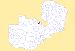
Kapiri Mposhi District is a district of Zambia, located in Central Province. The capital lies at Kapiri Mposhi. As of the 2022 Zambian Census, the district had a population of 371,068 people.

Chililabombwe District is a district of Zambia, located in Copperbelt Province. The capital is Chililabombwe. At the 2022 Zambian Census, the district had a population of 141,899.

Chingola District is a district of Zambia, located in Copperbelt Province. The capital lies at Chingola. As of the 2022 Zambian Census, the district had a population of 299,936 people. It is divided into two constituencies, namely Chingola constituency and Nchanga constituency.
Kalulushi District is a district of Zambia, located in Copperbelt Province. The capital lies at Kalulushi. As of the 2022 Zambian Census, the district had a population of 170,701 people.

Kitwe District is a district of Zambia, located in Copperbelt Province. The capital is Kitwe. As of the 2022 Zambian Census, the district had a population of 661,901 people.

Luanshya District is a district of Zambia, located in Copperbelt Province. The capital lies at Luanshya. As of the 2022 Zambian census, the district had a population of 211,966 people.
Mufulira District is a district of Zambia, located in Copperbelt Province. The capital lies at Mufulira. As of the 2022 Zambian Census, the district had a population of 200,182 people. It is divided into three constituencies, namely Mufulira, Kantanshi and Kankoyo.

Ndola District is a district of Zambia, located in Copperbelt Province. The capital lies at Ndola. As of the 2022 Zambian Census, the district had a population of 624,579 people.

Mpongwe District is a district of Zambia, located in Copperbelt Province. The capital lies at Mpongwe. As of the 2022 Zambian Census, the district had a population of 135,486 people.
Kafulafuta is a constituency of the National Assembly of Zambia. It covers the towns of Chondwe, Mubanga and Walamba in Masaiti District of Copperbelt Province.
Masaiti is a constituency of the National Assembly of Zambia. It covers the towns of Masaiti and Milomwe in Copperbelt Province.

Kafubu River is a river in the Copperbelt Province of Zambia. It starts in Ndola and it cuts through the city's main area westwards into the area in-between Levy Mwanawasa Stadium and Masala before turning southwards after Masala and continuing through the Luanshya and Masaiti districts to join the Kafue River.
