
Alberton is a town situated on the southern part of the East Rand of the Gauteng Province in South Africa and is situated very close to the major urban centre of Johannesburg.
Pinelands is an affluent garden city suburb located on the edge of the southern suburbs of Cape Town, South Africa, neighbouring the suburb of Thornton, and is known for its large thatched houses and green spaces. The suburb is primarily residential and is often praised for its peacefulness and abundance of trees. Pinelands is one of the few areas in Cape Town in which sale of alcohol to the public is prohibited, but some clubs have private liquor licenses. It is a popular place for senior citizens to retire to. While there are several retirement homes in the suburb, younger people are increasingly moving in.

Glenhazel is a suburb of Johannesburg, South Africa. It is located in Region E, bordering Fairmount, Sandringham, Lyndhurst and Percelia Estate. The area lies on a sloping hill with a park in the valley. It is known for its large Jewish population as well as for being home to the largest Jewish kosher hub in Johannesburg, which attracts many Jewish tourists.

Tokai, a large residential suburb of Cape Town, South Africa, is situated on the foothills of the Constantiaberg, and is bordered by Steenberg and Kirstenhof to the south, Bergvliet to the east, Constantia to the north and the SAFCOL pine tree plantations against the mountain to the west.

Khayelitsha is a township in Western Cape, South Africa, on the Cape Flats in the City of Cape Town Metropolitan Municipality. The name is Xhosa for New Home. It is reputed to be one of the largest and fastest-growing townships in South Africa.
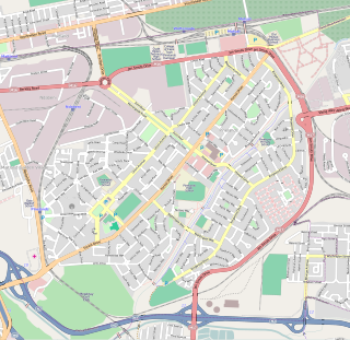
Meadowridge is a suburb in the southern suburbs of Cape Town, South Africa. It is the second garden city in Cape Town and was officially opened on 23 March 1955.
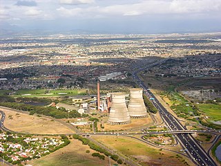
Athlone is a suburb of Cape Town located to the east of the city centre on the Cape Flats, south of the N2 highway. Two of the suburb's main landmarks are Athlone Stadium and the decommissioned coal-burning Athlone Power Station. Athlone is mainly residential and is served by a railway station of the same name. It however includes industrial and commercial zones. There are many "sub-areas" within Athlone, including Gatesville, Rylands, Belgravia Estate, Bridgetown and Hazendal. Colloquially other areas around Athlone are also often included in the greater Athlone area even though the City of Cape Town might classify them as separate neighborhoods such as Rondebosch East, Crawford, and Manenberg.

Vredehoek is a residential suburb of Cape Town, South Africa, located at the foot of Table Mountain and Devil's Peak. It is sandwiched between the two neighbouring suburbs of Oranjezicht and Devil's Peak Estate, the latter of which is often considered a sub-suburb of Vredehoek as they both fall under the neighbourhood watch community called DPV - Devil's Peak & Vredehoek.

Tamboerskloof is a neighbourhood and suburb of Cape Town, South Africa. It lies on the slopes of Lion's Head and Signal Hill, adjacent to the neighbourhoods of Gardens and Bo-Kaap. Tamboerskloof is one of the contiguous group of neighbourhoods referred to as the City Bowl.

Mitchells Plain is a large census designated sub-place located within the City of Cape Town, Western Cape, South Africa and situated about 28 km (17 mi) from the Cape Town city centre. It is one of South Africa's largest residential areas and contains multiple smaller suburbs. It is located on the Cape Flats on the False Bay coast between Muizenberg and Khayelitsha. Conceived of as a "model suburb" by the apartheid government, it was built during the 1970s to provide housing for Coloured victims of forced removal due to the implementation of the Group Areas Act.

Brackenfell is a town in the Western Cape province of South Africa and a northern suburb of Cape Town, situated about 30 km north-east of the city.

The Southern Suburbs are a group of Anglophone suburbs in Cape Town, Western Cape, South Africa. This group includes, among others, Observatory, Mowbray, Pinelands, Rosebank, Rondebosch, Rondebosch East, Newlands, Claremont, Lansdowne, Kenilworth, Bishopscourt, Constantia, Wynberg, Ottery, Plumstead, Diep River, Bergvliet and Tokai. The area is also commonly referred to as the Cape Peninsula, often including the towns further South such as Fish Hoek.

Observatory is a suburb in Cape Town, South Africa, colloquially known as Obs. Bordered by Mowbray to the south and Salt River to the northwest, the area is best known as a student neighbourhood associated with the nearby University of Cape Town and Groote Schuur Hospital. It takes its name from the South African Astronomical Observatory headquarters, built in 1829 by the Royal Observatory.

Green Point is an affluent suburb on the Atlantic Seaboard of Cape Town, South Africa located to the north west of the central business district. It is home to Cape Town Stadium, a major sporting venue that was built for the 2010 FIFA World Cup. Sea Point promenade runs through the suburb, connecting it to Three Anchor Bay and Sea Point, a popular Jewish neighbourhood. Somerset Road forms the main thoroughfare lined by restaurants, cafés, delis, boutiques and nightclubs.
Grassy Park is a suburb of the City of Cape Town in the Western Cape Province of South Africa.
Kenilworth is a suburb in Cape Town, South Africa.
Retreat is a suburb in Cape Town, South Africa.
Walmer Estate is a suburb of Cape Town in the Western Cape province of South Africa. It lies at the foot of Table Mountain and is bordered to the south by Table Mountain National Park, to the north-east by Woodstock and to the west by Zonnebloem. It covers an area of 0.47 km2.

Meadowridge Library is a public library in the suburb of Meadowridge, in Cape Town, South Africa. It has 8,112 members, and was ranked 14th in the City of Cape Town's top 20 circulating libraries in 2014, out of the city's 101 libraries.

Lentegeur is a neighbourhood located within the Mitchells Plain urban area of the City of Cape Town in the Western Cape province of South Africa. It is located in the north eastern section of the Mitchells Plain area. The 400 bed Mitchells Plain Hospital, one of Cape Town's larger hospitals, is located in the neighbourhood. The Lentegeur Sports Grounds dominate central area of the neighbourhood.


