The Mitchell River is a river located in Far North Queensland, Australia. The river rises on the Atherton Tableland about 50 kilometres (31 mi) northwest of Cairns and flows about 750 kilometres (470 mi) northwest across Cape York Peninsula from Mareeba to the Gulf of Carpentaria.
The Mitchell Museum of the American Indian is a museum in Evanston, Illinois that focuses exclusively on the history, culture and arts of North American native peoples. It is a Core Member of the Chicago Cultural Alliance, a consortium of 25 ethnic museums and cultural centres in Chicago.

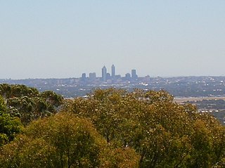
The Swan Coastal Plain in Western Australia is the geographic feature which contains the Swan River as it travels west to the Indian Ocean. The coastal plain continues well beyond the boundaries of the Swan River and its tributaries, as a geological and biological zone, one of Western Australia's Interim Biogeographic Regionalisation for Australia (IBRA) regions. It is also one of the distinct physiographic provinces of the larger West Australian Shield division.

Mitchells Plain is a township in the Western Cape, South Africa about 28 km (17 mi) from the city of Cape Town. It is one of South Africa's largest residential areas. It is located on the Cape Flats on the False Bay coast between Muizenberg and Khayelitsha. Conceived of as a "model suburb" by the apartheid government, it was built during the 1970s to provide housing for Coloured victims of forced removal due to the implementation of the Group Areas Act.

The Western Cape Anti-Eviction Campaign was a non-racial popular movement made up of poor and oppressed communities in Cape Town, South Africa. It was formed in November 2000 with the aim of fighting evictions, water cut-offs and poor health services, obtaining free electricity, securing decent housing, and opposing police brutality.

The Faculty of Dentistry at the University of the Western Cape (UWC) is the largest dental school in Africa. Located in Belville, near Cape Town the UWC Faculty of Dentistry offers the BChD (DDS) Degree, degree in dental hygiene, and post-graduate MChD, MSc(Dent) degrees.

The Carpentaria tropical savanna is a tropical and subtropical grasslands, savannas, and shrublands ecoregion in northern Australia.
The Central Line is a commuter rail service in Cape Town, South Africa, operated by Metrorail Western Cape. Central Line services operate along two routes from central Cape Town to Langa, and then along three branches from Langa to various areas in the south-east of the city. The first branch runs to Mitchell's Plain, the second to Khayelitsha, and the third passes through Belhar to terminate in Bellville.

Wolfgat Nature Reserve is a coastal nature reserve in Mitchells Plain on False Bay in the Western Cape, South Africa.

Pinelands railway station is a Metrorail station situated on the western edge of Pinelands, a suburb of Cape Town, South Africa. It is served by trains on the Cape Flats Line and the Central Line. Cape Flats Line trains travel from Cape Town through Pinelands and Athlone to Retreat. Central Line trains travel from Cape Town through Pinelands and Langa to Mitchell's Plain, Khayelitsha and Bellville.

Eastridge is a neighborhood located within the Mitchells Plain urban area of the City of Cape Town in the Western Cape province of South Africa.

Rocklands is a neighborhood located within the Mitchells Plain urban area of the City of Cape Town in the Western Cape province of South Africa. It is located in the south western most corner of Mitchells Plain and boarders the community of Strandfontein to its intimidate west.

Portland is a neighborhood located within the Mitchells Plain urban area of the City of Cape Town in the Western Cape province of South Africa. It is located within the central area of Mitchells Plain with Mitchells Plain Town Centre located to its immediate east.

Westgate is a neighbourhood located within the Mitchells Plain urban area of the City of Cape Town in the Western Cape province of South Africa. It is located in the central western part of Mitchells Plain. Westgate Mall is located to the neighbourhood's immediate north on the other side of Morgenster Road.

Tafelsig is a neighbourhood located within the Mitchells Plain urban area of the City of Cape Town in the Western Cape province of South Africa. It is located in the south eastern corner of the Mitchells Plain area.

Lentegeur is a neighbourhood located within the Mitchells Plain urban area of the City of Cape Town in the Western Cape province of South Africa. It is located in the north eastern section of the Mitchells Plain area. The 400 bed Mitchells Plain Hospital, one of Cape Town's larger hospitals, is located in the nieghbourhood. The Lentegeur Sports Grounds dominate central area of the neighbourhood.

Mandalay is a neighbourhood located within the Mitchells Plain urban area of the City of Cape Town in the Western Cape province of South Africa. It is located in the north eastern most corner of the Mitchells Plain area.

Colorado is a neighbourhood located within the Mitchells Plain urban area of the City of Cape Town in the Western Cape province of South Africa. It is located in the north western part of the Mitchells Plain area.

Westridge is a neighbourhood located within the Mitchells Plain urban area of the City of Cape Town in the Western Cape province of South Africa. It is located in the western part of the Mitchells Plain area. The Westridge Gardens, which hosts a number of indigenous Cape Flats fynbos species, is an important large public park in the area located in the north of Westridge.

Beacon Valley is a neighborhood located within the Mitchells Plain urban area of the City of Cape Town in the Western Cape province of South Africa. It is located in the central eastern part of Mitchells Plain just north and north east of Micheals Plain Town Centre.


