Liesbeek River

Last updated
Liesbeek River
Liesbeek river at Rosebank 2.jpg
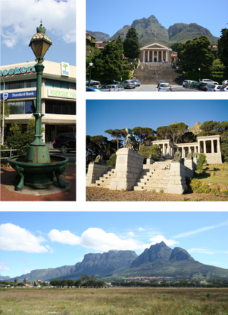
Liesbeek River in Rosebank
Location
Country South Africa
Region Cape Town
Physical characteristics
Length9 km (5.6 mi)

The Liesbeek River (also spelt Liesbeeck) is a river in Cape Town in South Africa. It is named after a small river in the Netherlands. The first "free burghers" of the Dutch East India Company were granted land to farm along the river in 1657, shortly after the first Dutch settlers arrived in the Cape. The river was originally called the Amstel or Versse Rivier. It is the first river that Jan van Riebeeck named. [1]

Contents

The Liesbeek, which is less than 9 km (5.6 mi) long, is situated in the oldest urbanised river valley in South Africa. The headwaters flow from the eastern slopes of Table Mountain above Kirstenbosch Botanical Gardens where the vegetation is largely indigenous. The slopes of Bishopscourt have large properties, including Jan van Riebeeck's farm. Water abstraction occurs here, often to water residential gardens, causing the flow to reduce during the summer months. [2]

In Newlands, there are smaller residential plots. South African Breweries and the Josephine Mill are located here. From Rondebosch, large sections of the river are canalised, and the short sections of the river that are not canalised are degraded by erosion as a consequence of the increased flow from the canalised sections. [3]

Below Rosebank and Mowbray, at Observatory, is the confluence of the Liesbeek and Black River 33°55′47.59″S18°28′41.97″E / 33.9298861°S 18.4783250°E / -33.9298861; 18.4783250 . The Two Rivers Urban Park is located on land between the Liesbeek and the Black with heritage sites and designated public open spaces. The Black River empties into Table Bay at Paarden Eiland. [4]

The Liesbeeck is home to the Platanna, or African clawed frog, an amphibian that has been important in certain areas of medical research.

Walking the Liesbeek

It is perfectly possible to walk almost the entire length of the Liesbeek River on public footpaths. The whole walk is about 9.7 km in length, and should take about two to two-and-a-half hours.

Starting from where the Liesbeek emerges from Kirstenbosch Botanical Gardens in Bishopscourt, walk from The Hill Pre-Primary School on Winchester Avenue through the old Boschenheuwel arboretum. You can follow its route for the first 500 metres or so, to the point where it enters a private estate.

Pick the river up again in Fernwood at the junction of Kirstenbosch Drive and St Albans Close; cross over to Riverside Road, where there is a path next to the river through Fernwood to the point where is passes under Edinburgh Drive. The Upper Liesbeek River Garden in Fernwood is the first formal park along the river's banks. Continue to walk along Riverside Road, then cross Edinburgh Drive and enter Paradise Park. The river comes down a cascade through the Park. A pedestrian bridge crosses the river, which you should use to follow the bank on the east side of the Park.

Access to the Liesbeek River bank temporarily ends at the boundary of the Vineyard Hotel. This is the only major part of the River that passes through private property. Leave the Park and walk up to Bucksburn Road; turn left onto Bucksburn, then right into Lothian Road. Follow Colinton Road past the Vineyard Hotel—you could call in to the hotel for a coffee and walk down through the hotel's grounds to the path next to the river, but you'll have to leave through the Hotel again as there is no other way out. Turn left into Kildare Road - you can catch a glimpse of the river as the road crosses it. The river continues through private property parallel with Main Street; turn right opposite the entrance to SACS into Sans Souci Road and pick up the river again on the left just before Newlands Swimming Pool.

From there, the Liesbeek River Trail takes you right through to Belmont Road in Rosebank. After passing under Main Road, the Trail passes Josephine Mill and the site of the Newlands Stadium, crossing back and forth over pedestrian bridges. It finally ends at the back of the Riverside Mall on Main Road Rosebank. From here, the path is informal, between the canalised bank and the grounds of St Joseph's Marist College in Rondebosch. From Belmont Road, the path eventually reaches the Liesbeek Parkway at the junction with Alma Road in Mowbray.

From here, cross the Liesbeek Parkway, and follow the route of the river through Mowbray, under Settlers Way (N2) to the Two Rivers Urban Park. The path continues opposite the Valkenberg Hospital and the South African Astronomical Observatory to the gates of the River Club in Observatory. The confluence with the Swart (Black) River is in sight, which continues on through Paarden Eiland to empty into Table Bay.

Great white pelicans in the Liesbeek River Pelecanus onocrotalus Great White Pelecan2 Liesbeek.JPG
Great white pelicans in the Liesbeek River

Related Research Articles

<span class="mw-page-title-main">Table Mountain</span> Flat-topped mountain overlooking the city of Cape Town, South Africa

Table Mountain is a flat-topped mountain forming a prominent landmark overlooking the city of Cape Town in South Africa. It is a significant tourist attraction, with many visitors using the cableway or hiking to the top. Table Mountain National Park is the most visited national park in South Africa, attracting 4.2 million people every year for various activities. The mountain has 8,200 plant species, of which around 80% are fynbos, meaning fine bush. It forms part of the Table Mountain National Park, and part of the lands formerly ranged by Khoe-speaking clans, such as the !Uriǁʼaes. It is home to a large array of mostly endemic fauna and flora.

<span class="mw-page-title-main">Devil's Peak (Cape Town)</span> Mountain peak in Cape Town, South Africa

Devil's Peak is part of the mountainous backdrop to Cape Town, South Africa. When looking at Table Mountain from the city centre, or when looking at the standard picture postcard view of the mountain, the skyline is from left to right: the spire of Devil's Peak, the flat mesa of Table Mountain, the dome of Lion's Head and Signal Hill.

<span class="mw-page-title-main">Rondebosch</span> Place in Western Cape, South Africa

Rondebosch is one of the Southern Suburbs of Cape Town, South Africa. It is primarily a residential suburb, with shopping and business districts as well as the main campus of the University of Cape Town.

<span class="mw-page-title-main">Cape Peninsula</span> Rocky peninsula in the Western Cape, South Africa

The Cape Peninsula is a generally mountainous peninsula that juts out into the Atlantic Ocean at the south-western extremity of the African continent. At the southern end of the peninsula are Cape Point and the Cape of Good Hope. On the northern end is Table Mountain, overlooking Table Bay and the city bowl of Cape Town, South Africa. The peninsula is 52 km long from Mouille point in the north to Cape Point in the south. The Peninsula has been an island on and off for the past 5 million years, as sea levels fell and rose with the ice age and interglacial global warming cycles of, particularly, the Pleistocene. The last time that the Peninsula was an island was about 1.5 million years ago. Soon afterwards it was joined to the mainland by the emergence from the sea of the sandy area now known as the Cape Flats. The towns and villages of the Cape Peninsula and Cape Flats, and the undeveloped land of the rest of the peninsula now form part of the City of Cape Town metropolitan municipality. The Cape Peninsula is bounded to the north by Table Bay, to the west by the open Atlantic Ocean, and to the east by False Bay in the south and the Cape Flats in the north.

<span class="mw-page-title-main">Thames Path</span> National Trail following the River Thames in England

The Thames Path is a National Trail following the River Thames from one of its sources near Kemble in Gloucestershire to the Woolwich foot tunnel, south east London. It is about 185 miles (298 km) long. A path was first proposed in 1948 but it only opened in 1996.

<span class="mw-page-title-main">Salt River, Cape Town</span> Place in Western Cape, South Africa

Salt River is a suburb of Cape Town, located near Table Bay, to the east of Cape Town's central business district. Salt River is served by a railway station of the same name, and has the postcode 7925. It is noted for its association with the clothing and textiles industry. The name Salt River is a translation of the Dutch "Soutrivier".

<span class="mw-page-title-main">M3 (Cape Town)</span> Expressway in Cape Town, South Africa, between the City Bowl to the Southern Suburbs

The M3 is an expressway in Cape Town, South Africa, connecting the upper part of the City Bowl to the Southern Suburbs and ending in Tokai. For most of its route it parallels - though further to the south and west - the M4, which was the original road connecting central Cape Town with the settlements to the south.

<span class="mw-page-title-main">Newlands, Cape Town</span> Place in Western Cape, South Africa

Newlands (Nuweland) is an upmarket suburb of Cape Town, South Africa. It is located at the foot of Table Mountain in the Southern Suburbs of Cape Town, and is the wettest suburb in South Africa due to its high winter rainfall. The neighborhood of Bishopscourt is situated to its south west, Claremont to its south east, and Rondebosch to its east and north east.

<span class="mw-page-title-main">Southern Suburbs, Cape Town</span> Sub-region of Cape Town, South Africa

The Southern Suburbs are a group of Anglophone suburbs in Cape Town, Western Cape, South Africa. This group includes, among others, Observatory, Mowbray, Pinelands, Rosebank, Rondebosch, Rondebosch East, Newlands, Claremont, Lansdowne, Kenilworth, Bishopscourt, Constantia, Wynberg, Ottery, Plumstead, Diep River, Bergvliet and Tokai. The area is also commonly referred to as the Cape Peninsula, often including the towns further South such as Fish Hoek.

<span class="mw-page-title-main">Anglican Diocese of Cape Town</span> Diocese of the Anglican Church of Southern Africa

The Diocese of Cape Town is a diocese of the Anglican Church of Southern Africa (ACSA) which presently covers central Cape Town, some of its suburbs and the island of Tristan da Cunha, though in the past it has covered a much larger territory. The Ordinary of the diocese is Archbishop of Cape Town and ex officio Primate and Metropolitan of the ACSA. His seat is St. George's Cathedral in Cape Town.

<span class="mw-page-title-main">Observatory, Cape Town</span> Place in Western Cape, South Africa

Observatory is a suburb in Cape Town, South Africa, colloquially known as Obs. Bordered by Mowbray to the south and Salt River to the northwest, the area is best known as a student neighbourhood associated with the nearby University of Cape Town and Groote Schuur Hospital. It takes its name from the South African Astronomical Observatory headquarters, built in 1829 by the Royal Observatory.

<span class="mw-page-title-main">Mowbray, Cape Town</span> Place in Western Cape, South Africa

Mowbray is one of the Southern Suburbs of Cape Town, South Africa and lies on the slopes of Devil's Peak. Mowbray is at a junction of several major Cape Town highways and has an important multi-modal public transport interchange at Mowbray railway station. Its original name was Driekoppen.

<span class="mw-page-title-main">Lea Valley Walk</span> Long-distance footpath in South East England

The Lea Valley Walk is a 50-mile (80 km) long-distance path located between Leagrave, the source of the River Lea near Luton, and the Thames, at Limehouse Basin, Limehouse, east London. From its source much of the walk is rural. At Hertford the path follows the towpath of the River Lee Navigation, and it becomes increasingly urbanised as it approaches London. The walk was opened in 1993 and is waymarked throughout using a swan logo.

<span class="mw-page-title-main">Rosebank, Cape Town</span> Place in Western Cape, South Africa

Rosebank is one of the Southern Suburbs of Cape Town, South Africa, located between the suburbs of Mowbray and Rondebosch.

<span class="mw-page-title-main">Braamfontein Spruit</span> River in Gauteng, South Africa

The Braamfontein Spruit is the longest stream in Johannesburg, South Africa. It originates in Barnato Park High School, Braamfontein. It is covered and canalised near its source, but once the river runs out of the Parkview Golf Course, it runs through parkland, right to the edge of the city, so that Johannesburgers can still enjoy it in its original state. Walkers, runners and cyclists use a path along its banks every weekend in Gauteng, South Africa. From Berea the stream runs through Pieter Roos Park, down Empire Road to the Frank Brown Park, then on towards the German School in Parktown. The stream then flows towards the Parkview Golf Course, where sections of it are canalised. It exits the golf course and runs through Parkhurst, where it meets the second small tributary, the Westdene Spruit. The stream then flows through River Club, Bryanston, Rivonia and Sunninghill. Its largest tributary, the Sand Spruit, joins the stream in Sunninghill before it joins the Jukskei River in Leeuwkop Prison.

Dozens of fortifications were built in Cape Town and the Cape Peninsula between the 1650s and the 1940s. Most have gone, but a few still stand.

<span class="mw-page-title-main">Cecilia, Table Mountain</span> Section of the Table Mountain National Park

Cecilia is a section of the Table Mountain National Park on the lower eastern slopes of Table Mountain in Cape Town, located just to the south of Kirstenbosch National Botanical Garden. It was previously used for commercial logging and known as Cecilia Forest or Cecilia Plantation, but has now been given protected status and integrated into the National Park.

<span class="mw-page-title-main">Black River (Cape Town)</span> River in Western Cape province, South Africa

The Black River(Swartrivier) is a river in Cape Town, South Africa. It is a tributary of the Salt River together with the Liesbeeck River and the Elsieskraal River. It rises in Arderne Gardens and flows underground initially beneath Main Road and the railway line, before continuing as a canal through Claremont and Rondebosch, then uncanalised through Mowbray, Observatory and Maitland after which it joins the Salt River. Its catchment is part of the Central Management Area of the City of Cape Town and the city has canalised 58% of the river.

<span class="mw-page-title-main">Outline of Cape Town</span> List of links to articles about Cape Town on Wikipedia

The following outline is provided as an overview of and topical guide to Cape Town:

<span class="mw-page-title-main">2021 Table Mountain fire</span> Cape Town fire that destroyed historic mill and library collections

The 2021 Table Mountain fire is a major fire that started on 18 April 2021 in and around Table Mountain National Park and the neighbourhoods of Newlands, Rosebank, Mowbray and Rondebosch in Cape Town, South Africa. The damage to sites in the Table Mountain area included the Rhodes Memorial, where a restaurant burned down; the upper campus of the University of Cape Town (UCT), where the Special Collections library was gutted; and Mostert's Mill, a historic windmill that burned down. In addition, five firefighters were hospitalised.

References

  1. "Archived copy". Archived from the original on 2011-12-15. Retrieved 2014-01-07.{{cite web}}: CS1 maint: archived copy as title (link)
  2. "Archived copy". Archived from the original on 2011-12-15. Retrieved 2014-01-07.{{cite web}}: CS1 maint: archived copy as title (link)
  3. "Archived copy". Archived from the original on 2011-12-15. Retrieved 2014-01-07.{{cite web}}: CS1 maint: archived copy as title (link)
  4. "Archived copy". Archived from the original on 2011-12-15. Retrieved 2014-01-07.{{cite web}}: CS1 maint: archived copy as title (link)

Commons-logo.svg Media related to Liesbeek River at Wikimedia Commons

Liesbeck's River.jpg
Pedestrian Bridge over Liesbeek River - William John Burchell 1811

33°56′11″S18°28′35″E / 33.93639°S 18.47639°E / -33.93639; 18.47639