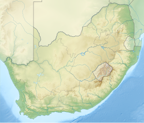
The Helderberg MPA is in the warm temperate Agulhas bioregion. The shoreline is sandy beach with mobile dunes, and the seabed is low sandstone reef with kelp beds and sand sediments. The areas nearest to the river mouths are in relatively poor condition due to pollution of the river water. The beach inside the MPA is the most pristine part of the north shore of False Bay.[1]
History
The area was established as a reserve in 1991.[1] The MPA was proclaimed by the Minister of Environmental Affairs and Tourism, Mohammed Valli Moosa, in Government Gazette No. 21948 of 29 December 2000 in terms section 43 of the Marine Natural Resources Act, 18 of 1998.[2]
A marine protected area is defined by the IUCN as "A clearly defined geographical space, recognised, dedicated and managed, through legal or other effective means, to achieve the long-term conservation of nature with associated ecosystem services and cultural values".[3]
This section needs expansion. You can help by adding to it. (January 2019)
Extent
The length of the protected shoreline is 4km, and the area of protected ocean is 24.6km2.
.[1] The marine protected areas of South Africa are the responsibility of the national government, which has management agreements with a variety of MPA management authorities, in this case, the MPA is managed by the City of Cape Town with funding from the SA Government through the Department of Environmental Affairs (DEA).[3]
The Department of Agriculture, Forestry and Fisheries is responsible for issuing permits, quotas and law enforcement.[5]
Management of the Helderberg MPA has objectives compliant with the general objectives of the Marine Living Resources Act, which are to protect the indigenous fauna and flora and the environment on which they depend, protect breeding stock, facilitate stock recovery, improve stock in surrounding areas and maintain pristine communities for research, and to minimise conflict between competing uses of the area.[6]
Specific biophysical goals of the MPA management plan are protection of the environment and maintenance of biodiversity and functioning of the ecosystems, to protect depleted and endemic species and their required habitats, and enhance sustainability of marine fisheries. Socioeconomic goals are to develop non-consumptive ecotourism, provide for research and monitoring effects of human activities, and promotion of conservation among tourists and scholars. The governance goals are to develop legal structures to protect the biodiversity of the MPA.[6]
Use
Activities requiring a permit
Fishing
Marine species for aquarium usage may only be collected under the authority of a valid permit issued under section 13 of the MLRA. Living organisms may be collected for scientific purposes, but only in terms of a permit.[6]
Boating
There is no boat launching site within the Helderberg MPA. Boats may pass through and anchor in the waters, but all fishing gear must be stowed during passage.[6]
Prohibited activities
The MPA is a no-take zone, so no fishing, harvesting of invertebrates or seaweeds, or bait collection of any kind is allowed.[6]
Geography
The main habitats in the Helderberg MPA are:
Sandy beaches, which include the typical three zones:
Sandy beaches are dynamic habitats, with change mostly driven by wave action. These habitats provide a home to hardy and well adapted organisms. The local dunes are part of a mobile dune system in which sand is transported in the littoral and longshore zones and is trapped by vegetation, causing fore-dune development.[6]
General topography
The coastline is sandy beaches with mobile dune systems, offshore habitats include rocky reefs and soft sandy sediments.[1]
Geology
Low sandstone reefs with sand deposits. Very fine, low density silt may settle during calm periods, but readily becomes suspended again when disturbed.[1][6]
Bathymetry
The nautical charts of this area indicate a depth not exceeding 10m.
The climate of the South-western Cape is markedly different from the rest of South Africa, which is a summer rainfall region, receiving most of its rainfall during the summer months of December to February. The South-western Cape has a Mediterranean type climate, with most of its rainfall during the winter months from June to September.
During the summer the dominant factor determining the weather in the region is a high pressure zone, known as the South Atlantic High, located over the South Atlantic ocean to the west of the Cape coast. Winds circulating in an anticlockwise direction from such a system reach the Cape from the south-east, producing periods of up to several days of high winds and mostly clear skies. These winds keep the region relatively cool. Because of its south facing aspect Helderberg MPA is exposed to these winds.
Winter in the South-western Cape is characterised by disturbances in the circumpolar westerly winds, resulting in a series of eastward moving depressions. These bring cool cloudy weather and rain from the north west. The south westerly winds over the South Atlantic produce the prevailing south-westerly swell typical of the winter months, which beat on the exposed coastline.
Temperatures are moderate and range from -5°C minimum in winter and 35°C maximum in summer. The annual average minimum and maximum temperatures are 11°C and 24°C respectively.[6]
Seasonal variations in sea conditions
There are often summer upwelling events, during which water temperatures may drop to 11°C. Although this area is included in the warm temperate Agulhas bioregion, it is part of the transition between warm and cool temperate regions.[6]
Ecology
Marine ecoregions of the South African Exclusive Economic Zone: Helderberg Marine Protected Area i in the Agulhas ecoregion.
This is a productive biologically-diverse area, and has the only population of the giant isopod Tylos granulatus south of Ysterfontein.[1]
The MPA is in the warm temperate Agulhas ecoregion to the east of Cape Point which extends eastwards to the Mbashe River. There are a large proportion of species endemic to South Africa along this coastline.[7][8]
Four major habitats exist in the sea in this region, distinguished by the nature of the substrate. The substrate, or base material, is important in that it provides a base to which an organism can anchor itself, which is vitally important for those organisms which need to stay in one particular kind of place. Rocky shores and reefs provide a firm fixed substrate for the attachment of plants and animals. Some of these may have Kelp forests, which reduce the effect of waves and provide food and shelter for an extended range of organisms. Sandy beaches and bottoms are a relatively unstable substrate and cannot anchor kelp or many of the other benthic organisms. Finally there is open water, above the substrate and clear of the kelp forest, where the organisms must drift or swim. Mixed habitats are also frequently found, which are a combination of those mentioned above.[9]
There are two small degraded estuarine habitats at the borders of the MPA.[6]
Rocky shores and reefs There are rocky reefs and mixed rocky and sandy bottoms. For many marine organisms the substrate is another type of marine organism, and it is common for several layers to co-exist. Examples of this are red bait pods, which are usually encrusted with sponges, ascidians, bryozoans, anemones, and gastropods, and abalone, which are usually covered by similar seaweeds to those found on the surrounding rocks, usually with a variety of other organisms living on the seaweeds.[9]:Ch.2
The type of rock of the reef is of some importance, as it influences the range of possibilities for the local topography, which in turn influences the range of habitats provided, and therefore the diversity of inhabitants. Sandstone and other sedimentary rocks erode and weather very differently, and depending on the direction of dip and strike, and steepness of the dip, may produce reefs which are relatively flat to very high profile and full of small crevices. These features may be at varying angles to the shoreline and wave fronts. There are fewer large holes, tunnels and crevices in sandstone reefs, but often many deep but low near-horizontal crevices.
Sandy beaches and bottoms (including shelly, pebble and gravel bottoms) Sandy bottoms at first glance appear to be fairly barren areas, as they lack the stability to support many of the spectacular reef based species, and the variety of large organisms is relatively low. The sand is continually being moved around by wave action, to a greater or lesser degree depending on weather conditions and exposure of the area. This means that sessile organisms must be specifically adapted to areas of relatively loose substrate to thrive in them, and the variety of species found on a sandy or gravel bottom will depend on all these factors. Sandy bottoms have one important compensation for their instability, animals can burrow into the sand and move up and down within its layers, which can provide feeding opportunities and protection from predation. Other species can dig themselves holes in which to shelter, or may feed by filtering water drawn through the tunnel, or by extending body parts adapted to this function into the water above the sand.[9]:Ch.3
Kelp forests
The open sea
Marine species diversity
Animals
The most abundant fauna found on sandy beaches are meiofauna. Their small size lets them live between the sand grains. They include nematodes, copepods and ostracods, which help break down organic matter, which then decomposes. Meiofauna are sensitive to pollution and other disturbances, and can be used to monitor pollution on sandy beaches.[6]
This section is empty. You can help by adding to it. (January 2019)
Endemism
The MPA is in the warm temperate Agulhas ecoregion to the east of Cape Point which extends eastwards to the Mbashe River. There are a large proportion of species endemic to South Africa along this coastline.[7][8]
Alien invasive species
This section is empty. You can help by adding to it. (January 2019)
Threats
Urban development in the fore-dune zone tends to be inundated by windblown sand. Artificial dune stabilisation and removal of fore-dunes for development can deplete the sand available for beach functioning. Pollution in by plastic and oil spills is a permanent threat if left unchecked. No specific research has been done on the threats to invertebrates in the MPA.[6]
The Betty's Bay Marine Protected Area is part of the Kogelberg Biosphere Reserve. It is about 29 km south-east of Gordon's Bay and approximately 37 km north-west of Hermanus on the south-western coast of the Western Cape. It is in the Atlantic Ocean immediately adjacent to the town of Betty's Bay, in the Overstrand Municipal area.
The De Hoop Marine Protected Area lies between Arniston and the mouth of the Breede River on the south coast of South Africa adjacent to the De Hoop Nature Reserve. The MPA is 51 kilometres long, and extends 5 nautical miles to sea. The whole MPA is a restricted area and is part of the migratory route and calving area for Southern right whales. The area protects habitats for several economically important inshore reef fish species, and ensures the retention of marine biomass in this part of the coast. The limestone coastline is includes archaeological sites and middens that date back centuries. The MPA is close to the Breede River estuary and, provides protection for species like cob that breed in the estuary and then return to the ocean.
The Tstsikamma Marine Protected Area is a marine protected area on the south coast of South Africa, in both the Western Cape and Eastern Cape. It is on the coast of the Tsitsikamma National Park, and is one of the oldest MPAs in the country. The MPA provides protection for marine habitat and wildlife, including birds and threatened and endangered fish species.
The Agulhas Bank Complex Marine Protected Area is an offshore marine protected area on the continental shelf lying approximately 39 nautical miles southeast of Cape Agulhas off the Western Cape in the Exclusive Economic Zone of South Africa.
The Browns Bank Corals Marine Protected Area is an offshore conservation region in the exclusive economic zone of South Africa
The Robberg Marine Protected Area is an inshore conservation region in the territorial waters of South Africa, near Plettenberg Bay in the Western Cape province.
The Goukamma Marine Protected Area is an inshore conservation region near Knysna in the territorial waters of South Africa
The Agulhas Front Marine Protected Area is an offshore conservation region in the exclusive economic zone of South Africa
The Browns Bank Complex Marine Protected Area is an offshore conservation region in the exclusive economic zone of South Africa
The Hluleka Marine Protected Area is an inshore conservation region in the territorial waters of the Eastern Cape province of South Africa
The Jutten Island Marine Protected Area is an inshore conservation region in the territorial waters of South Africa near Saldanha, Western Cape
The Langebaan Lagoon Marine Protected Area is an inshore conservation region in the territorial waters of South Africa
The Malgas Island Marine Protected Area is an inshore conservation region in the territorial waters of South Africa in the entrance to Saldanha Bay on the west coast of the Western Cape province.
The Stilbaai Marine Protected Area is an inshore conservation region in the territorial waters near Stilbaai on the south coast of the Western Cape province of South Africa.
The Sardinia Bay Marine Protected Area is an inshore conservation region in the territorial waters of the Eastern Cape province, South Africa
The Walker Bay Whale Sanctuary Marine Protected Area is an inshore conservation region in the territorial waters of South Africa in the Western Cape province between Hermanus and Gansbaai
The Marcus Island Marine Protected Area is a inshore conservation region in the territorial waters of South Africa
The Rocherpan Marine Protected Area is a small coastal conservation region on the West Coast of the Western Cape province, in the territorial waters of South Africa. It is about 25 km north of Velddrif on the road to Elands Bay, north of Dwarskersbos.
The Sixteen Mile Beach Marine Protected Area is a coastal conservation region in the territorial waters of South Africa, near Saldanha Bay on the Western Cape coast. The MPA is part of the West Coast National Park which is the core component of the Cape West Coast Biosphere Reserve.
The Amathole Marine Protected Area is an inshore conservation region in the territorial waters of South Africa, near East London on the coast of the Eastern Cape.
This page is based on this Wikipedia article Text is available under the CC BY-SA 4.0 license; additional terms may apply. Images, videos and audio are available under their respective licenses.