Kalk Bay

Last updated
Kalk Bay
Kalkbaai
Kalkbaai.JPG
Kalk Bay as seen from the railway
South Africa Western Cape location map.svg
Red pog.svg
Kalk Bay
South Africa adm location map.svg
Red pog.svg
Kalk Bay
Africa location map.svg
Red pog.svg
Kalk Bay
Coordinates: 34°07′40″S18°26′54″E / 34.12778°S 18.44833°E / -34.12778; 18.44833
Country South Africa
Province Western Cape
Municipality City of Cape Town
Main Place Cape Town
Government
  CouncillorAimee Kuhl (Democratic Alliance)
Area
[1]
  Total0.32 km2 (0.12 sq mi)
Population
 (2011) [1]
  Total700
  Density2,200/km2 (5,700/sq mi)
Racial makeup (2011)
[1]
   Black African 8.1%
   Coloured 32.3%
   Indian/Asian 0.1%
   White 54.6%
  Other4.9%
First languages (2011)
[1]
   English 86.2%
   Afrikaans 10.3%
  Other3.5%
Time zone UTC+2 (SAST)
Postal code (street)
7975
PO box
7990

Kalk Bay (Afrikaans: Kalkbaai) is a fishing village and suburb of Cape Town. It lies on the east coast of False Bay with much of the town built on the slopes of mountains which border the sea, with peaks of Table Mountain Sandstone forming valleys. [2] The railway from Cape Town to Simon's Town passes through Kalk Bay, which has one station near the harbour.

Contents

Kalk Bay is adjacent to the historically connected suburb of St James, with the division between the two being largely formal. They share the Kalk Bay & St. James Ratepayers and Residents Association, which manages a heritage committee and co-operates with the government on matters of safety and conservation. [3]

In 2018 Forbes Magazine voted the neighborhood one of the "coolest in the world". [4] [5]

History

A historic postcard of Kalk Bay Kalk Bay historic postcard.jpg
A historic postcard of Kalk Bay

Early history

It is challenging to separate the history of the Kalk Bay area from the wider history of False Bay. It is likely that the Kalk Bay area was inhabited by Khoekhoe for thousands of years before white settlement, much like the rest of False Bay. [6] Middens found under cliff overhangs in the mountains on which Kalk Bay sits indicate they may have been used for shelter. [7]

The village of Kalk Bay was likely established in the 17th century. The first written mention of the name Kalk Bay came from Simon van der Stel in 1687. [8] Its name is derived from the Dutch and Afrikaans name Kalkbaai, translating to Lime Bay. This name likely emerged from the deposits of mussel shells which were burnt by early settlers to make lime.

The early fishing population of Kalk Bay consisted primarily of slaves from the British colony of slaves brought from Bengal, Indonesia, and Ceylon. They would gain their freedom in 1807, when slavery was made illegal in the British Empire. They were also largely Muslims, leading to the construction of a mosque in 1846. [6]

The Kalk Bay train line in 1883 Kalk Bay's Train Line 1883.jpg
The Kalk Bay train line in 1883

Under British rule, whaling became an important industry within Kalk Bay. It began around the start of the 19th century, and drove human settlement in Kalk Bay. By the 1870s, whale stocks were so depleted that it became a secondary activity to fishing, and by the early 20th century the whale fishery collapsed. [6]

The population was bolstered by the arrival of Filipino fishermen in the 1850s, likely arriving from Simon's Town. The largely Catholic Filipinos are the origin the separation between Kalk Bay and St James, which contains the only Catholic church in the area. [6]

The railway line to St. James & Kalk Bay was opened in 1883, with construction beginning on the formal harbour walls in 1913. [7]

Attempts at dislocation

The "Fisherman Flats" from the harbour, identifiable by their red roofs and tan colouring Kalk Bay.jpg
The "Fisherman Flats" from the harbour, identifiable by their red roofs and tan colouring

The passing of the Slums Act of 1934 called for the demolition of 'slums', and was applied with the intent of advancing segregation. [9] Within Kalk Bay, this led to the demolition of houses in an area known as Die Land. This housing was largely inhabited by the Coloured fishing population, due to its proximity to the harbour. The act did require for the construction of replacement housing, but this housing was usually segregated and built on the periphery of towns and cities. [10]

The population of Kalk Bay fought for replacement housing to be built in the same location and succeeded, leading to the construction of a set of flats on the cleared land, colloquially known as the "Fisherman Flats". [11]

In 1967, Kalk Bay was proclaimed a "White Area" under Proclamation 150 of the Group Areas Act. This led to significant protest within Kalk Bay, and a historically unique about-face in which the majority of Kalk Bay's non-White population was allowed to remain for 15 years. This 15 year deadline was never acted upon, meaning that most of the population remained. Roughly a quarter of families were evicted. [11]

Tourism

Kalk Bay harbour Kalk Bay 2.JPG
Kalk Bay harbour

The historically dominant fishing industry of Kalk Bay has largely been replaced by tourism, [12] driven by a few notable attractions.

Kalk Bay is home to a reef which forms a surf spot known as "Kalk Bay Reef". It is known for heavy barrels and the associated shallow reef, which makes it more hazardous than most popular surf spots. It is best surfed on a big south-easterly swell or a north west wind. In smaller swells low tide makes for better barrels. The waves are often good for surfing in the winter and early spring.

Another popular activity is whale watching, as Southern right whales migrate through False Bay during a few months of the year.

In addition, the mountains above Kalk Bay contains multiple hikes, being Echo Valley and Trappieskop (which translates from Afrikaans as steps hill). These are accessible from Boyes Drive, which runs across the mountain above Kalk Bay. These trails can be used to access sandstone caves known as "Boomslang Cave" [13] and "Ronan's Well", [14] popular among amateur cavers for their ease of access, relative safety, and simple layouts.

These caves are of importance to speleologists because they have formed in sandstone. Large cave systems are not often found in this type of chemically nonreactive rock. [15]

Coat of arms

Kalk Bay (including Muizenberg and St James) was a municipality from 1895 to 1913. The town council assumed a coat of arms, designed by Frank Newnes, in July 1901. [16]

The shield was divided horizontally. The upper half was divided vertically, depicting a fishing boat (partly obscured by a small shield) and eight fleurs de lis, while the lower half depicted a bunch of grapes. A small shield displaying an arum lily was placed in the centre. [17]

See also

Related Research Articles

<span class="mw-page-title-main">Mossel Bay</span> Town in Western Cape, South Africa

Mossel Bay is a harbour town of about 120,000 people on the Southern Cape of South Africa. It is an important tourism and farming region of the Western Cape Province. Mossel Bay lies 400 kilometres east of the country's seat of parliament, Cape Town, and 400 km west of Port Elizabeth, the largest city in the Eastern Cape. The older parts of the town occupy the north-facing side of the Cape St Blaize Peninsula, whilst the newer suburbs straddle the Peninsula and have spread eastwards along the sandy shore of the Bay.

<span class="mw-page-title-main">Cape Point</span> Headland in the Western Cape, South Africa

Cape Point is a promontory at the southeast corner of the Cape Peninsula, a mountainous and scenic landform that runs north-south for about thirty kilometres at the extreme southwestern tip of the African continent in South Africa. Table Mountain and the city of Cape Town are close to the northern extremity of the same peninsula. The cape is located at 34°21′26″S18°29′51″E, about 2.3 kilometres (1.4 mi) east and a little north of the Cape of Good Hope on the southwest corner. Although these two rocky capes are very well known, neither cape is actually the southernmost point of the mainland of Africa; that is Cape Agulhas, approximately 150 kilometres (93 mi) to the east-southeast.

<span class="mw-page-title-main">Plettenberg Bay</span> Place in Western Cape, South Africa

Plettenberg Bay, nicknamed Plet or Plett, is the primary town of the Bitou Local Municipality in the Western Cape Province of South Africa. As of the census of 2001, there were 29,149 population. It was originally named Bahia Formosa by early Portuguese explorers and lies on South Africa's Garden Route 210 km from Port Elizabeth and about 600 km from Cape Town.

<span class="mw-page-title-main">Strand, Western Cape</span> Seaside town in the Western Cape, South Africa

Strand is a seaside resort town in the Western Cape, South Africa. It forms part of the Helderberg region of the City of Cape Town Metropolitan Municipality, situated on the north-eastern edge of False Bay and near the foot of the Helderberg Mountains. Its geographical position is between Somerset West and Gordon's Bay, and is about 50 km southeast of Cape Town City Bowl. Strand has a population of approximately 50,000. Strand's main attraction is the beach; 5 km of white sandy beach off False Bay.

<span class="mw-page-title-main">Cape Peninsula</span> Rocky peninsula in the Western Cape, South Africa

The Cape Peninsula is a generally mountainous peninsula that juts out into the Atlantic Ocean at the south-western extremity of the African continent. At the southern end of the peninsula are Cape Point and the Cape of Good Hope. On the northern end is Table Mountain, overlooking Table Bay and the City Bowl of Cape Town, South Africa. The peninsula is 52 km long from Mouille point in the north to Cape Point in the south. The Peninsula has been an island on and off for the past 5 million years, as sea levels fell and rose with the ice age and interglacial global warming cycles of, particularly, the Pleistocene. The last time that the Peninsula was an island was about 1.5 million years ago. Soon afterwards it was joined to the mainland by the emergence from the sea of the sandy area now known as the Cape Flats. The towns and villages of the Cape Peninsula and Cape Flats, and the undeveloped land of the rest of the peninsula now form part of the City of Cape Town metropolitan municipality. The Cape Peninsula is bounded to the north by Table Bay, to the west by the open Atlantic Ocean, and to the east by False Bay in the south and the Cape Flats in the north.

<span class="mw-page-title-main">Gansbaai</span> Place in Western Cape, South Africa

Gansbaai is a fishing town and popular tourist destination in the Overberg District Municipality, Western Cape, South Africa. It is known for its dense population of great white sharks and as a whale-watching location.

<span class="mw-page-title-main">Simon's Town</span> Seaside town in the Western Cape, South Africa

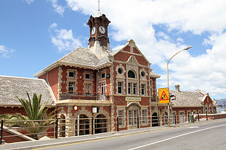
Simon's Town, sometimes spelled Simonstown, is a town in the Western Cape, South Africa and is home to Naval Base Simon's Town, the South African Navy's largest base. It is located on the shores of False Bay, on the eastern side of the Cape Peninsula. For more than two centuries it has been a naval base and harbour. The town is named after Simon van der Stel, an early governor of the Cape Colony.

<span class="mw-page-title-main">Fish Hoek</span> Place in Western Cape, South Africa

Fish Hoek is a coastal town at the eastern end of the Fish Hoek Valley on the False Bay side of the Cape Peninsula in the Western Cape, South Africa. Previously a separate municipality, Fish Hoek is now part of the City of Cape Town. As a coastal suburb of Cape Town, Fish Hoek is popular as a residence for commuters, retired people and holidaymakers alike. The traditional industries of 'trek' fishing and angling coexist with the leisure pursuits of surfing, although nearby Kommetjie is usually favoured, sailing and sunbathing. There is an active lifeguard community who utilise the beach and bay for training.

<span class="mw-page-title-main">False Bay</span> Large bay of the Atlantic Ocean at Cape Town, South Africa

False Bay is a body of water in the Atlantic Ocean between the mountainous Cape Peninsula and the Hottentots Holland Mountains in the extreme south-west of South Africa. The mouth of the bay faces south and is demarcated by Cape Point to the west and Cape Hangklip to the east. The north side of the bay is the low-lying Cape Flats, and the east side is the foot of the Hottentots Holland Mountains to Cape Hangklip which is at nearly the same latitude as Cape Point. In plan the bay is approximately square, being roughly the same extent from north to south as east to west, with the southern side open to the ocean. The seabed slopes gradually down from north to south, and is mostly fairly flat unconsolidated sediments. Much of the bay is off the coast of the City of Cape Town, and it includes part of the Table Mountain National Park Marine Protected Area and the whole of the Helderberg Marine Protected Area. The name "False Bay" was applied at least three hundred years ago by sailors returning from the east who confused Cape Point and Cape Hangklip, which are somewhat similar in profile when approached from the southeast.

<span class="mw-page-title-main">Saldanha Bay</span>

Saldanha Bay is a natural harbour on the south-western coast of South Africa. The town that developed on the northern shore of the bay, also called Saldanha, was incorporated with five other towns into the Saldanha Bay Local Municipality in 2000. The current population of the municipality is estimated at 72,000.

<span class="mw-page-title-main">Muizenberg</span> Coastal town in the Western Cape, South Africa

Muizenberg is a beach-side town in the Western Cape, South Africa. It is situated where the shore of the Cape Peninsula curves round to the east on the False Bay coast. It is considered to be the main surfing spot in Cape Town and is currently home to a surfing community, centered on the popular 'Surfer's Corner'.

<span class="mw-page-title-main">Hout Bay</span> Seaside suburb of Cape Town, Western Cape, South Africa

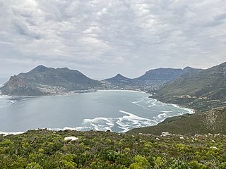
Hout Bay is a seaside suburb of Cape Town in the Western Cape province of South Africa. It is situated in a valley on the Atlantic seaboard of the Cape Peninsula, twenty kilometres south of the Central business district of Cape Town. The name "Hout Bay" can refer to the town, the bay on which it is situated, or the entire valley.

<span class="mw-page-title-main">Beaches of Cape Town</span> List of beaches in the Cape Town metropolitan region

The Cape Metropole has a wide variety of beaches divided into three regions by the Cape Peninsula:

<span class="mw-page-title-main">Helderberg</span> Region of the City of Cape Town, South Africa

Helderberg refers to a planning district of the City of Cape Town metropolitan municipality, the mountain after which it is named, a wine-producing area in the Western Cape province of South Africa, or a small census area in Somerset West.

Filipinos in South Africa are either migrants or descendants of the Philippines living in South Africa. Roughly half of them live in Gauteng and another 40% in Kalk Bay.

The Fish Hoek Valley is situated in the Cape Peninsula, eighteen miles south of Cape Town, South Africa. It takes its name from the town of Fish Hoek on the False Bay coast.

<span class="mw-page-title-main">St James, Cape Town</span> Seaside suburb of Cape Town, Western Cape, South Africa

St James is a seaside village on the Cape Peninsula, South Africa, situated on the False Bay coast between Muizenberg and Kalk Bay. The village is situated between the rocky shore and a steep mountain, and measures about 200m by 2 km. Its name derives from the early St James Catholic Church, built circa 1880. Most of the suburb was built between 1910 and 1950, after the railway line was built connecting Cape Town to False Bay.

<span class="mw-page-title-main">Miller's Point, Western Cape</span> Place in Western Cape, South Africa

Miller's Point is a headland and stretch of protected coastline in South Africa. It is located about 4 kilometres (2.5 mi) south of Simon's Town on the road to Cape Point.

<span class="mw-page-title-main">St Francis Bay</span> Place in Eastern Cape, South Africa

St Francis Bay is a holiday town in Sarah Baartman District Municipality in the Eastern Cape province of South Africa, roughly one hour’s drive from Gqeberha.

<span class="mw-page-title-main">Table Mountain National Park Marine Protected Area</span> Marine conservation area around the Cape Peninsula in South Africa

The Table Mountain National Park Marine Protected Area is an inshore marine protected area around the Cape Peninsula, in the vicinity of Cape Town, South Africa. It was proclaimed in Government Gazette No. 26431 of 4 June 2004 in terms of the Marine Living Resources Act, 18 of 1998.

References

  1. 1 2 3 4 "Sub Place Kalk Bay". Census 2011.
  2. Compton, J.S. (2004).The Rocks and Mountains of Cape Town. p. 24-26, 44-70. Double Storey Books, Cape Town. ISBN   1-919930-70-1.
  3. "Kalk Bay & St James Ratepayers". Kalk Bay & St James Ratepayers. Retrieved 2023-09-11.
  4. "Kalk Bay named one of the 'coolest places' - Forbes". SABC News. 2018-07-22. Retrieved 2020-05-01.
  5. Abel, Ann (22 June 2018). "The 12 Coolest Neighborhoods Around the World". Forbes. Retrieved 2020-05-01.
  6. 1 2 3 4 Kirkaldy, Alan (November 1988). "The sea is in our blood" - community and craft in Kalk Bay (PDF) (MA thesis). University of Cape Town.
  7. 1 2 "Timeline – Kalk Bay Historical Association" . Retrieved 2023-09-11.
  8. "Simon van der Stel's Day Register". Cape Archives (in Dutch). 11: 481.
  9. "Apartheid Legislation 1850s-1970s | South African History Online". www.sahistory.org.za. Retrieved 2023-09-11.
  10. "1934. Slums Act - The O'Malley Archives". omalley.nelsonmandela.org. Retrieved 2023-09-11.
  11. 1 2 "Kalk Bay Historical Association" . Retrieved 2023-09-11.
  12. "December Newsletter". Kalk Bay & St James Ratepayers. 2016-12-02. Retrieved 2023-09-11.
  13. "Subseries G10 - Avernas, Boomslang, White Dome Grotto, Wessels Grotto". AtoM@UCT. Retrieved 11 September 2023.
  14. "Subseries G8 - Ronan's Well Cave. Kalk Bay. Includes drawings on positions of caves on Black Table". AtoM@UCT. Retrieved 11 September 2023.
  15. Sharratt, Norma J.; Picker, Mike D.; Samways, Michael J. (2000). "The invertebrate fauna of the sandstone caves of the Cape Peninsula (South Africa): Patterns of endemism and conservation priorities". Biodiversity and Conservation. 9 (1): 107–143. doi:10.1023/A:1008968518058. S2CID   28508022.
  16. Western Cape Archives : Kalk Bay Municipal Minutes (23 July 1901).
  17. "GoSouth ~ South African, Credible and Current".