
A monsoon is traditionally a seasonal reversing wind accompanied by corresponding changes in precipitation but is now used to describe seasonal changes in atmospheric circulation and precipitation associated with annual latitudinal oscillation of the Intertropical Convergence Zone (ITCZ) between its limits to the north and south of the equator. Usually, the term monsoon is used to refer to the rainy phase of a seasonally changing pattern, although technically there is also a dry phase. The term is also sometimes used to describe locally heavy but short-term rains.

The mistral is a strong, cold, northwesterly wind that blows from southern France into the Gulf of Lion in the northern Mediterranean. It produces sustained winds often exceeding 66 km/h, sometimes reaching 185 km/h. It is most common in the winter and spring, and strongest in the transition between the two seasons. Periods of the wind exceeding 30 km/h for more than sixty-five hours have been reported.

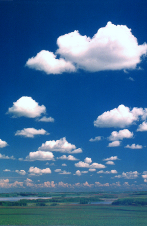
Orographic lift occurs when an air mass is forced from a low elevation to a higher elevation as it moves over rising terrain. As the air mass gains altitude it quickly cools down adiabatically, which can raise the relative humidity to 100% and create clouds and, under the right conditions, precipitation.

A nor'easter, is a large-scale extratropical cyclone in the western North Atlantic Ocean. The name derives from the direction of the winds that blow from the northeast. The term is commonly used in the winter in New England and Atlantic Canada.

A rain shadow is an area of significantly reduced rainfall behind a mountainous region, on the side facing away from prevailing winds, known as its leeward side.

Tuggerah Lake, an intermittently open intermediate wave dominated barrier estuary that is part of the Tuggerah Lakes, is located within the Central Coast Council local government area in the Central Coast region of New South Wales, Australia. The lake is located near Wyong and is situated about 90 kilometres (56 mi) north of Sydney.
Weather lore is the body of informal folklore related to the prediction of the weather and its greater meaning.

In meteorology, prevailing wind in a region of the Earth's surface is a surface wind that blows predominantly from a particular direction. The dominant winds are the trends in direction of wind with the highest speed over a particular point on the Earth's surface at any given time. A region's prevailing and dominant winds are the result of global patterns of movement in the Earth's atmosphere. In general, winds are predominantly easterly at low latitudes globally. In the mid-latitudes, westerly winds are dominant, and their strength is largely determined by the polar cyclone. In areas where winds tend to be light, the sea breeze/land breeze cycle is the most important cause of the prevailing wind; in areas which have variable terrain, mountain and valley breezes dominate the wind pattern. Highly elevated surfaces can induce a thermal low, which then augments the environmental wind flow.

The westerlies, anti-trades, or prevailing westerlies, are prevailing winds from the west toward the east in the middle latitudes between 30 and 60 degrees latitude. They originate from the high-pressure areas in the horse latitudes and trend towards the poles and steer extratropical cyclones in this general manner. Tropical cyclones which cross the subtropical ridge axis into the westerlies recurve due to the increased westerly flow. The winds are predominantly from the southwest in the Northern Hemisphere and from the northwest in the Southern Hemisphere.

The climate of India consists of a wide range of weather conditions across a vast geographic scale and varied topography. Based on the Köppen system, India hosts six major climatic sub types, ranging from arid deserts in the west, alpine tundra and glaciers in the north, and humid tropical regions supporting rain forests in the southwest and the island territories. Many regions have starkly different microclimates, making it one of the most climatically diverse countries in the world. The country's meteorological department follows the international standard of four seasons with some local adjustments: winter, summer, monsoon or rainy season, and a post-monsoon period.

Berg wind is the South African name for a katabatic wind: a hot dry wind blowing down the Great Escarpment from the high central plateau to the coast.
Delhi features a dry winter humid subtropical climate bordering a hot semi-arid climate, with high variation between summer and winter temperatures and precipitation. Delhi's version of a humid subtropical climate is markedly different from many other humid subtropical cities such as São Paulo, Houston, and Brisbane in that the city features dust storms and wildfire haze due to its semi-arid climate.

A western disturbance is an extratropical storm originating in the Mediterranean region that brings sudden winter rain to the northwestern parts of the Indian subcontinent, which extends as east as up to northern parts of Bangladesh and South eastern Nepal. It is a non-monsoonal precipitation pattern driven by the westerlies. The moisture in these storms usually originates over the Mediterranean Sea, the Caspian Sea and the Black Sea. Extratropical storms are a global phenomena with moisture usually carried in the upper atmosphere, unlike their tropical counterparts where the moisture is carried in the lower atmosphere. In the case of the Indian subcontinent, moisture is sometimes shed as rain when the storm system encounters the Himalayas. Western disturbances are more frequent and stronger in the winter season.
Athiyandal is a village in Tirukkoyilur, Taluk in Kallakurichi district in the state of Tamil Nadu, India. It is about 18 km from the town of Thiruvannamalai.
The levant is an easterly wind that blows in the western Mediterranean Sea and southern France, an example of mountain-gap wind. In Roussillon it is called "llevant" and in Corsica "levante". In the western Mediterranean, particularly when the wind blows through the Strait of Gibraltar, it is called the Viento de Levante or the Levanter. It is also known as the Solano.

Pakistan's climate varies from a continental type of climate in the north, a mountainous dry climate in the west (Baluchistan), a wet climate in the East (Punjab) an arid climate in the Thar Desert, to a tropical climate in the southeast (Sindh), characterized by extreme variations in temperature, both seasonally and daily, because it is located on a great landmass barely north of the Tropic of Cancer.

The Monsoon of South Asia is among several geographically distributed global monsoons. It affects the Indian subcontinent, where it is one of the oldest and most anticipated weather phenomena and an economically important pattern every year from June through September, but it is only partly understood and notoriously difficult to predict. Several theories have been proposed to explain the origin, process, strength, variability, distribution, and general vagaries of the monsoon, but understanding and predictability are still evolving.

A black nor'easter is a persistent and potentially violent north-easterly storm that occurs on the east coast of Australia, particularly from southeastern Queensland to southern New South Wales, usually between late spring and early autumn, about two days a year.

The southeast Australian foehn is a westerly foehn wind and a rain shadow effect that usually occurs on the coastal plain of southern New South Wales, and as well as in southeastern Victoria and eastern Tasmania, on the leeward side of the Great Dividing Range. Ranging from cool to hot, the effect occurs when westerly winds descend steeply from the Great Dividing Range onto the coastal slopes, whereby causing major adiabatic compression and a substantial loss of moisture.
