Camps Bay

Last updated
Camps Bay
Kampsbaai
Suburb of Cape Town
View of Camps Bay.jpg
Camps Bay view.jpg
From top, a view of Camps Bay from Lion's Head. Camps Bay as seen from Table Mountain.
Camps Bay map.jpg
Street map of Camps Bay
OpenStreetMap Cape Town small.svg
Red pog.svg
Camps Bay
South Africa Western Cape location map.svg
Red pog.svg
Camps Bay
South Africa adm location map.svg
Red pog.svg
Camps Bay
Africa location map.svg
Red pog.svg
Camps Bay
Coordinates: 33°57′00″S18°23′00″E / 33.95000°S 18.38333°E / -33.95000; 18.38333
Country Flag of South Africa.svg  South Africa
Province Flag of the Western Cape Province.png  Western Cape
District Atlantic Seaboard
Municipality City of Cape Town
Main Place Cape Town
Area
[1]
  Total1.68 km2 (0.65 sq mi)
Population
 (2011) [1]
  Total2,773
  Density1,700/km2 (4,300/sq mi)
Racial makeup (2011)
[1]
   Black African 13.5%
   Coloured 5.1%
   Indian/Asian 1.7%
   White 78.3%
  Other1.4%
First languages (2011)
[1]
   English 79.4%
   Afrikaans 9.4%
   Xhosa 2.1%
  Other9.0%
Time zone UTC+2 (SAST)
Postal code (street)
8005
PO box
8040
Area code 021

Camps Bay (Afrikaans: Kampsbaai) is an affluent suburb of Cape Town, South Africa, and the small bay on the west coast of the Cape Peninsula after which it is named. In summer it attracts many South African and foreign visitors.

Contents

History

A view of the Rotunda on Victoria road in Camps Bay in 1905. The tramway to Sea Point and Cape Town is visible in the foreground. Rotunda , Victoria road, Camps Bay 1905.jpg
A view of the Rotunda on Victoria road in Camps Bay in 1905. The tramway to Sea Point and Cape Town is visible in the foreground.

The first residents of Camps Bay were the San (Hunter Gatherers) and the Goringqhaique, Khoi pastorates. When Jan van Riebeek established a refreshment station for the VOC (Dutch East India Company), the Twelve Apostles were covered in forests with lion, leopard and antelope.

In competition with the more recent settlers, the Gringqhaique lost their grazing lands on the south east slopes of Table Mountain and in 1657 were restricted to Camps Bay.

By 1713 the number of Gringqhaique population had been reduced by measles and smallpox. All that was left of their settlement was an old kraal (Oudekraal).

The area was then granted to John Lodewyk Wernich and passed from father to son. Johan Wernich married Anna Koekemoer, who on his death in 1778, married Fredrick Ernst von Kamptz, a sailor and the area became known as “Die Baai van von Kamptz”.

For most of the 1800s Camps Bay was undeveloped. Lord Charles Somerset used the area for hunting and used the Roundhouse as his lodge. Kloof Nek Road was built in 1848 and in 1884 Thomas Bain was commissioned to build a road from Sea Point to Camps Bay using convict labour.

The road was completed in 1887 and named Victoria road to honour Queen Victoria’s jubilee in 1888. The road allowed people to cycle out to Camps Bay which had gained popularity as a picnic site. This led to the development, in 1901 of the Camps Bay tramway to bring people out for the day and with it the development of the tidal pools, the Rotunda (now the Bay Hotel) and a pavilion for concerts and shows.

In 1913 Camps Bay was incorporated into Cape Town although it was still seen as a recreational area rather than a residential area.

Beaches

Oudekraal is made up of a collection of tiny beaches sheltered amongst the boulders and a well established picnic area with lawns, Braais, covered seating areas with tables, benches and public toilets.

Lui Bay (also known as Witsand) is a popular dive site. In 1977 two scrap vessels, the Antipolis and Romelia, were being towed around the cape when their tow line broke in a storm. This caused the Antipolis to run aground near Oudekraal, while the Romelia foundered further south between Llandudno and Sandy Bay. The hull of the Antipolis is now visible at low tide.

Koeël Bay has an African open-air curio market that sells hand crafted items from all over Africa.

Bakoven gets its name because of a large rock just off-shore with what appears as an oven door in its side. There are several sheltered coves located in Bakoven. There is a sea rescue base stationed here and a popular swimming beach is off Beta Close. In the early 1940s a row of beach front houses were erected to house honored members of the South African Army who fought during World War II. Many of these old houses still stand and are now registered as South African National Heritage Sites.

Balie Bay, from the Afrikaans kak balie (shit barrel) after the sewer discharge that used to be there. [2]

Camps Bay Beach, a Blue Flag Beach since 2008, is the largest white sand beach in Camps Bay. There is a seasonal life guard station with toilets at the west end of the beach. The beach is opposite Camps Bay's main tourist hub, featuring multiple hotels, restaurants, and shops.

Glen Beach, at the far right of Camps Bay beach, is known as Camps Bay's best surfing beach. Short, fast rides and a small take-off area makes Glen Beach one of the hardest of Cape Town's beach breaks to surf and has resulted in a strong local atmosphere.

Notable residents

See also

Related Research Articles

<span class="mw-page-title-main">East London, South Africa</span> City in Eastern Cape, South Africa

East London is a city on the southeastern coast of South Africa, in the Buffalo City Metropolitan Municipality, Eastern Cape Province. The city lies on the Indian Ocean coast, largely between the Buffalo River and the Nahoon River, and hosts the country's only river port. As of 2011, East London had a population of over 267,000 with over 755,000 in the surrounding metropolitan area.

<span class="mw-page-title-main">Afrikaanse Hoër Seunskool</span> All-boys public school in Pretoria, Gauteng, South Africa

Afrikaanse Hoër Seunskool, is a public Afrikaans medium high school for boys situated in the suburb of Elandspoort in Pretoria in the Gauteng province of South Africa. The school was founded in 1920 by Jan Joubert and reverend Chris Neethling.

<span class="mw-page-title-main">Uitenhage</span> Place in Eastern Cape, South Africa

Uitenhage, officially renamed Kariega, is a South African town in the Eastern Cape Province. It is well known for the Volkswagen factory located there, which is the biggest car factory on the African continent. Along with the city of Port Elizabeth and the small town of Despatch, it forms the Nelson Mandela Bay Metropolitan Municipality.

<span class="mw-page-title-main">Graaff-Reinet</span> Place in Eastern Cape, South Africa

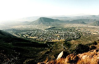
Graaff-Reinet is a town in the Eastern Cape Province of South Africa. It is the oldest town in the province. It is also the sixth-oldest town in South Africa, after Cape Town, Stellenbosch, Simon's Town, Paarl and Swellendam. The town was the centre of a short-lived republic in the late 18th century. The town was a starting point for Great Trek groups led by Gerrit Maritz and Piet Retief and furnished large numbers of the Voortrekkers in 1835–1842.

The following lists events that happened during 1933 in South Africa.

<span class="mw-page-title-main">Strand, Western Cape</span> Seaside town in the Western Cape, South Africa

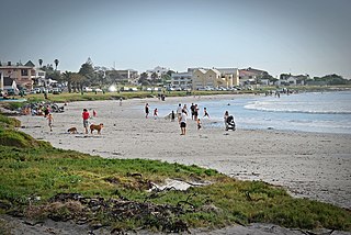
Strand is a seaside resort town in the Western Cape, South Africa. It forms part of the Helderberg region of the City of Cape Town Metropolitan Municipality, situated on the north-eastern edge of False Bay and near the foot of the Helderberg Mountains. Its geographical position is between Somerset West and Gordon's Bay, and is about 50 km southeast of Cape Town City Bowl. Strand has a population of approximately 50,000. Strand's main attraction is the beach; 5 km of white sandy beach off False Bay.

<span class="mw-page-title-main">Sea Point</span> Suburb of Cape Town in Western Cape, South Africa

Sea Point is an affluent and densely populated suburb of Cape Town, situated between Signal Hill and the Atlantic Ocean, a few kilometres to the west of Cape Town's Central Business District (CBD). Moving from Sea Point to the CBD, one passes first through the small suburb of Three Anchor Bay, then Green Point. Seaward from Green Point is the area known as Mouille Point, where the local lighthouse is situated. It borders to the southwest the suburb of Bantry Bay. It is known for its large Jewish population, synagogues, and kosher food options.

<span class="mw-page-title-main">Worcester, South Africa</span> Town in Western Cape, South Africa

Worcester is a town in the Western Cape, South Africa. It is the third-largest city in the western cape province of South Africa. It is located 120 kilometres (75 mi) north-east of Cape Town on the N1 highway north to Johannesburg.

<span class="mw-page-title-main">Hout Bay</span> Seaside suburb of Cape Town, Western Cape, South Africa

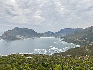
Hout Bay is a seaside suburb of Cape Town in the Western Cape province of South Africa. It is situated in a valley on the Atlantic seaboard of the Cape Peninsula, twenty kilometres south of the Central business district of Cape Town. The name "Hout Bay" can refer to the town, the bay on which it is situated, or the entire valley.

<span class="mw-page-title-main">Bloubergstrand</span> A seaside suburb of Cape Town on Table Bay, South Africa

Bloubergstrand is a seaside suburb of the City of Cape Town, South Africa, along the shores of Table Bay, 15 kilometres (9.3 mi) due north of the city centre of Cape Town. The name Bloubergstrand literally means "blue mountain beach" in Afrikaans, and is derived from Blaauwberg, a nearby hill. Bloubergstrand is mainly a residential area, and attracts large numbers of visitors especially kitesurf enthusiasts. The beach at Bloubergstrand is a popular location for a classic view of Table Mountain across the bay and is one of the world's top kitesurf destinations. Robben Island is located 6.9 kilometres (4.3 mi) west of the coast of Bloubergstrand.

<span class="mw-page-title-main">Melkbosstrand</span> Seaside suburb of Cape Town, in Western Cape, South Africa

Melkbosstrand is a coastal town located on the South West Coast of South Africa, 30 km north of Cape Town. It forms part of the City of Cape Town Metropolitan Municipality, the municipality governing Cape Town and its greater metropolitan area.

<span class="mw-page-title-main">Milnerton</span> Seaside town in the Western Cape, South Africa

Milnerton is a seaside town on Table Bay and is located north of Cape Town in South Africa. It is located 11 kilometres to the north of the city's centre.

<span class="mw-page-title-main">Kleinmond</span> Town in Western Cape, South Africa

Kleinmond is a small coastal town in the Overberg region of the Western Cape province, South Africa. It is situated inside a UNESCO-declared biosphere about 90 km east of Cape Town between Betty's Bay and Hermanus. The town's name, meaning "small mouth" in Afrikaans, refers to its location at the mouth of the Bot River lagoon. Stone axe heads found in the area indicate that people already lived in the vicinity of nearby Hangklip 20,000 years ago. Information about the area has existed in writing since the seventeenth century.

<span class="mw-page-title-main">Green Point, Cape Town</span> Suburb of Cape Town in Western Cape, South Africa

Green Point is an affluent suburb on the Atlantic Seaboard of Cape Town, South Africa located to the north west of the central business district and. It is home to Cape Town Stadium, a major sporting venue that was built for the 2010 FIFA World Cup. Sea Point promenade runs through the suburb, connecting it to Three Anchor Bay and Sea Point, a popular Jewish neighbourhood. Somerset Road forms the main thoroughfare lined by restaurants, cafés, delis, boutiques and nightclubs.

<span class="mw-page-title-main">Afrikaners</span> Southern African ethnic group descended from predominantly Dutch settlers

Afrikaners are a Southern African ethnic group descended from predominantly Dutch settlers first arriving at the Cape of Good Hope in 1652. Until 1994, they dominated South Africa's politics as well as the country's commercial agricultural sector.

Izak Stephanus de Villiers 'Balie' Swart, is a former South African rugby union player. He played as a prop, with the ability to prop on either side of the hooker.

Glen Beach is located north of Camps Bay Beach in Cape Town, South Africa. The two beaches are divided by a rock outcrop that extends from the land to the shore-line. During the summer months, sand deposits tend to build up at the shore-line, widening both Glen and Camps Bay beaches until the two beaches merge—until winter, when the sand deposits are eroded by winter storms. Glen Beach is well known for its beach-break surfing.

<span class="mw-page-title-main">Bakoven</span> Suburb of Cape Town in Western Cape, South Africa

Bakoven is a small residential suburb on the west coast of the Cape Peninsula, in the southwest of Camps Bay.

The following is a timeline of the history of Port Elizabeth in the Nelson Mandela Bay Municipality, Eastern Cape province, South Africa.

<span class="mw-page-title-main">Outline of Cape Town</span> List of links to articles about Cape Town on Wikipedia

The following outline is provided as an overview of and topical guide to Cape Town:

References

  1. 1 2 3 4 "Sub Place Camps Bay". Census 2011.
  2. Bakoven Heritage, The Bungalow Owners Association of Bakoven, Clifton & Glen Beach
  3. "Cape Town's landscapes shine worldwide | CapeTown ETC". CapeTown ETC. 2018-09-13. Retrieved 2018-10-11.

Further reading