
Smethwick is an industrial town in Sandwell, West Midlands, England. It lies 4 miles (6 km) west of Birmingham city centre. Historically it was in Staffordshire and then Worcestershire before being placed into then West Midlands county.

Preston is a suburb in Melbourne, Victoria, Australia, 9 km (5.6 mi) north-east of Melbourne's central business district, located within the City of Darebin local government area. Preston recorded a population of 33,790 at the 2021 census.

Weipa is a coastal mining town in the local government area of Weipa Town in Queensland. It is one of the largest towns on the Cape York Peninsula. It exists because of the enormous bauxite deposits along the coast. The Port of Weipa is mainly involved in exports of bauxite. There are also shipments of live cattle from the port.

Strand is a seaside resort town in the Western Cape, South Africa. It forms part of the Eastern Suburbs of the City of Cape Town Metropolitan Municipality, situated on the north-eastern edge of False Bay and near the foot of the Helderberg Mountains. Its geographical position is between Somerset West and Gordon's Bay, and is about 50 km southeast of Cape Town City Bowl. Strand has a population of approximately 50,000. Strand's main attraction is the beach; 5 km of white sandy beach off False Bay.

Victoria Falls, popularly known as Vic Falls, is a resort town and city in the province of Matabeleland North, Zimbabwe. It lies on the southern bank of the Zambezi River at the western end of Victoria Falls themselves. According to the 2022 Population Census, the town had a population of 35,199.
Bergvliet is a suburb of Cape Town, South Africa. Bergvliet, which means "Mountain Streamlet" in Afrikaans, is bordered by Retreat, Meadowridge, Tokai, and Heathfield.

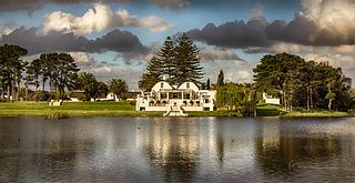
Somerset West is a town in the Western Cape, South Africa. Organisationally and administratively it is included in the City of Cape Town metropolitan municipality Eastern Suburbs zone . The vehicle registration code for Somerset West is CFM and the post code is 7130 for street addresses, and 7129 for post office boxes.

Khayelitsha is a township in Western Cape, South Africa, on the Cape Flats in the City of Cape Town Metropolitan Municipality. The name is Xhosa for New Home. It is reputed to be one of the largest and fastest-growing townships in South Africa.

Mitchells Plain is a large census designated sub-place located within the City of Cape Town, Western Cape, South Africa and situated about 28 km (17 mi) from the Cape Town city centre. It is one of South Africa's largest residential areas and contains multiple smaller suburbs. It is located on the Cape Flats on the False Bay coast between Muizenberg and Khayelitsha. Conceived of as a "model suburb" by the apartheid government, it was built during the 1970s to provide housing for Coloured victims of forced removal due to the implementation of the Group Areas Act.

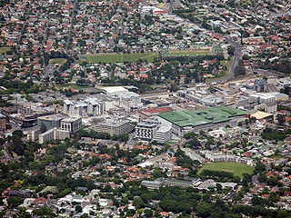
Bergvliet High School is a public high school in the suburb of Bergvliet in Cape Town, Western Cape, South Africa....

Brackenfell is a town in the Western Cape province of South Africa and a northern suburb of Cape Town, situated about 30 km north-east of the city.

The Southern Suburbs are a group of Anglophone suburbs in Cape Town, Western Cape, South Africa. This group includes, among others, Observatory, Mowbray, Pinelands, Rosebank, Rondebosch, Rondebosch East, Newlands, Claremont, Lansdowne, Kenilworth, Bishopscourt, Constantia, Wynberg, Ottery, Plumstead, Diep River, Bergvliet and Tokai. The area is also commonly referred to as the Cape Peninsula, often including the towns further South such as Fish Hoek.
Claremont is a suburb of Cape Town, South Africa. It is situated 9 kilometres south of the city, and is one of the so-called "Southern Suburbs", it is situated alongside Lansdowne. It is an important commercial and residential area, which is currently experiencing significant growth and development.
Gardens is an affluent inner-city suburb of Cape Town located just to the south of the city centre located in the higher elevations of the "City Bowl" and directly beneath Table Mountain and Lion's Head. It is home to several national museums such as Iziko South African National Gallery and the Iziko South African Museum. The University of Cape Town also houses its Fine Arts department in the suburb, at Michaelis School of Fine Art. Company's Garden, South Africa's oldest garden, a public park and heritage site is a focal point of the suburb. The area is also home to the oldest synagogue in Southern Africa, the Old Shul and its successor, the Gardens Shul, "The Mother Synagogue of South Africa."
Grassy Park is a suburb of the City of Cape Town in the Western Cape Province of South Africa.

Heideveld is a town or suburb in the Athlone part of Cape Town, South Africa. Heideveld got its name because the area used to have large grazing grounds where a popular flower ("heideblommetjie") grew in abundance. The area used to be a dairy farm, and cows used to graze amongst the heideblommetjies.
Joe Slovo Park is a township located between Milnerton and Montague Gardens near Cape Town, South Africa.

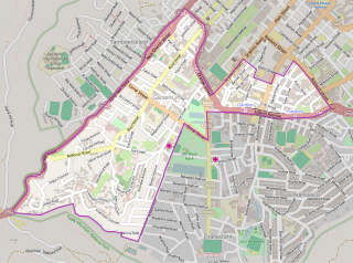
Meadowridge Library is a public library in the suburb of Meadowridge, in Cape Town, South Africa. It has 8,112 members, and was ranked 14th in the City of Cape Town's top 20 circulating libraries in 2014, out of the city's 101 libraries.

The following outline is provided as an overview of and topical guide to Cape Town:

Lentegeur is a neighbourhood located within the Mitchells Plain urban area of the City of Cape Town in the Western Cape province of South Africa. It is located in the north eastern section of the Mitchells Plain area. The 400 bed Mitchells Plain Hospital, one of Cape Town's larger hospitals, is located in the neighbourhood. The Lentegeur Sports Grounds dominate central area of the neighbourhood.

