The City of Gosnells is a local government area in the southeastern suburbs of the Western Australian capital city of Perth, located northwest of Armadale and about 20 kilometres (12 mi) southeast of Perth's central business district. The City covers an area of 128 square kilometres (49.42 sq mi), a portion of which is state forest rising into the Darling Scarp to the east, and had a population of approximately 118,000 at the 2016 Census. The largest activity centre in the City is the Central Maddington shopping centre. District centres exist in the Gosnells town centre and Thornlie.
The area referred to as Fourways is the fastest-developing commercial and residential hub in Sandton, north of Johannesburg, South Africa. The main access routes to Fourways are off the N1 at R511 Winnie Mandela Drive, or alternatively along R564 Witkoppen Road. It is located mostly in Region E of the City of Johannesburg Metropolitan Municipality. It is roughly as far as one can go in the Johannesburg Metropolitan area before it dissolves into rolling hills, game farms and the capital Pretoria, 55 kilometres to the northeast. Hartebeespoort Dam and the Magaliesberg Mountains lie half an hour to the north-west. It is bordered by Bryanston to the east and south and Randburg to the west.

Rondebosch is one of the Southern Suburbs of Cape Town, South Africa. It is primarily a residential suburb, with shopping and business districts as well as the main campus of the University of Cape Town. The area is noted for its beautiful views of Table Mountain, its convent location to the rest of the city of Cape Town, and its proximity to the University of Cape Town.
Pinelands is an affluent garden city suburb located on the edge of the southern suburbs of Cape Town, South Africa, neighbouring the suburb of Thornton, and is known for its large thatched houses and green spaces. The suburb is primarily residential and is often praised for its peacefulness and abundance of trees. Pinelands is one of the few areas in Cape Town in which sale of alcohol to the public is prohibited, but some clubs have private liquor licenses. It is a popular place for senior citizens to retire to. While there are several retirement homes in the suburb, younger people are increasingly moving in.
Bergvliet is a suburb of Cape Town, South Africa. Bergvliet, which means "Mountain Streamlet" in Afrikaans, is bordered by Retreat, Meadowridge, Tokai, and Heathfield.

Somerset West is a town in the Western Cape, South Africa. Organisationally and administratively it is included in the City of Cape Town metropolitan municipality Eastern Suburbs zone . The vehicle registration code for Somerset West is CFM and the post code is 7130 for street addresses, and 7129 for post office boxes.

Woodstock is one of the earliest suburbs of Cape Town, South Africa, between the docks of Table Bay and the lower slopes of Devil's Peak, about 1 kilometre (0.6 mi) east of the city centre of Cape Town. Woodstock is served by Woodstock and Esplanade railway stations, and has the postal code 7925 for street addresses and 7915 for post office box deliveries.

Wynberg is a southern suburb of the City of Cape Town in Western Cape, South Africa. It is situated between Plumstead and Kenilworth, and is a main transport hub for the Southern Suburbs of Cape Town.
Greenside, is a suburb of Johannesburg, South Africa. Greenside borders on the suburbs Emmarentia, Parkview, Parkhurst and Victory Park.

Constantia is an affluent suburb of Cape Town, South Africa, situated about 15 kilometres south of the centre of Cape Town. It is considered to be one of the most prestigious suburbs in South Africa. The Constantia Valley lies to the east of and at the foot of the Constantiaberg mountain. Constantia Nek is a low pass linking to Hout Bay in the west.

Groot Constantia is the oldest wine estate in South Africa and provincial heritage site in the suburb of Constantia in Cape Town, South Africa.

Durbanville, previously called Pampoenkraal, is a town in the Western Cape province of South Africa, part of the greater Cape Town metropolitan area. It is a semi-rural residential suburb on the north-eastern outskirts of the metropolis surrounded by farms producing wine and wheat.

Newlands (Nuweland) is an upmarket suburb of Cape Town, South Africa. It is located at the foot of Table Mountain in the Southern Suburbs of Cape Town, and is the wettest suburb in South Africa due to its high winter rainfall. The neighborhood of Bishopscourt is situated to its south west, Claremont to its south east, and Rondebosch to its east and north east.

The Southern Suburbs are a group of Anglophone suburbs in Cape Town, Western Cape, South Africa. This group includes, among others, Observatory, Mowbray, Pinelands, Rosebank, Rondebosch, Rondebosch East, Newlands, Claremont, Lansdowne, Kenilworth, Bishopscourt, Constantia, Wynberg, Ottery, Plumstead, Diep River, Bergvliet and Tokai. The area is also commonly referred to as the Cape Peninsula, often including the towns further South such as Fish Hoek.
Claremont is a suburb of Cape Town, South Africa. It is situated 9 kilometres south of the city, and is one of the so-called "Southern Suburbs", it is situated alongside Lansdowne. It is an important commercial and residential area, which is currently experiencing significant growth and development.

Ottery is a suburb in Cape Town, South Africa. It is on the edge of the Southern Suburbs. The Youngsfield Military Base, Royal Cape Golf Club and Cape Town's 'official' China Town are located in the suburb. Every year the Youngsfield Military Base in Ottery hosts the Cape Argus Junior Cycle Tour on 12 March. The name was derived off the Otter sanctuary which was opened here in the early 1900's, but was closed down as the neighbourhood rapidly expanded later in the century.
Lansdowne is a suburb in Cape Town, South Africa. situated 10 kilometres southeast of Cape Town City Centre, surrounded by the suburbs of Rondebosch East, Crawford, Wetton, Claremont, Kenwyn and Athlone. Lansdowne is served by a railway station of the same name, on the Cape Flats Line.

Stellenberg is a suburb in Bellville, Western Cape South Africa.
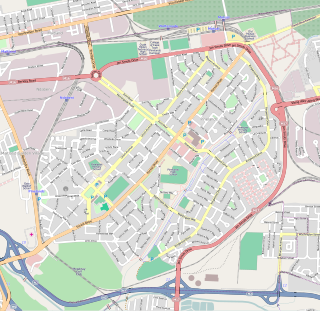
Lewsey Park is a suburb of Luton, Bedfordshire, England. Situated in the north-west of the town, the area is roughly bounded by Woodside Link to the North, Leagrave High Street to the south, Pastures Way to the west, and the M1 to the east.

The following outline is provided as an overview of and topical guide to Cape Town:


