
Pretoria, also known as Tshwane, is South Africa's administrative capital, serving as the seat of the executive branch of government, and as the host to all foreign embassies to South Africa.

Klerksdorp is located in the North West Province, South Africa. Klerksdorp, the largest city in the North West Province, is located 165 km (103 mi) southeast of Mahikeng, the provincial capital. Klerksdorp was also the first capital of the then Transvaal Republic and used to be the home of the first Stock Exchange in the region. It became an important trading town linking Kimberley to Johannesburg. It became home to a mix of farmers, miners and immigrants servicing the two industries.
Dobsonville is a township in greater Soweto, Johannesburg, South Africa. It lies to the west of Meadowlands, a part of Diepmeadow, and is adjacent to Mofolo North and Zondi, which are suburbs of Soweto on its southern border.
Jacobsdal is a small farming town in the Free State province of South Africa with various crops under irrigation, such as grapes, potatoes, lucerne, and groundnuts. The town was laid out in 1859 by Christoffel Jacobs on his farm Kalkfontein, and its last recorded population was 3,504.
Rustenburg is a city at the foot of the Magaliesberg mountain range. Rustenburg is the most populous city in North West province, South Africa. In 2017, the city's Gross Domestic Product (GDP) reached ZAR 63.8 billion, accounting for 21.1% of the GDP of the North West Province, and 1.28% of the GDP of South Africa. Rustenburg was one of the official host cities of the 2010 FIFA World Cup, being in close proximity to Phokeng, the capital of the Royal Bafokeng Nation, where the Royal Bafokeng Stadium is located. The England national football team also used this as their base camp for the tournament.

Vryburg is a large agricultural town with a population of 63 260 situated in the Dr Ruth Segomotsi Mompati District Municipality of the North West Province of South Africa. It is the seat and the industrial and agricultural heartland of the district of the Bophirima region.

Masiphumelele is a township on the Cape Peninsula, South Africa, situated between Kommetjie, Capri Village and Noordhoek.
Pinelands is an affluent garden city suburb located on the edge of the southern suburbs of Cape Town, South Africa, neighbouring the suburb of Thornton, and is known for its large thatched houses and green spaces. The suburb is primarily residential and is often praised for its peacefulness and abundance of trees. Pinelands is one of the few areas in Cape Town in which sale of alcohol to the public is prohibited, but some clubs have private liquor licenses. It is a popular place for senior citizens to retire to. While there are several retirement homes in the suburb, younger people are increasingly moving in.
Doornfontein is an inner-city suburb of Johannesburg, South Africa, located to the east of the city centre, Region 8.
Aliwal North is a town in central South Africa on the banks of the Orange River, Eastern Cape Province. It is a medium-sized commercial centre in the northernmost part of the Eastern Cape. The Dutch Reformed Church was built in 1855.

Woodstock is one of the earliest suburbs of Cape Town, South Africa, between the docks of Table Bay and the lower slopes of Devil's Peak, about 1 kilometre (0.6 mi) east of the city centre of Cape Town. Woodstock is served by Woodstock and Esplanade railway stations, and has the postal code 7925 for street addresses and 7915 for post office box deliveries.

Wynberg is a southern suburb of the City of Cape Town in Western Cape, South Africa. It is situated between Plumstead and Kenilworth, and is a main transport hub for the Southern Suburbs of Cape Town.

Newlands (Nuweland) is an upmarket suburb of Cape Town, South Africa. It is located at the foot of Table Mountain in the Southern Suburbs of Cape Town, and is the wettest suburb in South Africa due to its high winter rainfall. The neighborhood of Bishopscourt is situated to its south west, Claremont to its south east, and Rondebosch to its east and north east.

The Cape Town International Convention Centre (CTICC) is a convention centre in Cape Town, South Africa. The centre opened in June 2003. It is run as a partnership between the City of Cape Town and the Western Cape government.
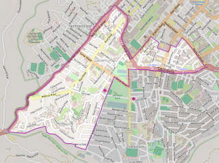
Claremont is a suburb of Cape Town, South Africa. It is situated 9 kilometres south of the city, and is one of the so-called "Southern Suburbs", it is situated alongside Lansdowne. It is an important commercial and residential area, which is currently experiencing significant growth and development.

Butterworth, also known as Gcuwa, is a town in the Eastern Cape Province, South Africa. Butterworth has a population of 45,900 and is situated on the N2 national highway 111 km north of East London.

Desmond Tutu was a South African Anglican bishop and theologian, known for his work as an anti-apartheid and human rights activist. He was Bishop of Johannesburg from 1985 to 1986 and then Archbishop of Cape Town from 1986 to 1996, in both cases being the first Black African to hold the position. Theologically, he sought to fuse ideas from Black theology with African theology.
Gardens is an affluent inner-city suburb of Cape Town located just to the south of the city centre located in the higher elevations of the "City Bowl" and directly beneath Table Mountain and Lion's Head. It is home to several national museums such as Iziko South African National Gallery and the Iziko South African Museum. The University of Cape Town also houses its Fine Arts department in the suburb, at Michaelis School of Fine Art. Company's Garden, South Africa's oldest garden, a public park and heritage site is a focal point of the suburb. The area is also home to the oldest synagogue in Southern Africa, the Old Shul and its successor, the Gardens Shul, "The Mother Synagogue of South Africa."

Rosebank is one of the Southern Suburbs of Cape Town, South Africa, located between the suburbs of Mowbray and Rondebosch.
Brooklyn is a suburb of Cape Town, Western Cape with a population of 10,941 people. It lies to the north of Maitland, east of the Atlantic Ocean and Paarden Eiland, and west of Air Force Base Ysterplaat. The Black River flows through a section of Brooklyn.


