
Eldora is an uninhabited place in Volusia County, Florida, United States. It is located within Canaveral National Seashore, south of Bethune Beach and west of County Road A1A. The average elevation is 3 feet above sea level.
Eldora is an uninhabited place in Volusia County, Florida, United States. It is located within Canaveral National Seashore, south of Bethune Beach and west of County Road A1A. The average elevation is 3 feet above sea level.
Eldora was a community of orange groves in the latter part of the 19th century. After a freeze destroyed most of its crops, it was nearly completely abandoned and has never regained its population. [1]
After the death of its last resident, Doris "Doc" Leeper in 2000, a locally famous artist and conservationist in the 1980s, [2] the management of the town was officially turned over to the federal government, and the town is now located more than two miles within the borders of the Canaveral National Seashore. The town claims no permanent residents, and visitation is limited and subject to park hours. Only two of its original buildings remain. The largest, "The Eldora House", now holds a museum. [3] Although the town's orange groves were nearly completely wiped out over one hundred years ago, some trees still remain.
The town is also the site of two marine research facilities jointly shared by Daytona State College and the University of Central Florida.
Eldora is located at 28°54′33″N80°49′11″W / 28.90917°N 80.81972°W . The town's location is remote, as it is only accessible by one service road, County Road A1A. It is nearly a thirty-minute drive to the mainland through New Smyrna Beach.
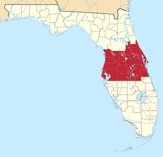
Volusia County is located in the east-central part of the U.S. state of Florida between the St. Johns River and the Atlantic Ocean. As of the 2020 census, the county was home to 553,543 people, an increase of 11.9% from the 2010 census. It was founded on December 29, 1854, from part of Orange County, and was named for the community of Volusia, located in northwestern Volusia County. Its first county seat was Enterprise. Since 1887, its county seat has been DeLand.

Cape Canaveral is a city in Brevard County, Florida. It is part of the Palm Bay–Melbourne–Titusville Metropolitan Statistical Area. The population was 9,912 at the 2020 US census.

Cocoa Beach is a city in Brevard County, Florida, United States. The population was 11,354 at the 2020 United States Census, up from 11,231 at the 2010 census. It is part of the Palm Bay–Melbourne–Titusville, Florida Metropolitan Statistical Area.

Titusville is a city in and the county seat of Brevard County, Florida, United States. As of the 2020 census, the population of the city was 48,789, up from 43,761 at the 2010 census. Titusville is located along the Indian River, west of Merritt Island and the Kennedy Space Center, and south-southwest of the Canaveral National Seashore. It is a principal city of the Palm Bay–Melbourne–Titusville, Florida Metropolitan Statistical Area.

New Smyrna Beach is a city in Volusia County, Florida, United States, located on the central east coast of the state, with the Atlantic Ocean to the east. The downtown section of the city is located on the west side of the Indian River and the Indian River Lagoon system. The Coronado Beach Bridge crosses the Intracoastal Waterway just south of Ponce de Leon Inlet, connecting the mainland with the beach on the coastal barrier island. Its population is 30,142 in 2020 by the United States Census Bureau.

State Road 528 (SR 528), alternatively named the Martin Andersen Beachline Expressway, is a partially-tolled freeway in the U.S. state of Florida; it is maintained by the Florida's Turnpike Enterprise (FTE), the Central Florida Expressway Authority (CFX), and the Florida Department of Transportation (FDOT). Spanning approximately 53 miles (85 km) along a west–east axis, it connects Interstate 4 (I-4) in Orlando with I-95, Titusville, and Cape Canaveral on the Space Coast. It passes close to the tourist areas of Orlando, including SeaWorld and Universal Orlando, and serves the north entrance to Orlando International Airport. Near its east end, it passes over the Intracoastal Waterway on the Emory L. Bennett Causeway, and ends at SR A1A and SR 401 near Port Canaveral.

State Road A1A (SR A1A) is a major north–south Florida State Road consisting of seven separate sections running a total of 338.752 miles (545.168 km) along the Atlantic Ocean, from Key West at the southern tip of Florida, to Fernandina Beach, just south of Georgia on Amelia Island. It is the main road through most oceanfront towns. Part of SR A1A is designated the A1A Scenic and Historic Coastal Byway, a National Scenic Byway. A portion of SR A1A that passes through Volusia County is designated the Ormond Scenic Loop and Trail, a Florida Scenic Highway. It is also called the Indian River Lagoon Scenic Highway from State Road 510 at Wabasso Beach to U.S. Route 1 in Cocoa. SR A1A is famous worldwide as a center of beach culture in the United States, a scenic coastal route through most Atlantic coastal cities and beach towns, including the unique tropical coral islands of the Florida Keys. SR A1A also serves as a major thoroughfare through Miami Beach and other south Florida coastal cities.
Central Florida is a region of the U.S. state of Florida. Different sources give different definitions for the region, but as its name implies it is usually said to comprise the central part of the state, including the Tampa Bay area and the Greater Orlando area, though in recent times the Tampa Bay area has often been described as its own region, with "central Florida" becoming more synonymous with the Orlando area.

Mosquito Lagoon is a body of water located on the east coast of Florida in Brevard and Volusia counties. It is part of the Indian River Lagoon system and the Atlantic Intracoastal Waterway. It extends from the Ponce de Leon Inlet to a point north of Cape Canaveral, and connects to the Indian River via the Haulover Canal. The Mosquito Lagoon Aquatic Preserve includes 4,740 acres (1,920 ha) in the northern end of the lagoon. The preserve originally extended to the southern end of the lagoon, but close to two-thirds of the preserve in the central and southern lagoon were transferred to the Federal government, and is now part of the Canaveral National Seashore. The cities of New Smyrna Beach and Edgewater, the Merritt Island National Wildlife Refuge and the Kennedy Space Center adjoin the lagoon.
Playalinda Beach is a beach located on Florida's east coast in Canaveral National Seashore near Titusville, Florida.

State Road 401 is a four-lane highway extending from a southern terminus at a trumpet interchange with the Martin Andersen Beachline Expressway and SR A1A to a northern terminus of the south gate of Cape Canaveral Space Force Station near Cape Canaveral. It is one of the shortest signed roads in the State of Florida. The route designation was established in June 1956.

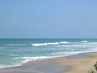
The Canaveral National Seashore (CANA) is a National Seashore located between New Smyrna Beach and Titusville, Florida, in Volusia and Brevard Counties. The park, located on a barrier island, was created on January 3, 1975, by an act of Congress. The park is split between Brevard and Volusia counties, with 9 miles of the seashore in Brevard County, and 15 miles of the seashore in Volusia County. CANA consists of 24 miles of beaches, dunes, mangrove wetlands, and a large portion of the Mosquito Lagoon. The Canaveral National Seashore is also the longest expanse of undeveloped land along the East Coast of Florida. The Canaveral National Seashore is home to more than 1,000 plant species and 310 bird species. CANA occupies 57,662 acres (23,335 ha). There are 3 major beach sections in the seashore. The southern section is Playalinda Beach, the middle section is Klondike Beach, and the northern section is Apollo Beach.
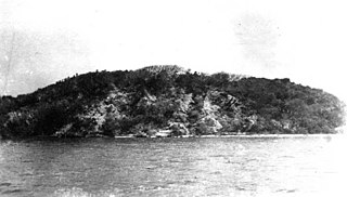
Turtle Mound is a prehistoric archaeological site located 9 miles (14 km) south of New Smyrna Beach, Florida, on State Road A1A. On September 29, 1970, it was added to the U.S. National Register of Historic Places. It is the largest shell midden on the mainland United States, with an approximate height of 50 feet (15 m). The mound extends for over 600 feet (180 m) along the Indian River shoreline and contains over 35,000 cubic yards (27,000 m3) of shells. Turtle Mound was estimated to be 75 feet (23 m) high before it was reduced by shellrock mining in the 19th and 20th centuries. Because it is visible seven miles out at sea, early Spanish explorers and subsequent mariners used the large mound as a landmark for coastal navigation. Today, the site is owned and managed by the National Park Service as part of Canaveral National Seashore.
The Ross Hammock Site is a historic site nine miles south of New Smyrna Beach, Florida. It is located inland from the Intracoastal Waterway on A1A within the Canaveral National Seashore. On February 5, 1981, it was added to the U.S. National Register of Historic Places.

The Acreage is a census-designated place (CDP) located in Palm Beach County, Florida, United States. It is part of the Miami metropolitan area of South Florida. The population of the CDP had 41,654 residents in the 2020 US census.

The Moulton–Wells House is a historic house in New Smyrna Beach, Florida. It is located west of Eldora Road, and is part of the Canaveral National Seashore. On November 21, 2001, it was added to the U.S. National Register of Historic Places.

Bethune Beach is an unincorporated community in Volusia County, Florida, United States. It is an urban residential single-family zoned community known for its peace, quiet and quaintness. It was once the only beach African Americans were permitted to use in the county and is named for Mary McLeod Bethune who helped organize a wade-in in support of desegregation.
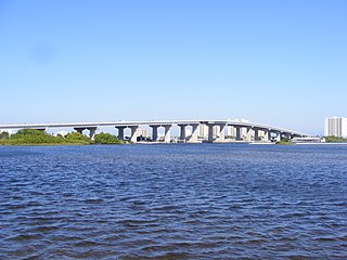
The Port Orange Causeway, commonly called the Port Orange Bridge or the Dunlawton Bridge, spans the Halifax River and Intracoastal Waterway in Port Orange, Volusia County, Florida. The bridge carries approximately 29,000 vehicles per day across four lanes of State Road A1A and Dunlawton Avenue.
Doris "Doc" Leeper was an American sculptor and painter from New Smyrna Beach, Florida. She was instrumental in the creation of the Canaveral National Seashore in 1975, and the Spruce Creek Preserve, renamed the Doris Leeper Spruce Creek Preserve in memoriam. She founded the Atlantic Center for the Arts in 1982. She was inducted into the Florida Artists Hall of Fame in 1999.

Hurricane Floyd in 1999 threatened Florida as a major hurricane roughly three times as large as Hurricane Andrew. Floyd originated from a tropical wave well east of the Lesser Antilles on September 7. While approaching the Bahamas, the storm strengthened significantly between September 12 and September 13. On the latter day, Floyd peaked as a strong Category 4 hurricane on the Saffir–Simpson scale. However, upon moving closer to the Bahamas, the storm fluctuated in intensity between a Category 3 and a Category 4 hurricane. A subtropical ridge eroded by a mid- to upper-tropospheric trough over the eastern United States caused Floyd to curve northwestward over the Abaco Islands and later to northeast, avoiding a potentially catastrophic landfall in Florida. The storm made its closest approach to Florida early on September 15, passing about 110 mi (180 km) east of Cape Canaveral.
Municipalities and communities of Volusia County, Florida, United States | ||
|---|---|---|
| Cities |  | |
| Towns | ||
| CDPs | ||
| Unincorporated communities | ||
| Ghost town | ||
| Footnotes | ‡This populated place also has portions in an adjacent county or counties | |