
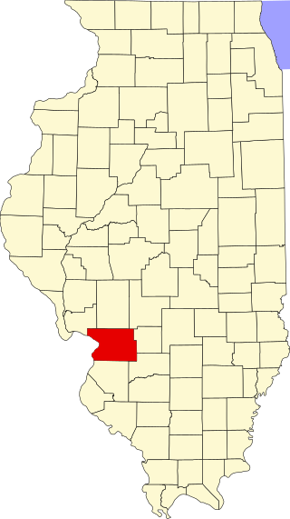
Scales Mound is a village in Jo Daviess County, Illinois, United States. The population was 376 at the 2010 census, down from 401 in 2000.

Franklin Township is a township in Adams County, Pennsylvania, United States. The population was 4,676 at the 2020 census.
Hanover Township is a township in Beaver County, Pennsylvania, United States. The population was 3,690 at the 2010 census. It is part of the Pittsburgh metropolitan area.

Nicholson Township is a township in Fayette County, Pennsylvania, United States. The population was 1,728 at the 2020 census, a decline from the figure of 1,805 tabulated in 2010. The Albert Gallatin Area School District serves the township. New Geneva, Martin, Gallatin, Old Frame, Bowood, Woodside, and Grays Landing are communities in the township.

Monongahela Township is a township in Greene County, Pennsylvania, United States. The population was 1,489 at the 2020 census, down from 1,572 at the 2010 census.
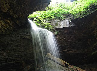
Richhill Township is a township in Greene County, Pennsylvania, United States. The population was 775 at the 2020 census, down from 896 at the 2010 census. Ryerson Station State Park is a Pennsylvania state park on Duke Lake in the township.

St. Clair Township is a township in Westmoreland County, Pennsylvania, United States. The population was 1,339 at the 2020 census. It is also one of three communities within the county to utilise the 814 area code, alongside New Florence and Seward.

This is a list of properties and districts in Illinois that are on the National Register of Historic Places. There are over 1,900 in total. Of these, 85 are National Historic Landmarks. There are listings in all of the state's 102 counties.
This National Park Service list is complete through NPS recent listings posted March 3, 2023.

East Millstone is an unincorporated community and census-designated place (CDP) located in Franklin Township in Somerset County, New Jersey.

Rush Township is one of twenty-three townships in Jo Daviess County, Illinois, USA. As of the 2010 census, its population was 380 and it contained 188 housing units.

Otter Creek Township is one of twelve townships in Vigo County, Indiana, United States. As of the 2010 census, its population was 9,069 and it contained 3,917 housing units.
Eagle Township is one of twelve townships in Boone County, Indiana. As of the 2010 census, its population was 21,977 and it contained 8,231 housing units.
This is a list of the National Register of Historic Places listings in Madison County, Illinois.
This is a list of the National Register of Historic Places listings in White County, Illinois.

The Mayberry Mound and Village Site are a valuable archaeological site in the southeastern portion of the U.S. state of Illinois. Located near the village of Sims in southern Wayne County, the site comprises what was once a substantial village during the Archaic period, and it has been designated a historic site because of its archaeological importance.

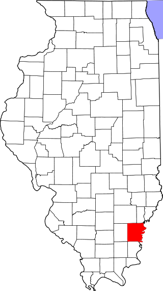
The Hubele Mounds and Village Site are an archaeological site in the southeastern part of the U.S. state of Illinois. Located near the community of Maunie in White County, the site has received recognition from the federal government because of its archaeological value. Due to the lack of recent excavations, the site's dates of habitation are debated, ranging from 400 BC in some estimates to AD 1000 in others, but all agree on the site's significance to understanding the prehistory of the region.
The Bieker-Wilson Village Site is an archaeological site in the far southeastern section of the U.S. state of Illinois. Inhabited during multiple periods over more than five hundred years, the village has been designated a historic site.

The Wilson Mounds and Village Site is a prehistoric archaeological site located in and around the Marshall Ferry Cemetery in Rising Sun, White County, Illinois. The site includes twelve Hopewell burial mounds and a village site.

The Mitchell Archaeological Site is a pre-Columbian archaeological site located at the western end of University Drive in Mitchell, Illinois. The site includes a platform mound and the remains of a village; while it once included several other mounds, they have been destroyed by modern activity. Mississippian peoples inhabited the site c. 1150–1200. The site is affiliated with the Cahokia settlement system and was the largest site in the system except for Cahokia itself. However, the majority of the site was destroyed by the construction of Interstate 270; known information about the site mainly comes from salvage excavations conducted before the highway was built.


