Louisa County, Virginia

Last updated

Louisa County
Louisa County Courthouse (Built 1905), Louisa (Louisa County, Virginia).jpg
Flag of Louisa County, Virginia.png
Seal of Louisa County, Virginia.png
Logo of Louisa County, Virginia.png
Map of Virginia highlighting Louisa County.svg
Location within the U.S. state of Virginia
Virginia in United States.svg
Virginia's location within the U.S.
Coordinates: 37°59′N77°58′W / 37.99°N 77.96°W / 37.99; -77.96
CountryFlag of the United States.svg United States
StateFlag of Virginia.svg  Virginia
Founded1742
Named for Louise of Great Britain
Seat Louisa
Largest townLouisa
Area
  Total511 sq mi (1,320 km2)
  Land496 sq mi (1,280 km2)
  Water15 sq mi (40 km2)  2.9%
Population
 (2020)
  Total37,596
  Density74/sq mi (28/km2)
Time zone UTC−5 (Eastern)
  Summer (DST) UTC−4 (EDT)
Congressional district 5th
Website www.louisacounty.com

Louisa County is a county located in the Commonwealth of Virginia. As of the 2020 census, the population was 37,596. [1] The county seat is Louisa. [2]

Contents

History

St. John's Chapel, near Boswells Tavern, Louisa County, Historic American Buildings Survey St John's Chapel Louisa County Virginia.jpg
St. John's Chapel, near Boswells Tavern, Louisa County, Historic American Buildings Survey

Prior to colonial settlement, the area comprising Louisa County was occupied by several indigenous peoples including the Tutelo, the Monacan, and the Manahoac peoples, who eventually fled to join the Cayuga Iroquois (Haudenosaunee) people in New York state under pressure from English settlers.

Louisa County was established in 1742 from Hanover County. The county is named for Princess Louise of Great Britain, youngest daughter of King George II, and wife of King Frederick V of Denmark. [3]

Patrick Henry lived for some time in Louisa County on Roundabout Creek in 1764. Henry was being mentored at that time by the Louisa County magnate Thomas Johnson the representative of Louisa County in the House of Burgesses. In 1765, Patrick Henry won his first election to represent Louisa County in the House of Burgesses. At the end of the eighteenth century and in the early nineteenth century, numerous free mixed-race families migrated together from here to Kentucky, where neighbors began to identify them as Melungeon. [ citation needed ]

The Virginia Central Railroad was completed through Louisa County in 1838–1840. During the Civil War, it was an important supply line for the Confederate armies. As a result, several significant cavalry actions took place in the county, particularly one fought at Trevilians in 1864.

20th century to present

Cooper Vineyards in Louisa is the first winery on the East Coast and the second in the country to be awarded the fourth and highest, Platinum certification by Leadership in Energy and Environmental Design (LEED) 20110504-RD-LSC-0451 - Flickr - USDAgov.jpg
Cooper Vineyards in Louisa is the first winery on the East Coast and the second in the country to be awarded the fourth and highest, Platinum certification by Leadership in Energy and Environmental Design (LEED)

The Twin Oaks Community is one of the country's oldest secular communes, established by its first eight members in 1967. This was part of a national movement among numerous young people to "get back to the land" and live in more simple ways based in community. Louisa is also home to the Acorn Community, a rural, cooperative, income sharing community on about 80 acres, founded in 1993 by one of the founding members of Twin Oaks, Kat Kincade. Another newly forming community as of 2011 is the Living Energy Farm, a 'neo-Amish' farm, where no fossil fuels will be used but new technologies such as solar will be embraced.

Lake Anna, a 13,000-acre (53 km2) artificial lake, and the associated North Anna Nuclear Generating Station were built by Virginia Power in the 1970s. In recent years the predominantly rural county has grown because of retirees' settling near Lake Anna, and because of its convenient location for commuters. It is an hour's drive or less from Richmond, Fredericksburg and Charlottesville. [4]

For a discussion and additional information on Louisa County history, see: Louisa County Historical Notes. [5]

2011 earthquake

The U.S. Geological Survey reported that a magnitude 5.8 earthquake hit Virginia on Tuesday, August 23, 2011, at 1:51 PM EST. The quake occurred at an approximate depth of 3.7 miles and was centered in Louisa County (location at 37.944°N, 77.942°W), 5 miles SSW of Mineral and 38 miles NW of Richmond. [6] According to Associated Press, "Shaking was felt at the White House and all over the East Coast, as far south as Charleston, S.C. Parts of the Pentagon, White House and Capitol were evacuated." [7] It was also felt in parts of Canada. [8]

Damage totals in Louisa County totaled over $70 million: [9]

Geography

According to the U.S. Census Bureau, the county has a total area of 511 square miles (1,320 km2), of which 496 square miles (1,280 km2) is land and 15 square miles (39 km2) (2.9%) is water. [10]

Adjacent counties

Major highways

Demographics

Historical population
CensusPop.Note
1790 8,467
1800 11,89240.5%
1810 11,9000.1%
1820 13,74615.5%
1830 16,15117.5%
1840 15,433−4.4%
1850 16,6918.2%
1860 16,7010.1%
1870 16,332−2.2%
1880 18,94216.0%
1890 16,997−10.3%
1900 16,517−2.8%
1910 16,5780.4%
1920 17,0893.1%
1930 14,309−16.3%
1940 13,665−4.5%
1950 12,826−6.1%
1960 12,9591.0%
1970 14,0048.1%
1980 17,82527.3%
1990 20,32514.0%
2000 25,62726.1%
2010 33,15329.4%
2020 37,59613.4%
2021 (est.)38,848 [11] 3.3%
U.S. Decennial Census [12]
1790–1960 [13] 1900–1990 [14]
1990–2000 [15] 2010 [16] 2020 [17]

2020 census

Louisa County, Virginia – Racial and ethnic composition
Note: the US Census treats Hispanic/Latino as an ethnic category. This table excludes Latinos from the racial categories and assigns them to a separate category. Hispanics/Latinos may be of any race.
Race / Ethnicity (NH = Non-Hispanic)Pop 2010 [16] Pop 2020 [17] % 2010% 2020
White alone (NH)25,56228,53577.10%75.90%
Black or African American alone (NH)5,8325,36517.59%14.27%
Native American or Alaska Native alone (NH)106930.32%0.25%
Asian alone (NH)1582510.48%0.67%
Pacific Islander alone (NH)15180.05%0.05%
Some Other Race alone (NH)411550.12%0.41%
Mixed Race or Multi-Racial (NH)6771,8142.04%4.82%
Hispanic or Latino (any race)7621,3652.30%3.63%
Total33,15337,596100.00%100.00%

2000 Census

As of the census [18] of 2000, there were 25,627 people, 9,945 households, and 7,259 families residing in the county. The population density was 52 people per square mile (20 people/km2). There were 11,855 housing units at an average density of 24 units per square mile (9.3 units/km2). The racial makeup of the county was 50.96% White, 46.58% Black [ dubious ] or African American, 0.42% Native American, 0.25% Asian, 0.01% Pacific Islander, 0.18% from other races, and 1.01% from two or more races. 0.71% of the population were Hispanic or Latino of any race.

There were 9,945 households, out of which 31.20% had children under the age of 18 living with them, 57.30% were married couples living together, 10.80% had a female householder with no husband present, and 27.00% were non-families. 22.10% of all households were made up of individuals, and 9.00% had someone living alone who was 65 years of age or older. The average household size was 2.56 and the average family size was 2.97.

In the county, the population was spread out, with 24.40% under the age of 18, 6.60% from 18 to 24, 29.90% from 25 to 44, 26.20% from 45 to 64, and 12.90% who were 65 years of age or older. The median age was 39 years. For every 100 females, there were 96.90 males. For every 100 females age 18 and over, there were 94.90 males.

The median income for a household in the county was $39,402, and the median income for a family was $44,722. Males had a median income of $31,764 versus $24,826 for females. The per capita income for the county was $19,479. About 7.10% of families and 10.20% of the population were below the poverty line, including 13.00% of those under age 18 and 12.50% of those age 65 or over.

Although the county's 2008 population is only 31,000, it is one of the fastest-growing in Virginia, as people have moved near Lake Anna. At least 15 new housing developments have sprouted in five years. [4]

Communities

Towns

Census-designated place

Other unincorporated communities

A local train of the Buckingham Branch railroad passes the C&O Depot and water tower in Louisa. BB7 Louisa WJGrimes.JPG
A local train of the Buckingham Branch railroad passes the C&O Depot and water tower in Louisa.

Historical places and points of interest

Notable people

Politics

United States presidential election results for Louisa County, Virginia [22]
Year Republican Democratic Third party
No.%No.%No.%
2020 13,29460.66%8,26937.73%3521.61%
2016 10,52859.78%6,21235.27%8724.95%
2012 9,21556.01%6,95342.26%2841.73%
2008 8,18253.29%6,97845.45%1931.26%
2004 7,08358.85%4,84440.25%1080.90%
2000 5,46154.09%4,30942.68%3263.23%
1996 3,76845.27%3,76145.19%7949.54%
1992 3,46141.66%3,39940.92%1,44717.42%
1988 3,83157.16%2,78941.61%821.22%
1984 3,78957.91%2,70341.31%510.78%
1980 2,63346.14%2,80949.23%2644.63%
1976 2,15141.89%2,85755.64%1272.47%
1972 2,54563.55%1,33833.41%1223.05%
1968 1,51038.09%1,29032.54%1,16429.36%
1964 1,36944.12%1,73155.78%30.10%
1960 1,17047.60%1,24450.61%441.79%
1956 1,15247.43%79532.73%48219.84%
1952 1,13552.26%1,02547.19%120.55%
1948 70141.45%78246.24%20812.30%
1944 63440.33%93059.16%80.51%
1940 57338.66%89660.46%130.88%
1936 48630.41%1,10068.84%120.75%
1932 36628.57%87968.62%362.81%
1928 77251.26%73448.74%00.00%
1924 28226.96%70767.59%575.45%
1920 31231.11%68468.20%70.70%
1916 26326.70%71072.08%121.22%
1912 9111.10%57870.49%15118.41%

See also

Related Research Articles

<span class="mw-page-title-main">Montgomery County, Virginia</span> County in Virginia, United States

Montgomery County is a county located in the Valley and Ridge area of the U.S. state of Virginia. As population in the area increased, Montgomery County was formed in 1777 from Fincastle County, which in turn had been taken from Botetourt County. As of the 2020 census, the population was 99,721. Its county seat is Christiansburg, and Blacksburg is the largest town. Montgomery County is part of the Blacksburg-Christiansburg metropolitan area. It is dominated economically by the presence of Virginia Tech, Virginia's third largest public university, which is the county's largest employer.

<span class="mw-page-title-main">Dukes County, Massachusetts</span> County in Massachusetts, United States

Dukes County is a county located in the U.S. state of Massachusetts. As of the 2020 census, the population was 20,600, making it the second-least populous county in Massachusetts. Its county seat is Edgartown.

<span class="mw-page-title-main">Chambers County, Alabama</span> County in Alabama, United States

Chambers County is a county located in the east central portion of the U.S. state of Alabama. As of the 2020 census the population was 34,772. Its county seat is LaFayette. Its largest city is Valley. Its name is in honor of Henry H. Chambers, who served as a United States Senator from Alabama.

<span class="mw-page-title-main">Henry County, Alabama</span> County in Alabama, United States

Henry County is a county in the southeastern part of the U.S. state of Alabama. As of the 2020 census, its population was 17,146. Its county seat is Abbeville. The county was named for Patrick Henry (1736–1799), famous orator and Governor of Virginia.

<span class="mw-page-title-main">Houston County, Alabama</span> County in Alabama, United States

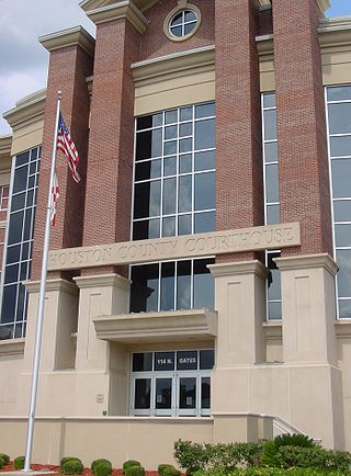
Houston County is a county located in the southeastern corner of the U.S. state of Alabama. As of the 2020 census the population was 107,202. Its county seat is Dothan, which is located on the border and partially in adjacent Henry County.

<span class="mw-page-title-main">Washington County, Virginia</span> County in Virginia, United States

Washington County is a county located in the Commonwealth of Virginia. As of the 2020 census, the population was 53,935. Its county seat is Abingdon.

<span class="mw-page-title-main">Spotsylvania County, Virginia</span> County in Virginia, United States

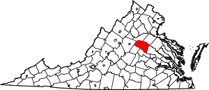
Spotsylvania County is a county in the U.S. state of Virginia. As of the July 2021 estimate, the population was 145,300. Its county seat is Spotsylvania Courthouse.

<span class="mw-page-title-main">Southampton County, Virginia</span> County in Virginia, United States

Southampton County is a county located on the southern border of the Commonwealth of Virginia. North Carolina is to the south. As of the 2020 census, the population was 17,996. Its county seat is Courtland.

<span class="mw-page-title-main">Henry County, Virginia</span> County in Virginia, United States

Henry County is a county located in the U.S. state of Virginia. As of the 2020 census, the population was 50,948. The county seat is usually identified as Martinsville; however, the administration building, county courthouse, and Henry County Sheriff's Office are located on Kings Mountain Road in Collinsville.The Henry County Adult Detention Center is located on DuPont Road in Martinsville.

<span class="mw-page-title-main">Hanover County, Virginia</span> County in Virginia, United States

Hanover County is a county in the Commonwealth of Virginia. As of the 2020 census, the population was 109,979. Its county seat is Hanover.

<span class="mw-page-title-main">Live Oak County, Texas</span> County in Texas, United States

Live Oak County is a county in the U.S. state of Texas. It was named for its native groves of live oak. George West is its county seat. Its population was 11,335 in the 2020 census.

<span class="mw-page-title-main">Karnes County, Texas</span> County in Texas, United States

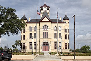
Karnes County is a county in the U.S. state of Texas. As of the 2020 census, the population was 14,710. Its county seat is Karnes City. The county is named for Henry Karnes, a soldier in the Texas Revolution. The former San Antonio and Aransas Pass Railway passed through Karnes County in its connection linking San Antonio with Corpus Christi.

<span class="mw-page-title-main">Louisa County, Iowa</span> County in Iowa, United States

Louisa County is a county located in the U.S. state of Iowa. As of the 2020 census, the population was 10,837. The county seat is Wapello.

<span class="mw-page-title-main">Henry County, Iowa</span> County in Iowa, United States

Henry County is a county located in the U.S. state of Iowa. As of the 2020 census, the population was 20,482. The county seat is Mount Pleasant. The county was named for General Henry Dodge, governor of Wisconsin Territory.

<span class="mw-page-title-main">Twin Falls County, Idaho</span> County in Idaho, United States

Twin Falls County is a county in the south central part of the U.S. state of Idaho. As of the 2020 census, the population was 90,046, making it the fifth-most populous county in Idaho. The county seat and largest city is Twin Falls. Twin Falls County is part of the Twin Falls, ID Twin Falls Metropolitan Statistical Area.

<span class="mw-page-title-main">Twin Oaks, Missouri</span> City in Missouri, United States

Twin Oaks is a 4th class city in St. Louis County, Missouri, United States. The former Village of Twin Oaks changed its status to that of a city by public election in November 2016. The population was 392 at the 2010 census.

<span class="mw-page-title-main">Twin Oaks, Oklahoma</span> Census-designated place in Oklahoma, United States

Twin Oaks is an unincorporated community and census-designated place (CDP) in Delaware County, Oklahoma, United States. The population was 198 at the 2010 census. A tornado hit the town on March 12, 2006, destroying 36 homes and damaging 31 others. 8 people were injured.

<span class="mw-page-title-main">Louisa, Virginia</span> Town in Virginia, United States

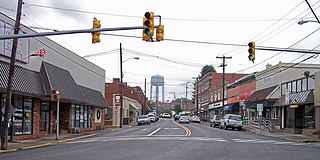
Louisa is a town in Louisa County, Virginia, United States. The population was 1,555 at the 2010 census. It is the county seat of Louisa County.

<span class="mw-page-title-main">Oak Hill, West Virginia</span> City in West Virginia, United States

Oak Hill is a city in Fayette County, West Virginia, United States. The population was 8,179 at the 2020 census. It is part of the Beckley metropolitan area.

<span class="mw-page-title-main">King William County, Virginia</span> County in Virginia, United States

King William County is a county located in the U.S. state of Virginia. As of the 2020 census, the population was 17,810. Its county seat is King William.

References

  1. "Louisa County, Virginia". United States Census Bureau . Retrieved January 30, 2022.
  2. "Find a County". National Association of Counties. Retrieved June 7, 2011.
  3. Gannett, Henry (1905). The Origin of Certain Place Names in the United States. U.S. Government Printing Office. p.  191.
  4. 1 2 Merida, Kevin (June 7, 2008). "The 'Obama Before Obama'". The Washington Post. p. A01.
  5. Pattie Cooke, "Louisa County Historical Notes" Archived May 11, 2008, at the Wayback Machine , Excerpt from Louisa & Louisa County, Dover, New Hampshire: Arcadia Publishing, 1997
  6. Archived August 24, 2011, at the Wayback Machine
  7. "Quake rocks Washington area, felt on East Coast". Associated Press (AP). August 23, 2011. Archived from the original on October 9, 2018. Retrieved August 23, 2011.
  8. "Strong earthquake hits Canada, U.S. East Coast". The Vancouver Sun. August 23, 2011.[ permanent dead link ]
  9. "Louisa Updates Earthquake Damage Estimates". Gray Television, Inc. Archived from the original on October 8, 2011. Retrieved August 31, 2011.
  10. "US Gazetteer files: 2010, 2000, and 1990". United States Census Bureau. February 12, 2011. Retrieved April 23, 2011.
  11. "Annual Estimates of the Resident Population for Counties: April 1, 2020 to July 1, 2021" . Retrieved April 6, 2022.
  12. "Census of Population and Housing from 1790-2000". US Census Bureau . Retrieved January 24, 2022.
  13. "Historical Census Browser". University of Virginia Library. Retrieved January 3, 2014.
  14. "Population of Counties by Decennial Census: 1900 to 1990". United States Census Bureau. Retrieved January 3, 2014.
  15. "Census 2000 PHC-T-4. Ranking Tables for Counties: 1990 and 2000" (PDF). United States Census Bureau. Archived (PDF) from the original on October 9, 2022. Retrieved January 3, 2014.
  16. 1 2 "P2 Hispanic or Latino, and Not Hispanic or Latino by Race – 2010: DEC Redistricting Data (PL 94-171) - Louisa County, Virginia". United States Census Bureau .
  17. 1 2 "P2 Hispanic or Latino, and Not Hispanic or Latino by Race – 2020: DEC Redistricting Data (PL 94-171) - Louisa County, Virginia". United States Census Bureau .
  18. "U.S. Census website". United States Census Bureau . Retrieved May 14, 2011.
  19. Google Maps: Yanceyville, Virginia, accessed March 13, 2022.
  20. Who Was Who in America, Historical Volume, 1607–1896. Chicago: Marquis Who's Who. 1963.
  21. Virginia Historical Markers Archived June 9, 2012, at the Wayback Machine , Virginia Historical Marker W-211: Patrick Henry's Home
  22. Leip, David. "Dave Leip's Atlas of U.S. Presidential Elections". uselectionatlas.org. Retrieved December 9, 2020.

37°59′N77°58′W / 37.99°N 77.96°W / 37.99; -77.96