The Pas-de-Calais is a department in northern France named after the French designation of the Strait of Dover, which it borders. It has the most communes of all the departments of France, with 890, and is the 8th most populous. It had a population of 1,465,278 in 2019. The Calais Passage connects to the Port of Calais on the English Channel. The Pas-de-Calais borders the departments of Nord and Somme and is connected to the English county of Kent via the Channel Tunnel.
Billy-Berclau is a commune in the Pas-de-Calais department in the Hauts-de-France region in northern France.

Croisilles is a village and commune in the Pas-de-Calais department of the Hauts-de-France region of France.
Montigny-en-Gohelle is a commune in the Pas-de-Calais department in the Hauts-de-France region of France.

Outreau is a commune in the Pas-de-Calais department in the Hauts-de-France region of France.

Wingles is a commune of the Pas-de-Calais department in the Hauts-de-France region of France.
Rouvroy is a commune in the Pas-de-Calais department in the Hauts-de-France region of France.

Angres is a commune in the Pas-de-Calais department in the Hauts-de-France region of France.
The Communauté d'agglomération de Lens – Liévin is the communauté d'agglomération, an intercommunal structure, centred on the cities of Lens and Liévin. It is located in the Pas-de-Calais department, in the Hauts-de-France region, northern France. It was created in January 2000. It adopted the name Communaupole on June 25, 2004. Its area is 239.4 km2. Its population was 241,703 in 2018, of which 31,606 in Lens and 30,423 in Liévin.

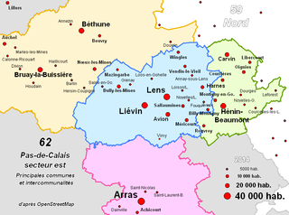
The arrondissement of Lens is an arrondissement of northern France in the Pas-de-Calais department in the Hauts-de-France region. It has 50 communes. Its population is 367,839 (2016), and its area is 351.5 km2 (135.7 sq mi).

Saint-Nicolas or Saint-Nicolas-lez-Arras is a commune in the Pas-de-Calais department in the Hauts-de-France region of France.

Méricourt is a commune in the Pas-de-Calais department in the Hauts-de-France region of France.

Avion is a commune in the Pas-de-Calais department in the Hauts-de-France region of France.

Fouquières-lès-Lens is a commune in the Pas-de-Calais department in the Hauts-de-France region of France.

Meurchin is a commune in the Pas-de-Calais department in the Hauts-de-France region of France.

Morval is a commune in the Pas-de-Calais department in the Hauts-de-France region of France.

Noyelles-Godault is a commune in the Pas-de-Calais department in the Hauts-de-France region of France.

Vendin-le-Vieil is a commune in the Pas-de-Calais department in the Hauts-de-France region of France.
The canton of Liévin-Sud is a former canton situated in the department of the Pas-de-Calais and in the Nord-Pas-de-Calais region of northern France. It was disbanded following the French canton reorganisation which came into effect in March 2015. It had a total of 24,326 inhabitants (2012).
The canton of Liévin is an administrative division of the Pas-de-Calais department, in northern France. It was created at the French canton reorganisation which came into effect in March 2015. Its seat is in Liévin.


