| |
| UTC time | ?? |
|---|---|
| ISC event | |
| USGS-ANSS | |
| Date * | January 27, 2006 |
| Local date | |
| Local time | |
| Magnitude | 7.6 Mw |
| Epicenter | 5°28′23″S128°07′52″E / 5.473°S 128.131°E Coordinates: 5°28′23″S128°07′52″E / 5.473°S 128.131°E |
| Areas affected | Indonesia |
| Max. intensity | V (Moderate) [1] |
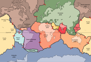
The 2006 Banda Sea earthquake occurred in the Banda Sea region, at 16:58 (UTC) on January 27, 2006, with a magnitude of 7.6Mw. The location was 200 km south of Ambon Island, and 445 km north east of Dili, East Timor. Other significant earthquakes occur regularly (2005, 2009 for example), however they are not identified readily due to the isolation of the occurrences, lack of damage to human communities, and dearth of reporting and research. The 2006 Banda Sea earthquake was felt as far away as Northern Australia.

The Banda Sea is a sea in the Maluku Islands of Indonesia, connected to the Pacific Ocean but surrounded by hundreds of islands, as well as the Halmahera and Ceram Seas. It is about 1000 km (600 mi) east to west, and about 500 km (300 mi) north to south.
The moment magnitude scale is a measure of n earthquake's magnitude based on its seismic moment, expressed in terms of the familiar magnitudes of the original "Richter" magnitude scale.

Ambon Island is part of the Maluku Islands of Indonesia. The island has an area of 775 km2 (299 sq mi) and is mountainous, well watered, and fertile. Ambon Island consists of two territories - the city of Ambon to the south and various districts (kecamatan) of the Central Maluku Regency to the north. The main city and seaport is Ambon, which is also the capital of Maluku province, while those districts of Maluku Tengah Regency situated on Ambon Island had a 2014 population of 132,377. Ambon has an airport and is home to the Pattimura University and Open University, state universities, and a few private universities, which include Darussalam University and Universitas Kristen Indonesia Maluku (UKIM).