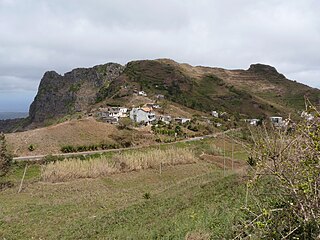
Rui Vaz is a settlement in the central part of the island of Santiago, Cape Verde. In 2010 its population was 1,078. It is situated at 809 m elevation, 2 km south of São Jorge dos Órgãos and 4 km west of São Domingos. It is part of the municipality of São Domingos.

Atalaia is a settlement in the northern part of the island of Fogo, Cape Verde. Its population was 700 in 2010. It is situated near the coast, 6 km west of Mosteiros and 19 km northeast of the island capital São Filipe. The municipal boundary with São Filipe is to the west. Nearby settlements area Ribeira Ilhéu to the east and Campanas Baixo to the west. The festival of Saint John is celebrated every June 24.
Figueira Pavão is a settlement in the southeastern part of the island of Fogo, Cape Verde. In 2010 its population was 320. It is situated 3 km southwest of Cova Figueira and 20 km east of the island capital São Filipe. Nearby settlements are Achada Furna to the west and Estância Roque to the north.
Ribeira do Ilhéu is a settlement in the northern part of the island of Fogo, Cape Verde. It is situated 6 km west of Mosteiros and 20 km northeast of the island capital São Filipe. The nearest village is Atalaia, 1.5 km to the southwest. The village's main festival is the festival of Saint Joseph that takes place on March 19.
Estância Roque is a settlement in the eastern part of the island of Fogo, Cape Verde. In 2010 its population was 411. It is situated 3 km west of Cova Figueira and 19 km east of the island capital São Filipe. Nearby places include Figueira Pavão in the south and Cabeça Fundão in the northwest.
Rincão is a settlement in the western part of the island of Santiago, Cape Verde. In 2010 its population was 1,048. It is situated on the west coast, 6 km southwest of Assomada. The westernmost point of the island, Ponta da Janela, lies 2 km to the northwest.

Fontainhas is a settlement in the northern part of the island of Santo Antão, Cape Verde. It is situated near the rocky north coast of the island, 2 km southwest of Ponta do Sol and 19 km north of the island capital Porto Novo. The settlement includes the smaller villages Corvo and Forminguinhas, about 1 km west of Fontainhas proper.
Monte Trigo is the westernmost settlement on the island of Santo Antão, Cape Verde. It is situated on the coast, at the foot of the Tope de Coroa, the highest mountain of the island. It is 28 km west of the island capital Porto Novo. In 2010 its population was 274. About 5 km to the northwest is Ponta do Chão de Mangrade, the westernmost point of all Africa.
Tarrafal de Monte Trigo is a settlement in the southwestern part of the island of Santo Antão, Cape Verde. In 2010 its population was 841. It is situated on the coast, 27 km west of the island capital Porto Novo. The settlement was mentioned as Terrafal in the 1747 map by Jacques-Nicolas Bellin.
Hortelã is a settlement in the western part of the island of São Nicolau, Cape Verde. In 2010 its population was 181. It is situated at the southern foot of Monte Gordo, 5 km north of Tarrafal de São Nicolau and 6 km west of Ribeira Brava.
Morro is a settlement in the west of the island of Maio in Cape Verde. It is located 5 km north of the island capital Porto Inglês and 6 km south of Calheta. As of the 2010 census, its population was 310. The beach north of the village, Praia do Morro, is a 6.66 km2 nature reserve.
Salineiro is a village in the southern part of the island of Santiago, Cape Verde. It is part of the municipality of Ribeira Grande de Santiago. In 2010 its population was 1,113. It is located on the western edge of the Ribeira Grande gorge, 2.5 km north of Cidade Velha and 11 km west of the capital Praia.
As Hortas is a settlement in the northwestern part of the island of Fogo, Cape Verde. It is situated 2 km west of Curral Grande, 3 km southwest of Ponta Verde and 8 km north of the island capital São Filipe.
Palhal is a settlement in the western part of the island of São Nicolau, Cape Verde. In 2010 its population was 100. It is situated 2 km west of Cabeçalinho and 5 km northeast of Tarrafal de São Nicolau.

Monte Largo is a settlement in the southern part of the island of Fogo, Cape Verde. It is situated 1.5 km northeast of Salto, 3 km southeast of Monte Grande, 3 km west of Achada Furna and 13 kilometres (8.1 mi) east of the island capital São Filipe. At the 2010 census its population was 274. Its elevation is about 800 meters.
Luzia Nunes is a settlement in the southwestern part of the island of Fogo, Cape Verde. It is situated 1.5 km west of Patim, 2 km southeast of Vicente Dias and 7 km southeast of the island capital São Filipe. At the 2010 census its population was 438.
Bolona is a settlement in the westcentral part of the island of Santo Antão, Cape Verde. In 2010 its population was 112. It is situated about 19 km west of the island capital Porto Novo. At about 1,500 m elevation, it is one of the highest settlements of the island.
Santa Cruz is a settlement in the eastern part of the island of Santiago, Cape Verde. It is part of the municipality of Santa Cruz. It is located 2 km south of Cancelo and 3 km west of Pedra Badejo, on the national road to Tarrafal (EN1-ST02). In 2010 its population was 2,019.
Charco is a settlement in the west of the island of Santiago, Cape Verde. It is part of the municipality of Santa Catarina. It lies 2.5 km southeast of Ribeira da Barca and 9 km west of the municipal seat Assomada. In 2010 its population was 266.
Belém is a settlement in the southwest of the island of Santiago, Cape Verde. It is part of the municipality of Ribeira Grande de Santiago. It is 2 km west of Santana, 6 km north of Porto Gouveia and 11 km northwest of the municipal seat Cidade Velha. In 2010 its population was 382.


