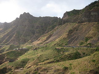
Tarrafal is a concelho (municipality) of Cape Verde. It is situated in the northern part of the island of Santiago. Its seat is the town Tarrafal. Its population was 18,565 at the 2010 census, and its area is 120.8 km2.

Tarrafal de São Nicolau is a concelho (municipality) of Cape Verde. Situated in the western part of the island of São Nicolau, it covers 35% of the island area (119.8 km²), and is home to 41% of its population. Its seat is the town Tarrafal de São Nicolau.

Tarrafal de São Nicolau is a city in the western part of the island of São Nicolau, Cape Verde. With a population of 3,733, it is the most populous settlement of the island. It is the seat of the Tarrafal de São Nicolau Municipality, and the main port of the island. It is situated on the west coast, 9 km southwest of Ribeira Brava.

Trás os Montes is a settlement in the northern part of the island of Santiago, Cape Verde. In 2010 its population was 464. It is situated 4 km northeast of Tarrafal.

Achada Tenda is a town in the northern part of the island of Santiago, Cape Verde. In 2010 its population was 1,242. It is situated on the east coast, 10 km southeast of Tarrafal. The small bay Porto Formoso is situated near the town.

Figueira das Naus is a settlement in the western part of the island of Santiago, Cape Verde. It is part of the municipality of Santa Catarina. In 2010 its population was 1,157. It is situated 11 km south of Tarrafal and 12 km northwest of Assomada. It is situated on the secondary road connecting Fundura and Ribeira da Prata.

Tarrafal de Monte Trigo is a settlement in the southwestern part of the island of Santo Antão, Cape Verde. In 2010 its population was 841. It is situated on the coast, 27 km west of the island capital Porto Novo. The settlement was mentioned as Terrafal in the 1747 map by Jacques-Nicolas Bellin.

Hortelã is a settlement in the western part of the island of São Nicolau, Cape Verde. In 2010 its population was 181. It is situated at the southern foot of Monte Gordo, 5 km north of Tarrafal de São Nicolau and 6 km west of Ribeira Brava.
Silvino Lopes Évora is a Cape Verdean writer, poet, journalist and a university professor.

Ribeira Prata is a settlement in the northwestern part of the island of São Nicolau, Cape Verde. In 2010 its population was 343. It is situated near the north coast, 3 km northeast of Praia Branca and 11 km north of Tarrafal de São Nicolau.

Palhal is a settlement in the western part of the island of São Nicolau, Cape Verde. In 2010 its population was 100. It is situated 2 km west of Cabeçalinho and 5 km northeast of Tarrafal de São Nicolau.

Ribeira dos Calhaus is a settlement in the western part of the island of São Nicolau, Cape Verde. It is part of the municipality of Tarrafal de São Nicolau. It is situated in a valley northwest of Monte Gordo, 3 km southeast of Praia Branca and 7 km north of Tarrafal de São Nicolau.

Estádio de Mangue or Estádio Municipal do Tarrafal is a multi-purpose stadium in the neighborhood of Mangue in Tarrafal, Cape Verde nearly 100 meters north of the communal boundary of Chão Bom and just west of the Assomada-Tarrafal Road (EN1-ST01). It is currently used mostly for football matches. The stadium holds 200 people and its dimensions is 105 x 67 meters. It is one of four that are operated by the Santiago North Regional Football Association (ARFSN). The stadium is home to Tarrafal's best clubs including Amabox Barcelona, Beira-Mar, Estrela dos Amadores and Varandinha. All clubs participate in the Santiago Island League North Zone. Other teams that base in another part include AEF Chão Bom. Since 2015, it is also the home field of Delta Cultura currently playing in the regional Second Division. Tarrafal's Health Center is east of the stadium.

Serra Malagueta is a settlement in the northwestcentral part of the island of Santiago, Cape Verde. It is part of the municipality of Santa Catarina. It is situated on the main road between Assomada and Tarrafal (EN1-ST01), 1 km south of Curral Velho, 3 km (1.9 mi) north of Fundura and 11 km (6.8 mi) north of Assomada. In 2010 its population was 572. The main village, Locotano, sits at about 800 m elevation, northwest of the summit of Serra Malagueta, and lies partly in the Serra Malagueta Natural Park.
The Santiago North Regional Football Association is a football (soccer) association covering the north of the island of Santiago. It is headquartered in the city of Assomada, in the middle of the island. The winner of the championship plays in the Cape Verdean football Championships of each season. The football association is the second largest behind Boa Vista and ahead of Santo Antão South. The association are one of three championship competitions that play in more than one stadium.

Veneza is a settlement in the northeastern part of the island of Santiago, Cape Verde. It is part of the municipality of São Miguel. It is a suburb of the city of Calheta de São Miguel, north of the city centre. It is situated on the coast, along the Praia-Pedra Badejo-Tarrafal Road (EN1-ST02). In 2010 its population was 1,375.

Mancholy is a settlement in the northwestern part of the island of Santiago, Cape Verde. It is part of the municipality of Santa Catarina. In 2010 its population was 903. It is situated 4 km northwest of Assomada, on the road to Tarrafal (EN1-ST01).


