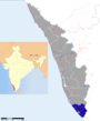
Attingal is a municipality in Thiruvananthapuram metropolitan area in Thiruvananthapuram district of Kerala state, India. It is the headquarters of Chirayinkeezhu Taluk, and the important government institutions of the taluk such as the Taluk office, court complex, office of the deputy superintendent of Police, civil station and treasuries are situated in Attingal. It is one among the oldest municipalities of Kerala which constituted prior to the independence on 1922. On 1914 itself Attingal Town Improvement Authority (TIA) was formed which was the term used before the municipality regulation act of 1922. Attingal Town is located 25 kilometres (16 mi) north of Thiruvananthapuram.
Nedumangad is a town and municipality in Thiruvananthapuram metropolitan area of Thiruvananthapuram district in the Indian state of Kerala, and is the headquarters of Nedumangad (tehsil) and Nedumangad Revenue Division(RDO). It is a suburb of the extended metropolitan region of Thiruvananthapuram city. It is located around 16 km to the north-east of Thiruvananthapuram city on the Thiruvananthapuram — Shencottah SH2. It is an important commercial center in the district. It is a growing commercial and educational hub and all important government institutions are situated in the town. Nedumangadu Market is important in South Kerala.

Parippally is a town in Kalluvathukal Panchayath of Kollam district, Kerala, India. Paripally town is situated 12 km north-west of Varkala Town along the State Highway 64 ,15km north of Attingal Town along NH66, 22km South of Kollam City along NH66 and 44km North of State capital city Trivandrum along NH66. It is just 2 km away from the border of Kollam district on the way to Trivandrum District. Kollam Medical College is situated in Parippally.
Cherunniyoor is a village in Varkala Taluk of Thiruvananthapuram district in the state of Kerala, India.

Kilimanoor is a panchayat and a town in the Chirayinkeezhu taluk of Trivandrum district in Kerala, India. It is located on MC/SH 1 Road, 33 kilometres (21 mi) North-west of the city of Thiruvananthapuram (Trivandrum), 14 km east of Attingal and 20 km east of Varkala. The town area is administrated by Kilimanoor grama panchayat. Kilimanoor town is an important business centre and one of the potential fast-growing towns in south Kerala. Kilimanoor is looking forward to become a municipality.
Pangode is a village and a Grama Panchayat in Trivandrum district, state of Kerala, India. The village is known for its participation in the Indian Independence Movement, through the Kallara-Pangode Struggle. It is situated on the foothills of Western Ghats.
Vakkom is a area of Trivandrum Metropolitan Area near Kadakkavoor in Thiruvananthapuram district of Kerala, India. It is 35 km north of Thiruvananthapuram, the state capital. Vakkom panchayat is surrounded by back waters (Kayal). Neighbouring panchayats are Anjengo, Kadakkavoor, Vettoor, Cherunniyoor and Manampoor. The towns within 9 km are Varkala and Attingal. The nearest airport is Trivandrum International Airport and Kadakkavoor (1 km) is the nearest railway station.
Thamarakulam is a village in Alappuzha district in the Indian state of Kerala. Located in Alappuzha District of Kerala, Thamarakulam is around 16 km south-east of Kayamkulam. It is located close to the border of Kollam District. Kayamkulam, Mavelikara,Adoor, Ochira and Sasthamkotta are nearby towns. Nearest airport is Trivandrum International Airport, which is 110 km south. Sasthamkotta Railway Station is the nearest railhed. Kayamkulam Junction Railway Station is a major railhead nearby.
Mangalpady is a Panchayath in Kasaragod district, Kerala. Uppala is the major town in this panchayat.

Kalluvathukkal is a village in the Kollam district of the Indian state of Kerala. NH 47 passes through the village. Kalluvathukkal panchayat has its own school (KPHS) for classes from 5th std to 10 th std. A mini stadium is also co located with the school. The nearest town, the people from the village relies for everything is Chathannoor
Alamcode is a village in Malappuram district in the state of Kerala, India.

Edappatta is a village in Malappuram district in the state of Kerala, India.
Niramaruthur is a village in Malappuram district in the state of Kerala, India.
Ozhur is a village in the Malappuram district of the state of Kerala, India. The village was a part of the Kingdom of Tanur (Vettattnad) in medieval times.

Kadakkavoor is a developing special grade town consisting central government postal office, railway station, sub treasury, police station, electricity board, telecom office and banks; Thiruvananthapuram district in the state of Kerala, India.
Malayinkeezhu is a suburb of Trivandum, the largest city and capital of the Indian state of Kerala. It is located at the south-eastern side of Thiruvanathapuram Metropolitan Area, and is at a distance of 13 km from the heart of the city. The town is famous for the religious festival named Malayinkeezhu Aarattu. Neyyar Wildlife Sanctuary, one of the major tourist destinations in Thiruvananthapuram district is situated 17 km away from the town. The nearest airport is Trivandrum International Airport and Balaramapuram Railway Station is the nearest Railway Station. The Pincode of Malayinkeezhu Post Office is 695571 which comes under the postal circle of Neyyattinkara region.

Avanavancherry is a village in Thiruvananthapuram district in the state of Kerala, India.
Kallambalam is a suburb of Varkala Town situated in Varkala Taluk of Thiruvananthapuram district, Kerala. Kallambalam joints Varkala with National Highway 66. It is 36 km north from state capital city Trivandrum, 30 km south of Kollam city, 8 km East of Varkala and 12 km West of Kilimanoor.
Venjaramoodu is a north-east suburb of Trivandrum city, the capital of Kerala. It is situated 09km east of Attingal, 11km north-west of Nedumangad, 12km north-east of Trivandrum City and 26km south-east of Varkala.
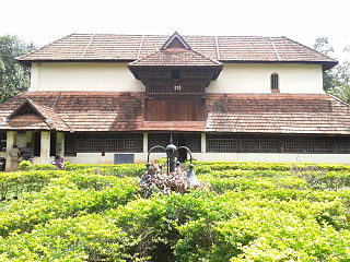
Avanavanchery Sri Indilayappan Temple is a popular Hindu temple in Attingal of Thiruvananthapuram district, Kerala.The temple is dedicated to Lord Indilayappan and is one of the oldest temples in the state of Kerala. Lord Indilayappan is worshipped by devotees for getting good health, courage and better life prospects. The primary deity of the temple is Lord Shiva and Umamaheswara. The Temple sub deities are Lord "Unni Ganapathy", Sree Dharmashastha and Naga Devatas. There is a separate sanctuary for Mallan Thamburan.