Alcozauca de Guerrero (municipality)

Last updated
Alcozauca de Guerrero
Mexico States blank map.svg
Red pog.svg
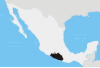
Alcozauca de Guerrero
Location in Mexico
Coordinates: 17°27′N98°23′W / 17.450°N 98.383°W / 17.450; -98.383 Coordinates: 17°27′N98°23′W / 17.450°N 98.383°W / 17.450; -98.383
CountryFlag of Mexico.svg  Mexico
State Guerrero
Municipal seat Alcozauca de Guerrero
Population
 (2005)
  Total16,237

Alcozauca de Guerrero is one of the 81 municipalities of Guerrero, in south-western Mexico. The municipal seat lies at Alcozauca de Guerrero. The municipality covers an area of 55,160 hectares.

Municipalities of Guerrero Wikimedia list article

Guerrero is a state in Southwest Mexico that is divided into 81 municipalities. According to the 2015 Mexican Intercensal Survey, Aguascalientes is the 12th most populous state with 3,533,251 inhabitants and the 14th largest by land area spanning 63,803.42 square kilometres (24,634.64 sq mi).

Mexico Country in the southern portion of North America

Mexico, officially the United Mexican States, is a country in the southern portion of North America. It is bordered to the north by the United States; to the south and west by the Pacific Ocean; to the southeast by Guatemala, Belize, and the Caribbean Sea; and to the east by the Gulf of Mexico. Covering almost 2,000,000 square kilometers (770,000 sq mi), the nation is the fourth largest country in the Americas by total area and the 13th largest independent state in the world. With an estimated population of over 129 million people, Mexico is the tenth most populous country and the most populous Spanish-speaking country in the world, while being the second most populous nation in Latin America after Brazil. Mexico is a federation comprising 31 states plus Mexico City (CDMX), which is the capital city and its most populous city. Other metropolises in the country include Guadalajara, Monterrey, Puebla, Toluca, Tijuana, and León.

Alcozauca de Guerrero Municipal seat and city in Guerrero, Mexico

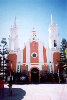
Alcozauca de Guerrero is a city and seat of the municipality of Alcozauca de Guerrero, in the state of Guerrero, south-western Mexico.

As of 2005, the municipality had a total population of 16,237. [1]

Climate

Climate data for Alcozauca de Guerrero (1951–2010)
MonthJanFebMarAprMayJunJulAugSepOctNovDecYear
Record high °C (°F)32.0
(89.6)
34.0
(93.2)
36.5
(97.7)
38.5
(101.3)
39.0
(102.2)
38.0
(100.4)
34.0
(93.2)
34.0
(93.2)
33.0
(91.4)
33.5
(92.3)
33.0
(91.4)
32.0
(89.6)
39.0
(102.2)
Average high °C (°F)27.4
(81.3)
28.9
(84.0)
31.1
(88.0)
32.3
(90.1)
32.1
(89.8)
29.4
(84.9)
27.7
(81.9)
27.7
(81.9)
27.4
(81.3)
27.6
(81.7)
27.7
(81.9)
27.1
(80.8)
28.9
(84.0)
Daily mean °C (°F)18.0
(64.4)
19.3
(66.7)
21.3
(70.3)
23.1
(73.6)
23.9
(75.0)
22.7
(72.9)
21.5
(70.7)
21.4
(70.5)
21.4
(70.5)
20.6
(69.1)
19.4
(66.9)
18.0
(64.4)
20.9
(69.6)
Average low °C (°F)8.6
(47.5)
9.7
(49.5)
11.6
(52.9)
13.8
(56.8)
15.6
(60.1)
16.0
(60.8)
15.3
(59.5)
15.1
(59.2)
15.4
(59.7)
13.5
(56.3)
11.0
(51.8)
8.9
(48.0)
12.9
(55.2)
Record low °C (°F)0.5
(32.9)
1.0
(33.8)
5.0
(41.0)
6.0
(42.8)
7.0
(44.6)
8.0
(46.4)
6.0
(42.8)
9.0
(48.2)
10.0
(50.0)
2.0
(35.6)
1.0
(33.8)
2.5
(36.5)
0.5
(32.9)
Average precipitation mm (inches)10.7
(0.42)
3.9
(0.15)
6.8
(0.27)
20.9
(0.82)
58.9
(2.32)
178.5
(7.03)
193.2
(7.61)
199.2
(7.84)
164.9
(6.49)
80.6
(3.17)
12.2
(0.48)
3.8
(0.15)
933.6
(36.76)
Average precipitation days (≥ 0.1 mm)0.90.71.02.46.415.818.318.816.78.21.50.591.2
Source: Servicio Meteorologico Nacional [2] [3]

Related Research Articles

Abasolo, Coahuila City in Coahuila, Mexico

Abasolo is a city and seat of the municipality of Abasolo in the northern Mexican state of Coahuila. In 2000, the city had 1,130 inhabitants.

San Francisco de los Romo Municipality in Aguascalientes, Mexico

San Francisco de los Romo is a municipality and city in the Mexican state of Aguascalientes. The city of San Francisco de los Romo serves as the municipal seat for the surrounding municipality of San Francisco de los Romo.

Apizaco Municipality in Tlaxcala, Mexico

Apizaco is a city in Apizaco Municipality located near the geographic center of the Mexican state of Tlaxcala, approximately 25 minutes by car from the state's capital city of Tlaxcala. The city gets its name from the Nahuatl language words "ātl" (water), "pitzāhuac" (thin), and the suffix "co" (place), forming "Āpitzāco", or roughly "thin water place". Those seeking to reach the port of Veracruz by railroad from Mexico City must travel through Apizaco. The city began because of its location on this railroad.

Huajicori is both a municipality and the municipal seat of the same in the Mexican state of Nayarit. The population of the municipality was 10,294 in 2000 in a total area of 2,603.5 km². Its area makes up almost 10% of the state. The population of the town was 2,201 (2005).

Altar, Sonora Place in Sonora, Mexico

Altar is small city and municipal seat of Altar Municipality in the Mexican state of Sonora. It is located in the northwest region of the state at 30°42′49″N111°50′07″W.

Concepción del Oro Municipality Municipality in Zacatecas, Mexico

Concepción del Oro is one of the 58 municipalities in the Mexican state of Zacatecas. It is located on the northern part of the state and it is bounded by the municipalities of Mazapil and El Salvador; it also lies next to the states of Coahuila and San Luis Potosí. The municipality covers a total surface area of 2,559 square kilometers (988 sq mi).

Tepezalá Municipality in Aguascalientes, Mexico

Tepezalá is a municipality and town in the Mexican state of Aguascalientes. The town of Tepezalá serves as the municipal seat for the surrounding municipality of Tepezalá.

Zumpango del Río Municipal seat and city in Guerrero, Mexico

Zumpango del Río is the capital of Eduardo Neri Municipality, within the state of Guerrero, in central−western Mexico.

Xochihuehuetlan Municipal seat and city in Guerrero, Mexico

Xochihuehuetlan is a city and seat of the municipality of Xochihuehuetlan, in the state of Guerrero, south-western Mexico.

Zapotitlán Tablas Municipal seat and city in Guerrero, Mexico

Zapotitlán Tablas is a city and seat of the municipality of Zapotitlán Tablas, in the state of Guerrero, south-western Mexico.

Acatzingo Municipality in Puebla, Mexico

Acatzingo Municipality is a municipality in Puebla in south-eastern Mexico.

Ahuazotepec Municipality in Puebla, Mexico

Ahuazotepec Municipality is a municipality in Puebla in south-eastern Mexico.

Quimixtlán Municipality is a municipality in Puebla in south-eastern Mexico.

Zongozotla Municipality is a municipality in Puebla in south-eastern Mexico.

Amaxac de Guerrero Municipality in Tlaxcala, Mexico

Amaxac de Guerrero is a municipality in Tlaxcala in south-eastern Mexico.

Teolocholco (municipality) is a municipality in Tlaxcala in south-eastern Mexico.

Matlapa is a town and municipality in San Luis Potosí in central Mexico.

Cosío Municipality in Aguascalientes, Mexico

Cosío is a municipality and town in the Mexican state of Aguascalientes. It stands at 22°22′N102°18′W. The municipal seat is the town of Cosío. As of 2010, the town of Cosío had a population of 4,898.

Zinapécuaro Municipality in Michoacán, Mexico

Zinapécuaro is a municipality in the Mexican state of Michoacán, located 50 kilometres (31 mi) northeast of the state capital Morelia.

Citlaltépetl, Veracruz Municipality in Veracruz, Mexico

Citlaltépetl is a municipality in the Mexican state of Veracruz, located 223 kilometres (139 mi) northwest of the state capital of Xalapa and 99 kilometres (62 mi) south of the city of Tampico, Tamaulipas.

References

  1. "Alcozauca de Guerrero". Enciclopedia de los Municipios de México. Instituto Nacional para el Federalismo y el Desarrollo Municipal. Archived from the original on December 22, 2004. Retrieved December 23, 2008.
  2. "Estado de Guerrero-Estacion: Alcozauca de Guerrero (DGE)". Normales Climatologicas 1951–2010 (in Spanish). Servicio Meteorologico Nacional. Archived from the original on 3 March 2016. Retrieved 30 April 2015.
  3. "Extreme Temperatures and Precipitation for Alcozauca de Guerrero 1971–2010" (in Spanish). Servicio Meteorológico Nacional. Archived from the original on 3 March 2016. Retrieved 30 April 2015.