Alva, Queensland

Last updated

Alva
Queensland
Alva Beach at low tide.jpg
Alva Beach at low tide
Australia Queensland location map.svg
Red pog.svg
Alva
Coordinates 19°27′20″S147°28′52″E / 19.4555°S 147.4811°E / -19.4555; 147.4811
Population214 (2021 census) [1]
 • Density1.733/km2 (4.488/sq mi)
Postcode(s) 4807
Area123.5 km2 (47.7 sq mi)
LGA(s) Shire of Burdekin
State electorate(s) Burdekin
Federal division(s) Dawson
Localities around Alva:
Coral Sea Coral Sea Coral Sea
Colevale Alva Coral Sea
Brandon Ayr Airdmillan

Alva is a coastal town and a locality in the Shire of Burdekin, Queensland, Australia. [2] [3] In the 2021 census, the locality of Alva had a population of 214 people. [1]

Contents

Geography

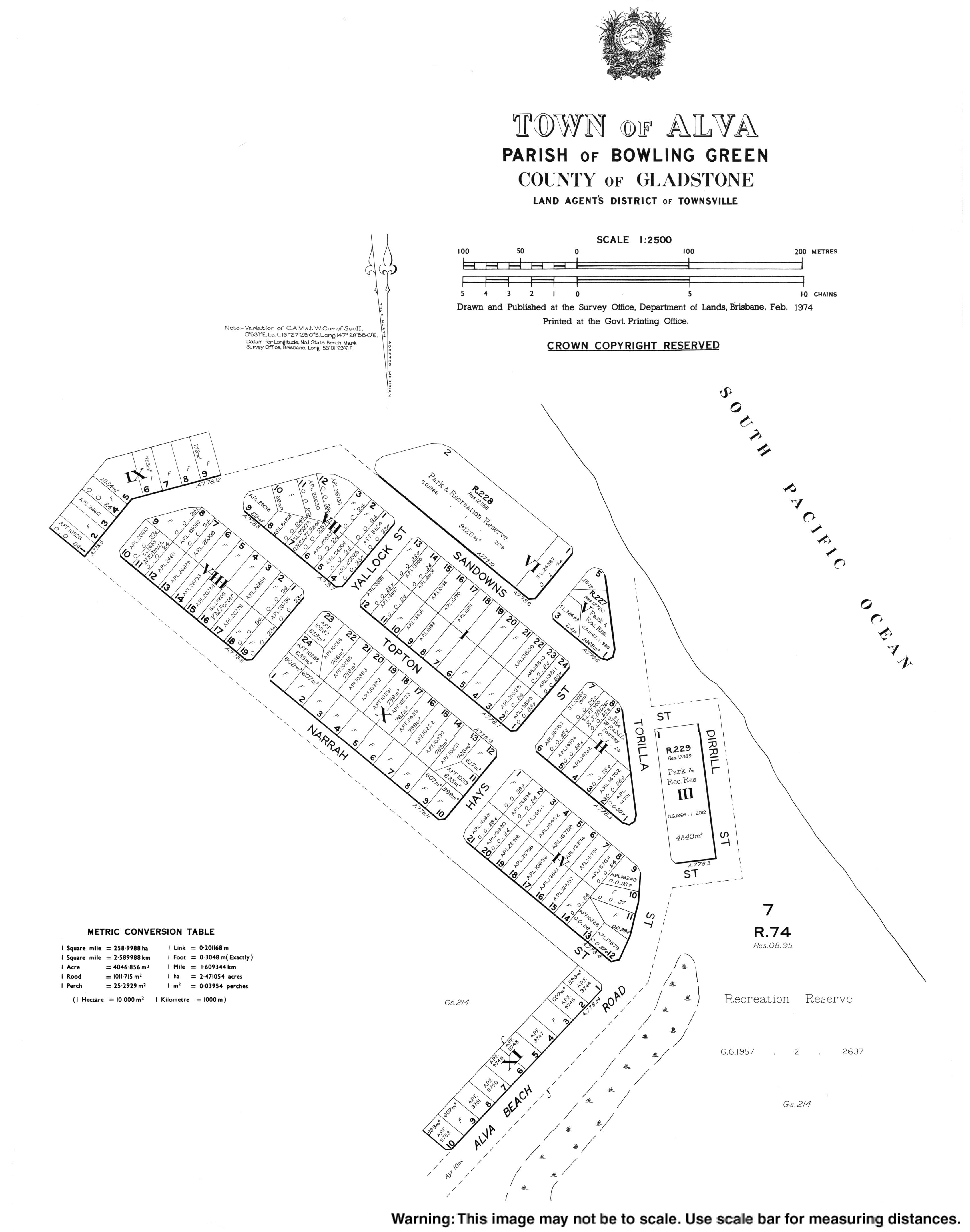
The northern part of Alva is a peninsula extending into the Coral Sea. The peninsula and north-western part of the locality are within the Bowling Green Bay National Park. [4]

Alva Beach, also known as Lynchs Beach, is part of the Burdekin River Delta. [5]

History

Alva was first surveyed as a town in 1926. [2]

Demographics

In the 2016 census, the locality of Alva had a population of 279 people. [6]

In the 2021 census, the locality of Alva had a population of 214 people. [1]

Amenities

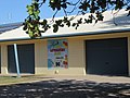
The town is home to the Ayr Surf Life Saving Club which opened in 1926 at Alva Beach, [7] the Alva Beach Tourist Park, [8] and a dive shop [9] offering trips to the SS Yongala ship wreck.

Related Research Articles

<span class="mw-page-title-main">Shire of Burdekin</span> Local government area in Queensland, Australia

The Shire of Burdekin is a local government area located in North Queensland, Australia in the Dry Tropics region. The district is located between Townsville and Bowen in the delta of the Burdekin River. The shire covers an area of 5,044 square kilometres (1,947 sq mi). It has existed as a local government entity since 1888. In the 2021 census, the shire had a population of 16,692 people.

<span class="mw-page-title-main">Portsea, Victoria</span> Suburb of Melbourne, Victoria, Australia

Portsea is a seaside suburb on the Mornington Peninsula in Melbourne, Victoria, Australia, approximately 60 kilometres (37 mi) south-west of Melbourne's Central Business District, located within the Shire of Mornington Peninsula local government area. Portsea recorded a population of 787 at the 2021 census.

<span class="mw-page-title-main">Ayr, Queensland</span> Town in Queensland, Australia

Ayr is a rural town and locality in the Shire of Burdekin, Queensland, Australia. It is the centre of a sugarcane-growing region and the administrative centre for the Burdekin Shire Council. In the 2021 census, the locality of Ayr had a population of 8,603 people.

<span class="mw-page-title-main">Peregian Beach</span> Town in Queensland, Australia

Peregian Beach is a beach and small coastal town on the Sunshine Coast, Queensland, Australia. It is a suburb split between two local government areas with the eastern coastal in the Shire of Noosa and the western hinterland part in the Sunshine Coast Region. In the 2021 census, the suburb of Peregian Beach had a population of 4,972 people.

<span class="mw-page-title-main">Giru, Queensland</span> Town in Queensland, Australia

Giru is a town and coastal locality in the Shire of Burdekin, Queensland, Australia, situated on the Haughton River, 54 kilometres (34 mi) south-east of Townsville. In the 2016 census, the locality of Giru had a population of 354 people.

<span class="mw-page-title-main">Home Hill, Queensland</span> Town in Queensland, Australia

Home Hill is a rural town and locality in the Shire of Burdekin, Queensland, Australia. In the 2016 census, the locality of Home Hill had a population of 2,954 people.

<span class="mw-page-title-main">One Mile, New South Wales</span> Suburb of Port Stephens Council, New South Wales, Australia

One Mile is a suburb of the Port Stephens local government area in the Hunter Region of New South Wales, Australia. The Worimi people are the traditional owners of the Port Stephens area. The suburb is semi-rural with a small urban settlement, several eco-resorts and back-packer accommodations to the west of Gan Gan Road. On the beach side there is a residential land-lease community and three tourist parks. The parks, two of which have licensed restaurants, are positioned to provide quick access to the suburb's two beaches. Since late 2017 Port Stephens Koala Hospital has been operating in the grounds of Treescape resort.

<span class="mw-page-title-main">Elliott Heads, Queensland</span> Town in Queensland, Australia

Elliott Heads is a coastal town and locality in the Bundaberg Region, Queensland, Australia. In the 2021 census, the locality of Elliott Heads had a population of 1,160 people.

<span class="mw-page-title-main">Moore Park Beach, Queensland</span> Town in Queensland, Australia

Moore Park Beach is a coastal rural locality in the Bundaberg Region, Queensland, Australia. The coastal town of Moore Park is within the locality.

Brandon is a rural town and locality in the Shire of Burdekin, Queensland, Australia. In the 2016 census, Brandon had a population of 1,094 people.

Millaroo is a rural town and locality in the Shire of Burdekin, Queensland, Australia. In the 2016 census, the locality of Millaroo had a population of 96 people.

Forrest Beach is a coastal locality in the Shire of Hinchinbrook, Queensland, Australia. In the 2016 census, Forrest Beach had a population of 1,254 people.

Separation Creek is a small coastal locality in the Shire of Colac Otway, Victoria, Australia. In the 2016 census, Separation Creek had a population of 19.

<span class="mw-page-title-main">Port Moorowie, South Australia</span> Town in South Australia

Port Moorowie is a small town in the Australian state of South Australia on the south coast of Yorke Peninsula. It has relatively calm beaches and a boat ramp on McLeod Harbour at the western end of Waterloo Bay in Investigator Strait. The town is predominantly a collection of holiday houses and shacks.

Wongarra is a coastal locality in the Shire of Colac Otway, Victoria, Australia. In the 2016 census, Wongarra had a population of 37.

Petticoat Creek is a small coastal locality in the Shire of Colac Otway, Victoria, Australia. In the 2011 census, the population of Petticoat Creek was too low to report separately; however in November 2014 the Victorian Electoral Commission recorded two enrolled voters in Petticoat Creek, living in two properties.

Horseshoe Lagoon is a rural locality in the Shire of Burdekin, Queensland, Australia. In the 2021 census, Horseshoe Lagoon had a population of 213 people.

<span class="mw-page-title-main">Cromarty, Queensland</span> Suburb of Shire of Burdekin, Queensland, Australia

Cromarty is a rural locality in the Shire of Burdekin, Queensland, Australia. In the 2021 census, Cromarty had a population of 43 people.

Mona Park is a rural locality in the Shire of Burdekin, Queensland, Australia. In the 2021 census, Mona Park had a population of 97 people.

Mount Kelly is a rural locality in the Shire of Burdekin, Queensland, Australia. In the 2021 census, Mount Kelly had a population of 291 people.

References

  1. 1 2 3 Australian Bureau of Statistics (28 June 2022). "Alva (SAL)". 2021 Census QuickStats. Retrieved 28 February 2023. OOjs UI icon edit-ltr-progressive.svg
  2. 1 2 "Alva – town in Shire of Burdekin (entry 42894)". Queensland Place Names. Queensland Government . Retrieved 18 November 2018.
  3. "Alva – locality in Shire of Burdekin (entry 44664)". Queensland Place Names. Queensland Government . Retrieved 18 November 2018.
  4. "Queensland Globe". State of Queensland . Retrieved 19 November 2018.
  5. "Beachsafe". Beachsafe. Surf Life Saving Australia. Archived from the original on 9 August 2021. Retrieved 9 August 2021.
  6. Australian Bureau of Statistics (27 June 2017). "Alva (SSC)". 2016 Census QuickStats. Retrieved 20 October 2018. OOjs UI icon edit-ltr-progressive.svg
  7. "Ayr Surf Life Saving Club". Ayr Surf Life Saving Club. Ayr Surf Life Saving Club. Archived from the original on 9 August 2021. Retrieved 9 August 2021.
  8. "AlvaBeachTP". Alva Beach Tourist Park. Alva Beach Tourist Park. Archived from the original on 9 August 2021. Retrieved 9 August 2021.
  9. "Yongala Dive". Yongala Dive. Yongala Dive. Archived from the original on 9 August 2021. Retrieved 9 August 2021.