Rita Island, Queensland

Last updated

Map all coordinates using: OpenStreetMap
Rita Island
Queensland
StateLibQld 1 394517 Anabranch Bridge, Burdekin River.jpg
Anabranch Bridge, connecting Rita Island to the mainland across the Burdekin River northern anabranch
Australia Queensland location map.svg
Red pog.svg
Rita Island
Coordinates 19°37′55″S147°32′05″E / 19.6320°S 147.5347°E / -19.6320; 147.5347 (Rita Island (centre of locality))
Population152 (2016 census) [1]
 • Density1.761/km2 (4.562/sq mi)
Postcode(s) 4807
Area86.3 km2 (33.3 sq mi)
Time zone AEST (UTC+10:00)
Location
LGA(s) Shire of Burdekin
State electorate(s) Burdekin
Federal division(s) Dawson
Suburbs around Rita Island:
Jarvisfield Jarvisfield Coral Sea
Carstairs Rita Island Coral Sea
Inkerman Groper Creek Groper Creek

Rita Island is a coastal and rural locality in the Shire of Burdekin, Queensland, Australia. [2] In the 2016 census, Rita Island had a population of 152 people. [1]

Contents

Geography

The Burdekin River breaks into two branches as it approaches the Coral Sea and Rita Island is the island that lies between the two branches. [3] [4]

Road and rail access is via the Anabranch Bridge across the northern anabranch ( 19°37′31″S147°28′57″E / 19.6253°S 147.4825°E / -19.6253; 147.4825 (Anabranch Bridge) ), which can be inaccessible if the Burdekin River is in flood. [5]

The land use is predominantly growing sugarcane. There is a cane tramway network to transport the harvested sugarcane to the Kalamia sugar mill in Brandon. [3]

History

In the 2016 census, Rita Island had a population of 152 people. [1]

Education

There are no schools in Rita Island. The nearest government primary school is Jarvisfield State School in neighbouring Jarvisfield to the north-west. The nearest government secondary school is Ayr State High School in Ayr to the north-west. [3]

Facilities

Rita Island SES Facility is at 3 Jones Road ( 19°37′47″S147°30′16″E / 19.6297°S 147.5044°E / -19.6297; 147.5044 (Rita Island SES Facility) ). [6]

Hell Hole Landing boat ramp is at Hodder Road ( 19°37′19″S147°33′56″E / 19.6220°S 147.5656°E / -19.6220; 147.5656 (Hell Hole Landing boat ramp) ). It is managed by the Burdekin Shire Council. [7]

Related Research Articles

<span class="mw-page-title-main">Shire of Burdekin</span> Local government area in Queensland, Australia

The Shire of Burdekin is a local government area located in North Queensland, Australia in the Dry Tropics region. The district is located between Townsville and Bowen in the delta of the Burdekin River.

<span class="mw-page-title-main">Ayr, Queensland</span> Town in Queensland, Australia

Ayr is a rural town and locality in the Shire of Burdekin, Queensland, Australia. It is the centre of a sugarcane-growing region and the administrative centre for the Burdekin Shire Council. In the 2016 census, the locality of Ayr had a population of 8,738 people.

<span class="mw-page-title-main">Giru, Queensland</span> Town in Queensland, Australia

Giru is a town and coastal locality in the Shire of Burdekin, Queensland, Australia, situated on the Haughton River, 54 kilometres (34 mi) south-east of Townsville. In the 2016 census, the locality of Giru had a population of 354 people.

<span class="mw-page-title-main">Home Hill, Queensland</span> Town in Queensland, Australia

Home Hill is a rural town and locality in the Shire of Burdekin, Queensland, Australia. In the 2016 census, the locality of Home Hill had a population of 2,954 people.

<span class="mw-page-title-main">North Queensland</span> Region in Queensland, Australia

North Queensland or the Northern Region is the northern part of the Australian state of Queensland that lies just south of Far North Queensland. Queensland is a massive state, larger than many countries, and its tropical northern part has been historically remote and undeveloped, resulting in a distinctive regional character and identity.

<span class="mw-page-title-main">Inkerman, Queensland</span> Town in Queensland, Australia

Inkerman is a rural town and locality in the Shire of Burdekin, Queensland, Australia. In the 2016 census, the locality of Inkerman had a population of 145 people.

<span class="mw-page-title-main">Dalbeg, Queensland</span> Town in Queensland, Australia

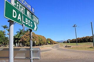
Dalbeg is a rural town and locality in the Shire of Burdekin, Queensland, Australia. In the 2016 census, Dalbeg had a population of 76 people.

Clare is a rural town and locality in the Shire of Burdekin, Queensland, Australia. In the 2016 census the locality of Clare had a population of 196 people.

Brandon is a rural town and locality in the Shire of Burdekin, Queensland, Australia. In the 2016 census, Brandon had a population of 1,094 people.

Millaroo is a rural town and locality in the Shire of Burdekin, Queensland, Australia. In the 2016 census, the locality of Millaroo had a population of 96 people.

Majors Creek is a locality split between the City of Townsville and the Shire of Burdekin, Queensland, Australia. In the 2016 census, Majors Creek had a population of 329 people.

Breddan is a rural locality in the Charters Towers Region, Queensland, Australia. In the 2016 census, Breddan had a population of 485 people.

<span class="mw-page-title-main">Airville, Queensland</span> Suburb of Shire of Burdekin, Queensland, Australia

Airville is a rural locality in the Shire of Burdekin, Queensland, Australia. In the 2016 census, Airville had a population of 338 people.

<span class="mw-page-title-main">Jarvisfield, Queensland</span> Suburb of Shire of Burdekin, Queensland, Australia

Jarvisfield is a coastal rural locality in the Shire of Burdekin, Queensland, Australia. In the 2016 census Jarvisfield had a population of 367 people.

Osborne is a rural locality in the Shire of Burdekin, Queensland, Australia. In the 2016 census Osborne had a population of 273 people.

McDesme is a rural locality in the Shire of Burdekin, Queensland, Australia. In the 2016 census McDesme had a population of 277 people.

<span class="mw-page-title-main">Bemerside, Queensland</span> Suburb of Shire of Hinchinbrook, Queensland, Australia

Bemerside is a rural locality in the Shire of Hinchinbrook, Queensland, Australia. In the 2016 census, Bemerside had a population of 241 people.

Fredericksfield is a rural locality in the Shire of Burdekin, Queensland, Australia. In the 2016 census Fredericksfield had a population of 219 people.

Groper Creek is a coastal town and rural locality in the Shire of Burdekin, Queensland, Australia. In the 2016 census, Groper Creek had a population of 62 people.

<span class="mw-page-title-main">Cromarty, Queensland</span> Suburb of Shire of Burdekin, Queensland, Australia

Cromarty is a rural locality in the Shire of Burdekin, Queensland, Australia. In the 2021 census, Cromarty had a population of 43 people.

References

  1. 1 2 3 Australian Bureau of Statistics (27 June 2017). "Rita Island (SSC)". 2016 Census QuickStats. Retrieved 20 October 2018. OOjs UI icon edit-ltr-progressive.svg
  2. "Rita Island – locality in Shire of Burdekin (entry 42301)". Queensland Place Names. Queensland Government . Retrieved 12 February 2022.
  3. 1 2 3 "Queensland Globe". State of Queensland . Retrieved 23 February 2022.
  4. "Rita Island – island in the Burdekin Shire (entry 28529)". Queensland Place Names. Queensland Government . Retrieved 23 February 2022.
  5. Charles, Caitlan (7 January 2021). "STOCK UP: Island residents warned to prepare for worst". Townsville Bulletin. Archived from the original on 23 February 2022. Retrieved 23 February 2022.
  6. "Emergency services facilities - Queensland". Queensland Open Data. Queensland Government. 18 November 2020. Archived from the original on 24 November 2020. Retrieved 24 November 2020.
  7. "Recreational Boating Facilities Queensland". Queensland Open Data. Queensland Government. 12 November 2020. Archived from the original on 22 November 2020. Retrieved 22 November 2020.