Mulgrave, Queensland

Last updated

Map all coordinates using: OpenStreetMap
Mulgrave
Queensland
VIEW FROM SUMMIT - panoramio.jpg
View from Mount Dalrymple, 2011
Australia Queensland location map.svg
Red pog.svg
Mulgrave
Coordinates 19°57′16″S147°02′02″E / 19.9544°S 147.0338°E / -19.9544; 147.0338 (Mulgrave (centre of locality))
Population19 (SAL 2021) [1]
Postcode(s) 4807
Area819.8 km2 (316.5 sq mi)
Time zone AEST (UTC+10:00)
Location
LGA(s) Shire of Burdekin
State electorate(s) Burdekin
Federal division(s) Kennedy
Suburbs around Mulgrave:
Ravenswood Upper Haughton Clare
Ravenswood Mulgrave Kirknie
Millaroo
Ravenswood Swans Lagoon Swans Lagoon

Mulgrave is a rural locality in the Shire of Burdekin, Queensland, Australia. [2] In the 2021 census, Mulgrave had a population of 19 people. [3]

Contents

Geography

Although the Shire of Burdekin is mostly lower-lying land used for growing sugarcane, Mulgrave in the south-west of the shire has more mountainous terrain, with a number of named peaks and gorges (from north to south):

There is some crop growing (including sugarcane) in the lower north-eastern part of the locality, but otherwise the predominant land use is grazing on native vegetation. [10]

History

The locality was officially named and bounded on 23 February 2001. [2]

Demographics

In the 2016 census, Mulgrave had a population of 21 people. [11]

In the 2021 census, Mulgrave had a population of 19 people. [3]

Education

There are no schools in Mulgrave. The nearest government primary schools are Clare State School in neighbouring Clare to the north-east and Millaroo State School in neighbouring Millaroo to the south-east. The nearest government secondary school is Home Hill State High School in Home Hill to the north-east. However, it is too distant from much of the locality for a daily commute and the options are distance education and boarding school. [12]

Related Research Articles

<span class="mw-page-title-main">Ayr, Queensland</span> Town in Queensland, Australia

Ayr is a rural town and locality in the Shire of Burdekin, Queensland, Australia. It is the centre of a sugarcane-growing region and the administrative centre for the Burdekin Shire Council. In the 2016 census, the locality of Ayr had a population of 8,738 people.

<span class="mw-page-title-main">Inkerman, Queensland</span> Town in Queensland, Australia

Inkerman is a rural town and locality in the Shire of Burdekin, Queensland, Australia. In the 2016 census, the locality of Inkerman had a population of 145 people.

<span class="mw-page-title-main">Dalbeg, Queensland</span> Town in Queensland, Australia

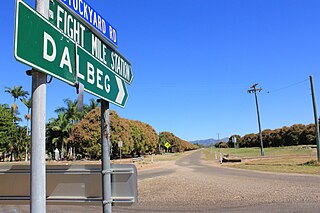
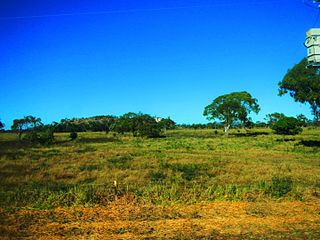
Dalbeg is a rural town and locality in the Shire of Burdekin, Queensland, Australia. In the 2016 census, Dalbeg had a population of 76 people.

Clare is a rural town and locality in the Shire of Burdekin, Queensland, Australia. In the 2016 census the locality of Clare had a population of 196 people.

Millaroo is a rural town and locality in the Shire of Burdekin, Queensland, Australia. In the 2016 census, the locality of Millaroo had a population of 96 people.

<span class="mw-page-title-main">Cape Cleveland, Queensland</span> Suburb of Townsville, Queensland, Australia

Cape Cleveland is a rural locality in the City of Townsville, Queensland, Australia. In the 2016 census Cape Cleveland had a population of 155 people.

<span class="mw-page-title-main">Alligator Creek, Queensland (Townsville)</span> Suburb of City of Townsville, Queensland, Australia

Alligator Creek is a rural locality in the City of Townsville, Queensland, Australia.

Majors Creek is a locality split between the City of Townsville and the Shire of Burdekin, Queensland, Australia. In the 2016 census, Majors Creek had a population of 329 people.

Breddan is a rural locality in the Charters Towers Region, Queensland, Australia. In the 2016 census, Breddan had a population of 485 people.

<span class="mw-page-title-main">Guthalungra, Queensland</span> Town in Queensland, Australia

Guthalungra is a rural town and coastal locality in the Whitsunday Region, Queensland, Australia. In the 2016 census, the locality of Guthalungra had a population of 112 people.

<span class="mw-page-title-main">Airville, Queensland</span> Suburb of Shire of Burdekin, Queensland, Australia

Airville is a rural locality in the Shire of Burdekin, Queensland, Australia. In the 2016 census, Airville had a population of 338 people.

<span class="mw-page-title-main">Mount Elliot, Queensland</span> Suburb of City of Townsville, Queensland, Australia

Mount Elliot is a rural locality in the City of Townsville, Queensland, Australia. It contains the mountain of the same name. In the 2021 census, Mount Elliot had "no people or a very low population".

McDesme is a rural locality in the Shire of Burdekin, Queensland, Australia. In the 2016 census McDesme had a population of 277 people.

Dalrymple Creek is a locality in the Shire of Hinchinbrook, Queensland, Australia. In the 2021 census, Dalrymple Creek had a population of 51 people.

Kirknie is a rural locality in the Shire of Burdekin, Queensland, Australia. In the 2021 census, Kirknie had a population of 70 people.

<span class="mw-page-title-main">Cromarty, Queensland</span> Suburb of Shire of Burdekin, Queensland, Australia

Cromarty is a rural locality in the Shire of Burdekin, Queensland, Australia. In the 2021 census, Cromarty had a population of 43 people.

Mount Kelly is a rural locality in the Shire of Burdekin, Queensland, Australia. In the 2021 census, Mount Kelly had a population of 291 people.

Minerva is a rural locality in the Central Highlands Region, Queensland, Australia. At the 2021 census, Minerva had a population of 55 people.

Mantuan Downs is a rural locality in the Central Highlands Region, Queensland, Australia. In the 2016 census Mantuan Downs had a population of 31 people.

<span class="mw-page-title-main">Hawkins Creek, Queensland</span> Suburb of Shire of Hinchinbrook, Queensland, Australia

Hawkins Creek is a rural locality in the Shire of Hinchinbrook, Queensland, Australia. In the 2016 census, Hawkins Creek had a population of 216 people.

References

  1. Australian Bureau of Statistics (28 June 2022). "Mulgrave (Qld) (suburb and locality)". Australian Census 2021 QuickStats. Retrieved 28 June 2022.  OOjs UI icon edit-ltr-progressive.svg
  2. 1 2 "Mulgrave – locality in Shire of Burdekin (entry 42298)". Queensland Place Names. Queensland Government . Retrieved 18 November 2018.
  3. 1 2 Australian Bureau of Statistics (28 June 2022). "Mulgrave (SAL)". 2021 Census QuickStats. Retrieved 28 February 2023. OOjs UI icon edit-ltr-progressive.svg
  4. 1 2 3 4 5 6 7 "Mountain peaks and capes - Queensland". Queensland Open Data. Queensland Government. 12 November 2020. Archived from the original on 25 November 2020. Retrieved 25 November 2020.
  5. "Woodhouse Mountain – mountain in Burdekin Shire (entry 37978)". Queensland Place Names. Queensland Government . Retrieved 25 November 2020.
  6. "Bunkers Hill – mountain in Burdekin Shire (entry 5291)". Queensland Place Names. Queensland Government . Retrieved 25 November 2020.
  7. "Mount Dalrymple – mountain in Burdekin Shire (entry 9251)". Queensland Place Names. Queensland Government . Retrieved 25 November 2020.
  8. "Mount Benjonney – mountain in Burdekin Shire (entry 2310)". Queensland Place Names. Queensland Government . Retrieved 25 November 2020.
  9. "Blue Mountain – mountain in Burdekin Shire (entry 3273)". Queensland Place Names. Queensland Government . Retrieved 25 November 2020.
  10. "Queensland Globe". State of Queensland . Retrieved 18 December 2023.
  11. Australian Bureau of Statistics (27 June 2017). "Mulgrave (SSC)". 2016 Census QuickStats. Retrieved 20 October 2018. OOjs UI icon edit-ltr-progressive.svg
  12. "Layers: Locality; Schools and school catchments". Queensland Globe. Queensland Government. Archived from the original on 19 December 2017. Retrieved 18 December 2023.