Groper Creek, Queensland

Last updated

Map all coordinates using: OpenStreetMap  
Download coordinates as: KML  ·  GPX
Groper Creek
Queensland
Australia Queensland location map.svg
Red pog.svg
Groper Creek
Coordinates 19°41′31″S147°31′48″E / 19.6919°S 147.53°E / -19.6919; 147.53 (Groper Creek (town centre))
Population62 (2016 census) [1]
 • Density1.240/km2 (3.212/sq mi)
Established1921
Postcode(s) 4806
Area50.0 km2 (19.3 sq mi)
Time zone AEST (UTC+10:00)
Location
LGA(s) Shire of Burdekin
State electorate(s) Burdekin
Federal Division(s) Dawson
Localities around Groper Creek:
Rita Island Rita Island Rita Island
Inkerman Groper Creek Coral Sea
Inkerman Wunjunga Wunjunga

Groper Creek is a coastal town and rural locality in the Shire of Burdekin, Queensland, Australia. [2] [3] In the 2016 census, Groper Creek had a population of 62 people. [1]

Contents

Geography

The locality is bounded by the Burdekin River to the north and by the Coral Sea to the east. [4] Groper Creek is a distributary of the Burdekin River delta, splitting from the river at the north-western corner of the locality ( 19°40′18″S147°30′38″E / 19.6716°S 147.5105°E / -19.6716; 147.5105 (Groper Creek (source)) ) and then flowing south-east towards the creek mouth at the Coral Sea ( 19°42′51″S147°35′18″E / 19.7143°S 147.5883°E / -19.7143; 147.5883 (Groper Creek (mouth)) ), about 3.3 kilometres (2.1 mi) south of the mouth of the Burdekin River ( 19°41′18″S147°36′22″E / 19.6884°S 147.6060°E / -19.6884; 147.6060 (Burdekin River (mouth)) ). [4]

The southern part of the locality is part of the mainland but the northern part of the locality is part of the delta and comprises a number of islands, the largest being: [4]

Much of the locality is unused marshland but there is some grazing on native vegetation on Big Patterson Island and other areas. [4]

The town of Groper Creek is located on the mainland on the western edge of the locality and is accessed via Groper Creek Road which passes through neighbouring Inkerman to Home Hill. [4]

The Speter Island Cattle Farm is a 235.122-hectare (581.00-acre) farm that includes 65 hectares (160 acres) on the mainland (directly south of the town) and extends across the creek Groper Creek onto Peters Island where there are 140 hectares (350 acres) of usable land. The herd of Droughtmaster/Senepol cross cattle swim across the creek when they wish to graze on the other side. As at May 2019, none of the cattle have been taken by the crocodiles in the creek. [7]

History

In 1873 the Queensland Government reserved 10 acres 1 rood for a landing place on Heath's Creek. [8] In that era, Heath Creek was a distributary of the Burdekin River and its mouth ( 19°43′24″S147°34′43″E / 19.7234°S 147.5785°E / -19.7234; 147.5785 (Heath Creek (mouth)) ) [9] provided access to boats to travel up the river, not possible from the river mouth. [10] A wharf was built on Health Creek in 1883. [11] However, changes to the delta over time resulted in Health Creek no longer being usable. So in 1921 a new landing area was established on Groper Creek which was a natural inlet off the Coral Sea that became a distributary of the Burdekin River following the floods in 1918. [12] By 1924, it had become a popular fishing spot. [13]

There were numerous crocodiles seen in the area in the 1930s but many of them were shot. [14] Crocodile hunting was not prohibited in Queensland until 1974, the last jurisdiction within Australia to do so. [15] Although their numbers are reduced, they are still seen in the creek. [16]

For many years, the settlement of Groper Creek was not an official place name, but was a widely used and well-known local name. On 28 November 2018 it officially became a town and locality. The name comes from the creek of the same name. [2] [3] [17]

In the 2016 census, Groper Creek had a population of 62 people. [1]

Amenities

There is a caravan park in the town on Hinkson Esplanade on the southern bank of the creek ( 19°41′28″S147°31′52″E / 19.6910°S 147.5312°E / -19.6910; 147.5312 (Groper Creek Caravan Park) ). [18]

There are two public boat ramps into the creek Groper Creek on either side of a public jetty in the town at Hinkson Esplanade ( 19°41′30″S147°31′54″E / 19.6917°S 147.5317°E / -19.6917; 147.5317 (Groper Creek Jetty) ). There is also the Wallace Landing boat ramp into Alma Creek further south ( 19°44′09″S147°33′22″E / 19.7359°S 147.5561°E / -19.7359; 147.5561 (Wallace Landing boat ramp) ) accessed via Peak Road in Inkerman. [19]

Education

There are no schools in Groper Creek. The nearest primary school is Home Hill State School in Home Hill to the west. The nearest secondary school is Home Hill State High School in Home Hill. [4]

Related Research Articles

Shire of Burdekin Local government area in Queensland, Australia

The Shire of Burdekin is a local government area located in North Queensland, Australia in the Dry Tropics region. The district is located between Townsville and Bowen in the delta of the Burdekin River.

Bowen, Queensland Town in Queensland, Australia

Bowen is a coastal town and locality in the Whitsunday Region on the eastern coast of Queensland, Australia. The locality is a large one, and contains two other towns, Heronvale and Merinda. The Abbot Point coal shipping port is also within the locality. At the 2016 census, Bowen had a population of 10,377.

Burdekin River

The Burdekin River is a river located in North and Far North Queensland, Australia. The river rises on the northern slopes of Boulder Mountain at Valley of Lagoons, part of the western slope of the Seaview Range, and flows into the Coral Sea at Upstart Bay over 200 kilometres (124 mi) to the southeast of the source, with a catchment area of approximately 130,000 square kilometres (50,000 sq mi). The Burdekin River is Australia's largest river by (peak) discharge volume.

Hebel, Queensland Town in Queensland, Australia

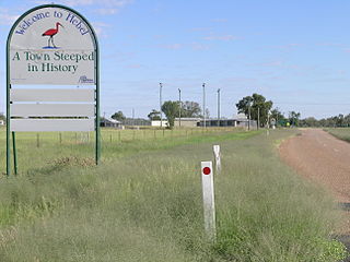
Hebel is a rural town and locality in the Shire of Balonne, Queensland, Australia. It is on the border of Queensland and New South Wales. In the 2016 census, Hebel had a population of 67 people.

Ayr, Queensland Town in Queensland, Australia

Ayr is a town and locality in the Shire of Burdekin, Queensland, Australia. It is the centre of a sugarcane-growing region. In the 2016 census, Ayr had a population of 8,738 people.

Upstart Bay is a bay in the Burdekin Shire, Queensland, Australia. It is part of the Coral Sea and is the mouth of the Burdekin River.

Giru, Queensland Town in Queensland, Australia

Giru is a town and coastal locality in the Shire of Burdekin, Queensland, Australia, situated on the Haughton River, 54 kilometres (34 mi) south-east of Townsville. In the 2016 census, Giru had a population of 354 people.

Home Hill, Queensland Town in Queensland, Australia

Home Hill is a town and locality in the Burdekin Shire, Queensland, Australia at the delta of the Burdekin River. It is a sugarcane growing area with underground water supplies to irrigate crops.

North Queensland Region in Queensland, Australia

North Queensland or the Northern Region is the northern part of the Australian state of Queensland that lies just south of Far North Queensland. Queensland is a massive state, larger than many countries, and its tropical northern part has been historically remote and undeveloped, resulting in a distinctive regional character and identity.

Dalbeg, Queensland Town in Queensland, Australia

Dalbeg is a rural town and locality in the Shire of Burdekin, Queensland, Australia. In the 2016 census, Dalbeg had a population of 76 people.

Brandon, Queensland Town in Queensland, Australia

Brandon is a rural town and locality in the Shire of Burdekin, Queensland, Australia. In the 2016 census, Brandon had a population of 1,094 people.

Millaroo, Queensland Town in Queensland, Australia

Millaroo is a small town and locality in the Shire of Burdekin in Queensland, Australia.

Gilberton, Queensland (Etheridge Shire) Town in Queensland, Australia

Gilberton is a rural locality in the Shire of Etheridge, Queensland, Australia. In the 2016 census, Gilberton had a population of 4 people.

Minnamoolka, Queensland Suburb of Tablelands Region, Queensland, Australia

Minnamoolka is a locality in the Tablelands Region, Queensland, Australia. In the 2016 census, Minnamoolka had a population of 38 people.

Bloomfield, Queensland Suburb of Shire of Cook, Queensland, Australia

Bloomfield is a town in the Shire of Cook and a coastal locality which is split between the Shire of Cook and the Shire of Douglas in Queensland, Australia. The neighbourhood of Ayton is within the locality. In the 2016 census, Bloomfield had a population of 204 people.

Airville, Queensland Suburb of Shire of Burdekin, Queensland, Australia

Airville is a rural locality in the Shire of Burdekin, Queensland, Australia. In the 2016 census, Airville had a population of 338 people.

Rita Island, Queensland Suburb of Shire of Burdekin, Queensland, Australia

Rita Island is a coastal locality in the Shire of Burdekin, Queensland, Australia.

Jerona, Queensland Town in Queensland, Australia

Jerona is a town and coastal locality in the Shire of Burdekin, Queensland, Australia. In the 2016 census, Jerona had a population of 40 people.

Mount Kelly, Queensland Suburb of Shire of Burdekin, Queensland, Australia

Mount Kelly is a rural locality in the Shire of Burdekin, Queensland, Australia. In the 2016 census, Mount Kelly had a population of 280 people.

Drummondslope, Queensland Suburb of Barcaldine Region, Queensland, Australia

Drummondslope is a former rural locality in the Barcaldine Region, Queensland, Australia. In the 2016 census, Drummondslope had a population of 43 people. On 22 November 2019 the Queensland Government decided to amalgamate the localities in the Barcaldine Region, resulting in five expanded localities based on the larger towns: Alpha, Aramac, Barcaldine, Jericho and Muttaburra. Drummondslope was incorporated into Alpha.

References

  1. 1 2 3 Australian Bureau of Statistics (27 June 2017). "Groper Creek (SSC)". 2016 Census QuickStats. Retrieved 20 October 2018. OOjs UI icon edit-ltr-progressive.svg
  2. 1 2 "Groper Creek - town in Shire of Burdekin (entry 38876)". Queensland Place Names. Queensland Government . Retrieved 18 September 2020.
  3. 1 2 "Groper Creek - locality in Shire of Burdekin (entry 49457)". Queensland Place Names. Queensland Government . Retrieved 18 September 2020.
  4. 1 2 3 4 5 6 "Queensland Globe". State of Queensland . Retrieved 8 November 2020.
  5. "Big Patterson Island - island in Shire of Burdekin (entry 2513)". Queensland Place Names. Queensland Government . Retrieved 8 November 2020.
  6. "Peters Island - island in Shire of Burdekin (entry 26520)". Queensland Place Names. Queensland Government . Retrieved 8 November 2020.
  7. Johnston, Jessica (1 May 2019). "Wave of opportunity". North Queensland Register. Archived from the original on 8 November 2020. Retrieved 8 November 2020.
  8. "OFFICIAL NOTIFICATIONS". The Telegraph (311). Queensland, Australia. 27 September 1873. p. 3. Retrieved 8 November 2020 via National Library of Australia.
  9. "Heath Creek - watercourse in Shire of Burdekin (entry 15611)". Queensland Place Names. Queensland Government . Retrieved 8 November 2020.
  10. "MINISTERS IN THE NORTH". The Brisbane Courier . XXXVII (7, 781). Queensland, Australia. 19 December 1882. p. 3. Retrieved 8 November 2020 via National Library of Australia.
  11. "The Brisbane Courier". The Brisbane Courier . XXXVIII (8, 070). Queensland, Australia. 21 November 1883. p. 5. Retrieved 8 November 2020 via National Library of Australia.
  12. "About". Groper Creek Caravan Park. Archived from the original on 8 November 2020. Retrieved 8 November 2020.
  13. "HOME HILL NOTES". Townsville Daily Bulletin . XXXX (12, 748). Queensland, Australia. 23 August 1924. p. 6 (MAGAZINE SECTION). Retrieved 8 November 2020 via National Library of Australia.
  14. "HOME HILL NOTES". Townsville Daily Bulletin . LXI (208). Queensland, Australia. 31 August 1939. p. 9. Retrieved 8 November 2020 via National Library of Australia.
  15. Brennan, Claire (2013). "Crocodile hunting". Queensland Historical Atlas. University of Queensland. Archived from the original on 8 November 2020. Retrieved 8 November 2020.
  16. Garvey, Casandra (14 May 2017). "WATCH: Huge crocodile spotted sunbaking near anglers". Daily Mercury (includes 2 videos (32 secs and 40 secs) of a crocodile sighting in the creek). Archived from the original on 8 November 2020. Retrieved 8 November 2020.
  17. "Groper Creek - watercourse in Burdekin Shire (entry 14908)". Queensland Place Names. Queensland Government . Retrieved 21 November 2018.
  18. "Welcome to Groper Creek Caravan Park". Groper Creek Caravan Park. Archived from the original on 8 November 2020. Retrieved 8 November 2020.
  19. "Recreational Boating Facilities Queensland". Queensland Open Data. Queensland Government. 27 March 2020. Archived from the original on 22 October 2020. Retrieved 22 October 2020.