
Giru is a town and coastal locality in the Shire of Burdekin, Queensland, Australia, situated on the Haughton River, 54 kilometres (34 mi) south-east of Townsville. In the 2021 census, the locality of Giru had a population of 387 people.

Home Hill is a rural town and locality in the Shire of Burdekin, Queensland, Australia. In the 2021 census, the locality of Home Hill had a population of 2,876 people.

Inkerman is a rural town and locality in the Shire of Burdekin, Queensland, Australia. In the 2021 census, the locality of Inkerman had a population of 119 people.
Millaroo is a rural town and locality in the Shire of Burdekin, Queensland, Australia. In the 2021 census, the locality of Millaroo had a population of 86 people.

Cape Cleveland is a rural locality in the City of Townsville, Queensland, Australia. In the 2021 census, Cape Cleveland had a population of 128 people.
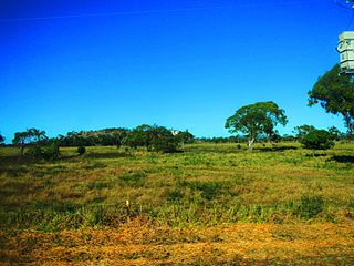
Majors Creek is a locality split between the City of Townsville and the Shire of Burdekin, Queensland, Australia. In the 2021 census, Majors Creek had a population of 327 people.
Guthalungra is a rural town and coastal locality in the Whitsunday Region, Queensland, Australia. In the 2021 census, the locality of Guthalungra had a population of 112 people.

Airville is a rural locality in the Shire of Burdekin, Queensland, Australia. In the 2021 census, Airville had a population of 308 people.

Mount Elliot is a rural locality in the City of Townsville, Queensland, Australia. It contains the mountain of the same name. In the 2021 census, Mount Elliot had "no people or a very low population".

McDesme is a rural locality in the Shire of Burdekin, Queensland, Australia. In the 2021 census, McDesme had a population of 254 people.
Mount Surround is a rural locality in the Shire of Burdekin, Queensland, Australia. In the 2021 census, Mount Surround had a population of 130 people.
Rita Island is a coastal and rural locality in the Shire of Burdekin, Queensland, Australia. In the 2021 census, Rita Island had a population of 172 people.
Fredericksfield is a rural locality in the Shire of Burdekin, Queensland, Australia. In the 2021 census, Fredericksfield had a population of 259 people.
Horseshoe Lagoon is a rural locality in the Shire of Burdekin, Queensland, Australia. In the 2021 census, Horseshoe Lagoon had a population of 213 people.
Upper Haughton is a rural locality in the Shire of Burdekin, Queensland, Australia. In the 2021 census, Upper Haughton had a population of 34 people.

Mulgrave is a rural locality in the Shire of Burdekin, Queensland, Australia. In the 2021 census, Mulgrave had a population of 19 people.
Kirknie is a rural locality in the Shire of Burdekin, Queensland, Australia. In the 2021 census, Kirknie had a population of 70 people.
Groper Creek is a coastal town and rural locality in the Shire of Burdekin, Queensland, Australia. In the 2021 census, the locality of Groper Creek had a population of 66 people.
Mount Kelly is a rural locality in the Shire of Burdekin, Queensland, Australia. In the 2021 census, Mount Kelly had a population of 291 people.

Kianga is a rural locality in the Shire of Banana, Queensland, Australia. In the 2021 census, Kianga had a population of 219 people.


