Ascension, Prince Edward Island

Last updated

Ascension (also known as Pigbrook) is a small community located mainly on Route 160 from 3 miles NE of Tignish. Ascension is within the Canadian province of Prince Edward Island, in Eastern Canada.

Community group of interacting living organisms sharing a populated environment; a social unit of human organisms who share common values

A community is a small or large social unit that has something in common, such as norms, religion, values, or identity. Communities often share a sense of place that is situated in a given geographical area or in virtual space through communication platforms. Durable relations that extend beyond immediate genealogical ties also define a sense of community. People tend to define those social ties as important to their identity, practice, and roles in social institutions. Although communities are usually small relative to personal social ties (micro-level), "community" may also refer to large group affiliations, such as national communities, international communities, and virtual communities.

Canada Country in North America

Canada is a country in the northern part of North America. Its ten provinces and three territories extend from the Atlantic to the Pacific and northward into the Arctic Ocean, covering 9.98 million square kilometres, making it the world's second-largest country by total area. Canada's southern border with the United States is the world's longest bi-national land border. Its capital is Ottawa, and its three largest metropolitan areas are Toronto, Montreal, and Vancouver. As a whole, Canada is sparsely populated, the majority of its land area being dominated by forest and tundra. Consequently, its population is highly urbanized, with over 80 percent of its inhabitants concentrated in large and medium-sized cities, many near the southern border. Canada's climate varies widely across its vast area, ranging from arctic weather in the north, to hot summers in the southern regions, with four distinct seasons.

Prince Edward Island Province of Canada

Prince Edward Island is a province of Canada consisting of the Atlantic island of the same name along with several much smaller islands nearby. Prince Edward Island is one of the three Maritime Provinces. It is the smallest province of Canada in both land area and population, but the most densely populated. Part of the traditional lands of the Mi'kmaq, it became a British colony in the 1700s and was federated into Canada as a province in 1873. Its capital is Charlottetown. According to the 2016 census, the province of Prince Edward Island has 142,907 residents.

The community is home to Harper's Brook, a tributary to the Tignish River, which runs from Tignish to DeBlois. It is home to approximately 130 people.

The name "Ascension" is believed to have come from the Christian doctrine account of the Ascension of Jesus after his death. The name may also be derived from the fact that the Ascension road ascends, from its starting point at Tignish to its finish in Nail Pond.

Jesus Central figure of Christianity

Jesus, also referred to as Jesus of Nazareth and Jesus Christ, was a first-century Jewish preacher and religious leader. He is the central figure of Christianity and is widely described as the most influential person in history. Most Christians believe he is the incarnation of God the Son and the awaited Messiah (Christ) prophesied in the Old Testament.

Coordinates: 46°57′45.1″N64°4′12″W / 46.962528°N 64.07000°W / 46.962528; -64.07000

Geographic coordinate system Coordinate system

A geographic coordinate system is a coordinate system that enables every location on Earth to be specified by a set of numbers, letters or symbols. The coordinates are often chosen such that one of the numbers represents a vertical position and two or three of the numbers represent a horizontal position; alternatively, a geographic position may be expressed in a combined three-dimensional Cartesian vector. A common choice of coordinates is latitude, longitude and elevation. To specify a location on a plane requires a map projection.

Related Research Articles

Skinners Pond, Prince Edward Island human settlement in Canada

Skinners Pond is a rural unincorporated community in Prince County, Prince Edward Island, Canada.

Lot 1, Prince Edward Island Township in Prince Edward Island, Canada

Lot 1 is a township in Prince County, Prince Edward Island, Canada created during the 1764–1766 survey of Samuel Holland. It is part of North Parish.

St. Felix is a municipality that holds community status in Prince Edward Island, Canada. It is located in Prince County, 4 km (2.5 mi) south of Tignish.

Alberton, Prince Edward Island Town in Prince Edward Island, Canada

Alberton is a Canadian town located in Prince County, Prince Edward Island. It is situated in the western part of the county in the township of Lot 5. The population was 1,149 as of the 2016 census.

Prince County, Prince Edward Island Place

Prince County is located in western Prince Edward Island, Canada. The county's defining geographic feature is Malpeque Bay, a sub-basin of the Gulf of St. Lawrence, which creates the narrowest portion of Prince Edward Island's landmass, an isthmus upon which the city of Summerside is located.

Palmer Road is a small community located in Lot 1, in Prince County, Prince Edward Island, Canada that is located on Route 155, Route 156 and Route 158. There are approximately 100 citizens in Palmer Road, and it is located between the two towns of Tignish and St. Louis, Prince Edward Island. It is also home to the Immaculate Conception Church, and the nearby Palmer Road Community Center. Palmer Road is located 2 mi (3.2 km) northwest of St. Louis, and 6 mi (9.7 km) southwest of Tignish.

Miminegash, Prince Edward Island human settlement in Canada

Miminegash is a municipality that holds community status in Prince Edward Island, Canada. It is located 8 miles (13 km) northwest of Alberton and 11 miles (18 km) southwest of Tignish. It is part of a small area known as either the St. Louis, Palmer Road, or Miminegash area. This area is often associated with Tignish due to the shared Acadian roots between these areas.

Harper, Prince Edward Island human settlement in Canada

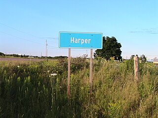
Harper is a Canadian rural community located in western Prince County, Prince Edward Island.

Leoville is a Canadian rural community located on Route 158, 3.50–5.00 miles SW of Tignish in western Prince County, Prince Edward Island.

Ascension Road, labelled Route 160, is a 2-lane collector highway in western Prince County, Prince Edward Island, Canada. It is located 2 miles (3.2 km) NW of the community of Tignish. Its maximum speed limit is 80 kilometres per hour (50 mph).

Peter Road, or Peterville Road, labelled Route 159, is a 2-lane collector highway in western Prince County, Prince Edward Island, Canada. It is near the community of Tignish. Its maximum speed limit is 80 km/h (50 mph).

Peterville is a small community located on Route 159 from 2.01 – 3.78 miles SW of Tignish, in the Lot 1 township. Peterville is within the Canadian province of Prince Edward Island, in Eastern Canada. The community is home to Harper's Brook, a tributary to the Tignish River, which runs from Tignish to DeBlois. It is home to approximately 20 people. The name "Peterville" is believed to have come from an explorer, Peters, who visited the area in the 18th century or later.

Pridham Road, labelled Route 154, is a 2-lane collector highway in western Prince County, Prince Edward Island, Canada. It is near the town of Alberton. Its maximum speed limit is 80 km/h (50 mph).

Prince Edward Island Route 156 highway in Prince Edward Island

Palmer Road, labelled Route 156, is a 2-lane collector highway in western Prince County, Prince Edward Island, Canada. It is between the communities of Tignish and Miminegash. Its maximum speed limit is 80 km/h (50 mph). The road is considered part of two larger communities, Tignish and Miminegash.

Greenmount Road, labelled Route 153, is a 2-lane collector highway in western Prince County, Prince Edward Island, Canada. It is between the communities of Tignish and Alberton. Its maximum speed limit is 90 km/h (56 mph). The road is considered part of two larger communities, Tignish and Alberton.

Nail Pond, Prince Edward Island human settlement in Canada

Nail Pond is a Canadian rural community in Prince County, Prince Edward Island.

Tignish-Palmer Road Provincial electoral district in Prince Edward Island

Tignish-Palmer Road is a provincial electoral district for the Legislative Assembly of Prince Edward Island, Canada. It was formerly Tignish-DeBlois from 1996 to 2007.

Tidnish Bridge, Nova Scotia human settlement in Canada

Tidnish Bridge is a community in the Canadian province of Nova Scotia, located in Cumberland County on the interprovincial border with New Brunswick between Upper Tidnish, and Lower Tidnish on the Tidnish River. Tidnish Bridge is home to the Chignecto Ship Railway Keystone Bridge and would have been the Baie Verte terminus. Tidnish Dock Provincial Park is where the last piece of the project remained. The name Tidnish is of Indian origin, said to signify "A Paddle".

Tignish Shore, Prince Edward Island

Tignish Shore is a municipality that holds community status in Prince Edward Island, Canada. It is located in the Lot 1 township.

Division No. 1, Subdivision C is an unorganized subdivision on the Avalon Peninsula in Newfoundland and Labrador, Canada. It is in Division 1 and contains the unincorporated communities of Cape St. Mary's, Cuslett, Gooseberry Cove, Great Barasway, Lears Cove, Patrick's Cove-Angels Cove, Ship Cove and Stoney House.