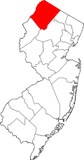
Augusta, New Jersey

Last updated

Augusta, New Jersey
Location map of Sussex County, New Jersey.svg
Red pog.svg
Augusta, New Jersey
Location within Sussex County. Inset: Location of Sussex County within New Jersey
USA New Jersey location map.svg
Red pog.svg
Augusta, New Jersey
Augusta, New Jersey (New Jersey)
Usa edcp location map.svg
Red pog.svg
Augusta, New Jersey
Augusta, New Jersey (the United States)
Coordinates: 41°07′44″N74°43′42″W / 41.12889°N 74.72833°W / 41.12889; -74.72833
Country Flag of the United States.svg  United States
State Flag of New Jersey.svg  New Jersey
County Sussex
Township Frankford
Elevation
495 ft (151 m)
Population
  Total887
ZIP code
07822 [2] [3]
GNIS feature ID0874424 [4]

Augusta is an unincorporated community located within Frankford Township, in Sussex County, New Jersey, United States. [5] As of the 2010 United States Census, the population for the ZIP Code Tabulation Area 07822 was 887. [1]

Contents

Augusta is the home of the New Jersey State Fair and the Sussex County Farm and Horse Show.

Skylands Park, a 4,300-seat ballpark, was home to the New Jersey Cardinals of the New York–Penn League from 1993 to 2005, and the Sussex Skyhawks of the Can-Am League from 2006 to 2010. The stadium is the home of the Sussex County Miners of the Frontier League, which debuted in the Can-Am League for the 2015 season.[ needs update ] [6]

Geography

Augusta is located at 41°8'42" North, 74°41'5" West (41.145086, -74.684753). [7]

Augusta lies in the Kittatinny Valley which is part of the Great Appalachian Valley. The Kittatinny Mountains are to the west and the New Jersey Highlands are to the east.

Geology

Augusta lies on top of the Ordovician Martinsburg Formation, created around 450 million B. C. when a volcanic chain of islands collided with the proto North American Plate. The islands rode over top of the North American Plate creating the valley. The valley was under a shallow sea until geologic pressure forced the shale upwards.

The Wisconsin Glacier covered the valley from 21,000 B.C. to 13,000 B.C. Augusta was covered in three hundred meters of ice. When the ice slowly melted this created the Paulinskill River as well as Papakatkin Creek.

The Paulinskill River, which starts in Newton and flows westerly through Augusta from Lafayette, drains into the Delaware River to the southwest. The Paulinskill is one of the premier fishing streams in the state of New Jersey. Each year, thousands of trout are stocked in the Paulinskill River from the New Jersey Division of Fish and Wildlife.

Papakatkin Creek drains into the Wallkill River to the north. The drainage divide is just north of Route 206 in Augusta. A chain of hills leads Papakatkin Creek to travel east and then north into the Wallkill River.

Notable people

People who were born in, residents of, or otherwise closely associated with Augusta include:

Related Research Articles

<span class="mw-page-title-main">Sussex County, New Jersey</span> County in New Jersey, United States

Sussex County is the northernmost county in the U.S. state of New Jersey. Its county seat is Newton. It is part of the New York metropolitan area and is part of New Jersey's Skylands Region. As of the 2020 census, the county was the state's 17th-most-populous county, with a population of 144,221, a decrease of 5,044 (−3.4%) from the 2010 census count of 149,265, which in turn reflected an increase of 5,099 (+3.5%) over the 144,166 persons at the 2000 census. Based on 2020 census data, Vernon Township was the county's largest in both population and area, with a population of 22,358 and covering an area of 70.59 square miles (182.8 km2). The county is part of the North Jersey region of the state.

<span class="mw-page-title-main">Branchville, New Jersey</span> Borough in Sussex County, New Jersey, US

Branchville is a borough in Sussex County, in the U.S. state of New Jersey. As of the 2020 United States census, the borough's population was 791, a decrease of 50 (−5.9%) from the 2010 census count of 841, which in turn reflected a decline of 4 (−0.5%) from the 845 counted in the 2000 census. The borough is located in the northernmost region of Sussex County.

<span class="mw-page-title-main">Frankford Township, New Jersey</span> Township in Sussex County, New Jersey, US

Frankford Township is a township in Sussex County, in the U.S. state of New Jersey. As of the 2020 United States census, the township's population was 5,302, a decrease of 263 (−4.7%) from the 2010 census count of 5,565, which in turn reflected an increase of 145 (+2.7%) from the 5,420 counted in the 2000 census.

<span class="mw-page-title-main">Franklin, New Jersey</span> Borough in Sussex County, New Jersey, US

Franklin is a borough in Sussex County, in the U.S. state of New Jersey. As of the 2020 United States census, the borough's population was 4,912, a decrease of 133 (−2.6%) from the 2010 census count of 5,045, which in turn reflected a decline of 115 (−2.2%) from the 5,160 counted in the 2000 census.

<span class="mw-page-title-main">Fredon Township, New Jersey</span> Township in Sussex County, New Jersey, US

Fredon Township is a township in Sussex County, in the U.S. state of New Jersey. As of the 2020 United States census, the township's population was 3,235, a decrease of 202 (−5.9%) from the 2010 census count of 3,437, which in turn reflected an increase of 577 (+20.2%) from the 2,860 counted in the 2000 census.

<span class="mw-page-title-main">Stillwater Township, New Jersey</span> Township in Sussex County, New Jersey, US

Stillwater Township is a township located in Sussex County, in the U.S. state of New Jersey. Situated in the Kittatinny Valley, Stillwater is a rural farming community with a long history of dairy farming. As of the 2020 United States census, the township's population was 4,004, a decrease of 95 (−2.3%) from the 2010 census count of 4,099, which in turn reflected a decrease of 168 (−3.9%) from the 4,267 counted in the 2000 census.

<span class="mw-page-title-main">Skylands Stadium</span> Baseball park in Augusta, New Jersey, US

Skylands Stadium is a professional minor-league baseball stadium located in the Augusta section of Frankford Township in Sussex County, New Jersey. It is located off of US 206, near its intersection with Route 15, on a plot of land adjacent to the Sussex County Fairgrounds where the Sussex County Farm and Horse Show and the New Jersey State Fair are held concurrently every August, and is home to the Sussex County Miners of the independent Frontier League.

<span class="mw-page-title-main">High Point (New Jersey)</span> Mountain peak in New Jersey

High Point is a mountain peak within High Point State Park on the border of Wantage Township and Montague Township, Sussex County in the U.S. state of New Jersey. Located in the portion of the state known as the Skylands, it is the highest elevation in the state, with a peak elevation of 1,803 feet (550 m). The closest city is Port Jervis, New York, which lies to the northwest. Besides being the highest peak in New Jersey, High Point is also the highest peak of the Kittatinny Mountains. Three states – New Jersey, New York, and Pennsylvania – can be seen from the summit.

<span class="mw-page-title-main">Paulins Kill</span> River in New Jersey, United States

The Paulins Kill is a 41.6-mile (66.9 km) tributary of the Delaware River in northwestern New Jersey in the United States. With a long-term median flow rate of 76 cubic feet of water per second (2.15 m3/s), it is New Jersey's third-largest contributor to the Delaware River, behind the Musconetcong River and Maurice River. The river drains an area of 176.85 square miles (458.0 km2) across portions of Sussex and Warren counties and 11 municipalities. It flows north from its source near Newton, and then turns southwest. The river sits in the Ridge and Valley geophysical province.

<span class="mw-page-title-main">Papakating Creek</span> Creek in Sussex County, New Jersey, U.S.

Papakating Creek is a 20.1-mile-long (32.3 km) tributary of the Wallkill River located in Frankford and Wantage townships in Sussex County, New Jersey in the United States. The creek rises in a small swamp located beneath the eastern face of Kittatinny Mountain in Frankford and its waters join the Wallkill to the east of Sussex borough.

<span class="mw-page-title-main">High Point State Park</span> State park in New Jersey

High Point State Park is a state park straddling the border of Wantage Township and Montague Township in Sussex County, within the Skylands Region of northwestern New Jersey, United States, near the border with New York State and Pennsylvania. The park covers 15,413 acres (62.37 km2). Part of the Kittatinny Mountains, the highest point in the state of New Jersey, the aptly named High Point, sits in the northern reaches of the park, at elevation 1,803 feet (550 m). Route 23 skirts the park and provides access for visitors from the New Jersey suburbs and from points in New York. The park is administered by the New Jersey Division of Parks and Forestry.

<span class="mw-page-title-main">Skylands Region</span> Region of New Jersey, US

The Skylands Region is a region of New Jersey located in the northern and central parts of the state. It is one of seven tourism regions established by the New Jersey State Department of Tourism; the others are Gateway Region, Greater Atlantic City Region, the Southern Shore Region, the Delaware River Region, the Shore Region, and the Central Jersey Region.

<span class="mw-page-title-main">Paulinskill Valley Trail</span>

The Paulinskill Valley Trail is a rail trail along the Paulins Kill river in New Jersey. It is the sixth longest trail in the state at 27 miles (43 km). It was originally a right-of-way of the New York, Susquehanna and Western Railroad and the Blairstown Railway.

<span class="mw-page-title-main">Kittatinny Valley</span>

The Kittatinny Valley is a section of the Great Appalachian Valley in Sussex and Warren counties in northwestern New Jersey that is bounded on the northwest by Kittatinny Mountain, and in the southeast by the New Jersey Highlands region. The valley is roughly 40 miles (64 km) long, with a breadth of 10 to 13 miles.

The Northwest Jersey Athletic Conference (NJAC) is a sports league that includes 39 public and private high schools from Morris County, Sussex County and Warren County, New Jersey, that operates under the auspices of the New Jersey State Interscholastic Athletic Association.

<span class="mw-page-title-main">Sussex Branch Trail</span>

The Sussex Branch Trail is a rail trail in New Jersey, United States, with a total length of 20 miles (32 km).

<span class="mw-page-title-main">Sussex County Miners</span> American independent league baseball team

The Sussex County Miners are a professional baseball team based in Augusta, New Jersey. They compete in the Frontier League (FL) as a member of the East Division, and have played their home games at Skylands Stadium, originally known as Skylands Park, since 2015. The Miners are not currently affiliated to any Major League Baseball teams, but are official MLB Partners since 2020. They were originally members of the Canadian American Association of Professional Baseball until 2020. They joined the Frontier League for the 2020 season when it absorbed the Can-Am League.

<span class="mw-page-title-main">Neepaulakating Creek</span> Tributary of Papakating Creek

Neepaulakating Creek is a 2.4-mile long (3.8 km) tributary of Papakating Creek in Wantage Township in Sussex County, New Jersey in the United States. It is one of three streams feeding the Papakating Creek, a major contributor to the Wallkill River. Although the stream was dammed in the 1950s to create Lake Neepaulin as the focal point of a private residential development, the stream did not receive a name until 2002. Residents chose a name that combined elements of the names "Neepaulin" and "Papakating", and submitted a proposal to the United States Board of Geographic Names. The name was approved in 2004.

<span class="mw-page-title-main">Lake Neepaulin</span> Lake of Sussex County, New Jersey, United States

Lake Neepaulin is a small man-made freshwater lake located in Wantage Township in Sussex County, New Jersey in the United States. Located in the watershed of Papakating Creek, a tributary of the Wallkill River, the lake was created in the 1950s by damming an unnamed mountain stream as the feature of a private residential development. The stream, now known as Neepaulakating Creek, did not receive a name until 2002.

References

  1. 1 2 DP-1 – Profile of General Population and Housing Characteristics: 2010 from 2010 Demographic Profile Data for ZCTA5 07822 Archived 2020-02-12 at archive.today , United States Census Bureau. Accessed August 27, 2013.
  2. Look Up a ZIP Code for Augusta, NJ, United States Postal Service. Accessed August 27, 2013.
  3. Zip Codes, State of New Jersey. Accessed August 27, 2013.
  4. "Augusta". Geographic Names Information System . United States Geological Survey, United States Department of the Interior . Retrieved September 21, 2012.
  5. Locality Search Archived 2016-07-09 at the Wayback Machine , State of New Jersey. Accessed June 9, 2016.
  6. Westhoven, William. "Miners to fill major baseball void in Sussex", Daily Record (Morristown) , December 10, 2014. Accessed December 24, 2014. "The new owners of Skylands Stadium in Augusta announced Wednesday that they have established a new minor-league team — appropriately dubbed the Sussex County Miners — that will begin play in the independent Can-Am Association of Professional Baseball."
  7. US Gazetteer files: 2010, 2000, and 1990, United States Census Bureau. Accessed September 4, 2014.
  8. Russ Van Atta Stats, Baseball-Reference.com. Accessed August 20, 2020. "Born: June 21, 1906 in Augusta, NJ"