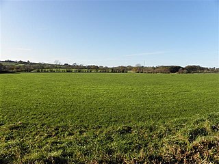
Dunamuggy is a townland of 172 acres in County Antrim, Northern Ireland. It is situated in the civil parish of Donegore and the historic barony of Antrim Upper.

Tullylish is a small village, townland and civil parish in County Down, Northern Ireland. It sits on the River Bann, along the main road between the towns of Banbridge and Portadown. In the 2001 Census it had a population of 105 people. It lies within the civil parish of Tullylish and Banbridge District.
Aughnacloy is a townland of 115 acres in County Tyrone, Northern Ireland. It is situated in the civil parish of Annaclone and the historic barony of Iveagh Upper, Upper Half.

Benraw is a townland of 860 acres in County Down, Northern Ireland, two miles north of Leitrim and six miles from Castlewellan. It is situated in the civil parish of Drumgooland and the historic barony of Iveagh Upper, Lower Half. It is set in the middle of the Dromara Hills and Slieve Croob. It has an average population of 50 people. It contains two roads: the Whitehill Road and the Benraw Road. It is in the middle of the townlands Leitrim, Legananny and Derryneill. It is a very mountainous area and the two main mountains in Benraw are Benraw Mountain and The Whitehill. Benraw is also close to Legananny Dolmen.
Derryneill is a townland of 1,049 acres in County Down, Northern Ireland, near to Leitrim, County Down. It is situated in the civil parish of Drumgooland and the historic barony of Iveagh Upper, Lower Half. Derryneill is mainly made up of small rocky drumlins.
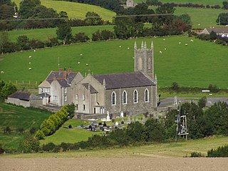
Annaclone is a village and civil parish between Rathfriland and Banbridge in south County Down, Northern Ireland, about 7 km south-east of Banbridge. The village is situated in the townlands of Ardbrin and Tullintanvally and both it and the civil parish are located in the historic barony of Iveagh Upper, Upper Half. It had a population of 150 people in the 2011 Census.
Ballydown is a townland of 529 acres in County Down, Northern Ireland. It is situated in the civil parish of Seapatrick and the historic barony of Iveagh Upper, Lower Half.
Killinchy is a civil parish in County Down, Northern Ireland. It is mainly situated in the historic barony of Dufferin, with two smaller portions in the baronies of Castlereagh Upper and Castlereagh Lower.

Iveagh Upper, Upper Half is the name of a barony in County Down, Northern Ireland. It was created by 1851 with the division of the barony of Iveagh Upper into two. It lies to the west and south of the county, split in half by the Lordship of Newry. It is bordered by six other baronies: Mourne to the south; Iveagh Upper, Lower Half to the east; Iveagh Lower, Lower Half and Iveagh Lower, Upper Half to the north; and Orior Lower and Orior Upper to the west.
Tullycarnan (Ardglass) is a townland of 154 acres in County Down, Northern Ireland. It is situated in the civil parish of Ardglass and the historic barony of Lecale Lower.
Ballynafern is a townland of 778 acres in County Down, Northern Ireland. It is situated in the civil parish of Annaclone and the historic barony of Iveagh Upper, Upper Half.
Ballynagross is a townland of 368 acres in County Down, Northern Ireland. It is situated in the civil parish of Annaclone and the historic barony of Iveagh Upper, Upper Half.
Lisnasliggan is a townland of 568 acres in County Down, Northern Ireland. It is situated in the civil parish of Annaclone and the historic barony of Iveagh Upper, Upper Half.
Derrylough is a townland of 222 acres in County Down, Northern Ireland. It is situated in the civil parish of Annaclone and the historic barony of Iveagh Upper, Upper Half. It is the most northerly townland in the parish of Annaclone.
Ballynanny (Annaclone) is a townland of 538 acres in County Down, Northern Ireland. It is situated in the civil parish of Annaclone and the historic barony of Iveagh Upper, Upper Half.
Ballysheil is a townland of 385 acres in County Down, Northern Ireland. It is situated in the civil parish of Annaclone and the historic barony of Iveagh Upper, Upper Half.
Ardbrin is a townland of 1,007 acres in County Down, Northern Ireland. It is situated in the civil parish of Annaclone and the historic barony of Iveagh Upper, Upper Half.

Magherally is a civil parish and townland in County Down, Northern Ireland. It is largely situated in the historic barony of Iveagh Lower, Lower Half, with one townland (Tullyhinan) in the barony of Iveagh Lower, Upper Half. The townland of Magherally contains the parish church.

Castlereagh Lower is a historic barony in County Down, Northern Ireland. It was created by 1841 with the division of Castlereagh into two. The barony roughly matches the former Gaelic territory of Uí Blathmaic, anglicized Blathewic. It is bordered by three other baronies: Ards Lower to the east; Dufferin to the south; and Castlereagh Upper to the west and south-west. Castlereagh Lower is also bounded by Belfast Lough to the north and Strangford Lough to the south-east.

Castlereagh Upper is a historic barony in County Down, Northern Ireland. It was created by 1841 with the division of Castlereagh into two. It is bordered by eight other baronies: Castlereagh Lower and Dufferin to the east; Lecale Lower and Kinelarty to the south; Iveagh Lower, Lower Half, Iveagh Lower, Upper Half, and Massereene Upper to the west; and Belfast Upper to the north.

