Transport in Angola comprises:

Bengo is a province of Angola. Its capital is Caxito. It has an area of 31,371 square kilometres, and its population as of the 2014 Census was 356,641. The province was created in 1980 by dividing the original province of Luanda into Bengo and a new smaller province of Luanda.

Moçâmedes is a city in southwestern Angola, capital of Namibe Province. The city's current population is 255,000. Founded in 1840 by the Portuguese colonial administration, the city was named Namibe between 1985 and 2016. Moçâmedes has a cool dry climate and desert vegetation, because it is near the Namib Desert.

Lobito is a municipality in Angola. It is located in Benguela Province, on the Atlantic Coast north of the Catumbela Estuary. The Lobito municipality had a population of 393,079 in 2014.

Corinto is a town, with a population of 18,552, on the northwest Pacific coast of Nicaragua in the province of Chinandega. The municipality was founded in 1863.
Porto Amboim is a port town in Cuanza Sul Province, Angola with a population of 65,000; it comprises an area of 4,638 km2. In the past Porto Amboim was connected by an isolated 123 km 610 mm narrow gauge railway to Gabela, albeit closed in 1987 due to the civil war and to the abandonment of most coffee plantations, the biggest source of revenue from Gabela. Originally Porto Amboim was known as Kissonde, a small village later colonized in 1587 by the Portuguese naming it Benguela and later Benguela Velha due to the creation of another village today known as Benguela located 350 km south of Benguela Velha. In 1923, the name was changed to Porto Amboim. Today (2014) Porto Amboim is one of the growing areas for the offshore industry. The pre-salt in front of the coast of Angola, with Porto Amboim in the centre is a planned development area. With companies as Paenal, a joint venture between Sonangol, SBM and DSME and Heerema Porto Amboim, the two major offshore fabrication yards, Porto Amboim is developing.

Ambriz is a village and municipality in Bengo Province, Angola. It is located 127 km from the town of Caxito. It borders the municipality of N'zeto, Zaire Province, to the north and the municipality of Dande to the south.

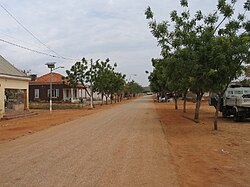
Caxito is a town, with a population of 55,000 (2014), and a commune in the municipality of Dande, province of Bengo, Angola. It is also the capital of the Bengo province.

N'dalatando, formerly Vila Salazar, is a town, with a population of 161,584 (2014), and a commune in the municipality of Cazengo, province of Cuanza Norte, Angola.

Sumbe, formerly Novo Redondo, is a city located in west central Angola. It is the administrative capital of Cuanza Sul Province. In 2014 its population was 279,968.

Ténès is a town in Algeria located around 200 kilometers west of the capital Algiers. As of 2000, it has a population of 65,000 people.

Dande, with its capital at Barra do Dande, is a municipality in Bengo Province in Angola.

Ícolo e Bengo is a city council in the province of Luanda in Angola. It had a population of 81,144 in 2014.

Ana Chaves Bay is a bay on the northeast coast of São Tomé Island in São Tomé and Príncipe. The capital city of São Tomé and its port are situated by the bay. It stretches from the Ponta Oque del Rei in the north to Ponta São Sebastião in the south. Forte de São Sebastião, now part of São Sebastião Museum, occupies Ponta São Sebastião. The port of São Tomé was built at the end of the 1950s on reclaimed land that extends 0.2 miles (0.32 km) north of Ponta São Sebastião; there is a 200 m quay at its north end, with a depth of 3 metres alongside. It is the main port of the country for solid goods; the port of Neves is the main point of entry for liquid fuels. The bay is generally shallow, offering anchorage for small vessels in depths of less than 5 metres (16 ft).

Belas is an city and one of the nine municipalities that make up the province of Luanda, as per the new administrative division of the province.

Mussulo is a peninsula and a commune, with a population of 7,798 (2014), located south of Luanda, Angola. It is part of the municipality of Belas, province of Luanda. It is actually a spit created by sediments from the Cuanza River, moved north by the Benguela Current. It is about 30 km long, at most 3 km wide, and at the narrowest parts in the south of the peninsula, less than 100 metres.
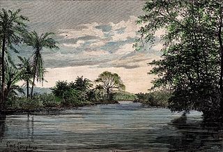
The Dande is a river in northern Angola with a source in the Crystal Mountains. Its mouth is at the Atlantic Ocean at Barra do Dande in Bengo Province. It also flows through the city of Caxito, and Uige Province. The river is 285 kilometres (177 mi) long. The lower section of the river is a floodplain with several small lakes including Lakes Sungue, Ibendua and Morima.
Porto Alexandre, occasionally known in English as Port Alexander, is a bay in Angola. It is located in the Namibe Province.
Calulo is a town, with a population of 44,000 (2014), and a commune in the municipality of Libolo, province of Cuanza Sul, Angola and the seat of the municipality. The town stands at an altitude of 990 m (3,250 ft) above sea level.
Barra do Cuanza is a town and commune of Angola, located in the province of Luanda.