Darton is a large village in the Metropolitan Borough of Barnsley, on the border with West Yorkshire, England. At the time of the 2001 UK census, it had a population of 14,927, increasing to 21,345 for both Darton Wards at the 2011 Census.
The Metropolitan Borough of Barnsley is a metropolitan borough in South Yorkshire, England; the main settlement is Barnsley and other notable towns include Penistone, Wombwell and Hoyland.

Brierley is a village in the Metropolitan Borough of Barnsley in South Yorkshire, England. The settlement is tightly clustered and green buffered on a modest escarpment close to the border with West Yorkshire, it is almost wholly in population south of the A628 road, and is less than 2 miles (3 km) to the south west of Hemsworth.

Carlton is a village in the Metropolitan Borough of Barnsley in South Yorkshire, England. It is situated between the villages of Athersley and Royston. The village is split in two with one half in the Monk Bretton ward and the rest in the Royston ward of the Barnsley MBC. It was built up on coking and coal mining industries and now has one of the largest industrial estates within the surrounding area. In the industrial estate lies a glass recycling plant, called Rexam. To its east stands the Mr Kipling cake factory, owned by Premier Foods. Until 1974 it was in the West Riding of Yorkshire.

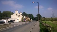
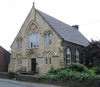
Barugh Green is a semi-rural commuter village in the metropolitan borough of Barnsley in South Yorkshire, England. The village falls within the Barnsley Metropolitan Council Ward of Darton West.

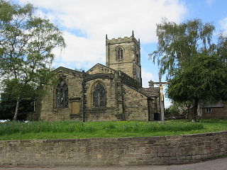
Ardsley is a small village approximately 3 miles (5 km) east from Barnsley and forms part of the Metropolitan Borough of Barnsley of South Yorkshire, England. The village is in the Stairfoot ward of Barnsley Metropolitan Council. It is historically part of the West Riding of Yorkshire. The A635 divides the village into two parts.

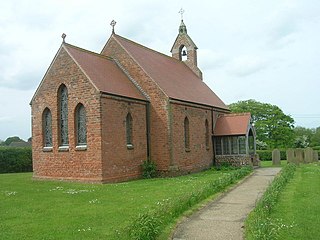
Ingbirchworth is a village and former civil parish, now in the parish of Gunthwaite and Ingbirchworth, in the Barnsley district, in the county of South Yorkshire, England. It is on the boundary of Kirklees in West Yorkshire. At the 2001 Census, the parish had a population of 400, increasing to 460 at the 2011 Census, and now estimated to be around 600.
Barugh (Great and Little) is a civil parish in North Yorkshire, England, covering Great Barugh and Little Barugh. Great Barugh is located at a junction on the road between Malton and Kirkbymoorside. Barugh is about 15 miles (24 km) west of Scarborough.
Thurlstone is a village and former civil parish, now in the parish of Penistone, in the metropolitan borough of Barnsley, in South Yorkshire, England. Originally it was a small farming community. Some industries developed using water power from the River Don such as corn milling, wire drawing and various wool and cloth processes. Most of these are now gone and only James Durrans and Service Direct owned by 'Don Eddie' remain. The village is now a dormitory for the urban areas of South and West Yorkshire. The village now falls in the Penistone West ward of the Barnsley MBC.
Bolton upon Dearne is a village in the Metropolitan Borough of Barnsley, South Yorkshire, England, in the part of the Dearne Valley through which the River Dearne passes. Historically part of the West Riding of Yorkshire, it is approximately 7 miles (11 km) east of Barnsley, 10 miles (16 km) west of Doncaster and 8 miles (13 km) north of Rotherham.

Minskip is a village in the civil parish of Boroughbridge, in North Yorkshire, England. It is on the A6055 road and 1 mile south-west of Boroughbridge. Minskip appears in the Domesday Book as Minescip, a name derived from the Old English gemaenscipe meaning a community or communal holding.

Wansford is a village and former civil parish, now in the parish of Skerne and Wansford, in the East Riding of Yorkshire, England. It is situated on the B1249 road and just to the north of the River Hull and the Driffield Canal. It is approximately 2.5 miles (4 km) south-east of Driffield and 3 miles (4.8 km) north-west of North Frodingham.
Towthorpe is a hamlet and former civil parish, now in the parish of Fimber, in the East Riding of Yorkshire, England. It is situated in the Yorkshire Wolds just north of the B1248 road, approximately 8 miles (13 km) north-west of Driffield and 2 miles (3 km) south-west of Sledmere. In 1931 the parish had a population of 66. The deserted medieval village is a scheduled monument.

Storwood is a hamlet and former civil parish, now in the parish of Cottingwith, East Riding of Yorkshire, England. It is situated approximately 6 miles (9.7 km) south-west of Pocklington and lies to the south of the B1228 road on the south bank of the Pocklington Canal. In 1931 the civil parish had a population of 63. Storwood was formerly a township in the parish of Thornton, in 1866 Storwood became a civil parish, on 1 April 1935 the civil parish was merged with East Cottingwith to create Cottingwith.
Little Hatfield is a small hamlet in the civil parish of Hatfield, in the East Riding of Yorkshire, England, in an area known as Holderness. It is situated approximately 3 miles (5 km) south-west of Hornsea town centre, and less than 1 mile (1.6 km) west of Great Hatfield.
Dunnington is a village in the civil parish of Bewholme, in the East Riding of Yorkshire, England. It is situated approximately 4 miles (6.4 km) north-west of the town of Hornsea and 2 miles (3.2 km) south-east of the village of Beeford.
Weardley is a village on the Harewood Estate in the parish of Harewood, at the northern edge of the City of Leeds metropolitan borough, West Yorkshire, England. The village is in the Harewood ward of the City of Leeds Metropolitan Council. In 1931 the parish had a population of 94.

Wike is a hamlet and a former civil parish, now in the parish of Harewood, north of Leeds, West Yorkshire, England. It is in the City of Leeds metropolitan borough and is north of Shadwell and Roundhay, west of Scarcroft and south of East Keswick. Many residents use facilities in Leeds as well as in the nearby town of Wetherby. In 1931 the parish had a population of 88.
Duggleby is a hamlet in the civil parish of Kirby Grindalythe, in North Yorkshire, England. It was historically part of the East Riding of Yorkshire until 1974. It was part of the Ryedale district from 1974 to 2023.

Midgley is a hill-top village in Calderdale, West Yorkshire, England. It is situated approximately 12 miles (20 km) east from Burnley and 4 miles (6 km) west-north-west of Halifax, and just north of the A646 road. Nearby villages are Mytholmroyd 1 mile (1.6 km) to the west-south-west, and Hebden Bridge 2.5 miles (4.0 km) to the west-north-west.