Bazaga | |
---|---|
Commune and village | |
Country | |
Elevation | 830 ft (253 m) |
Population (2012) | |
• Total | 37.571 |
Time zone | WAT (UTC+1) |
Bazaga is a village and rural commune in Niger. [1]
The Departments of Niger are subdivided into communes. As of 2005, in the seven Regions and one Capital Area, there were 36 départements, divided into 265 communes, 122 cantons and 81 groupements. The latter two categories cover all areas not covered by Urban Communes or Rural Communes, and are governed by the Department, whereas Communes have elected councils and mayors. Additional semi-autonomous sub-divisions include Sultanates, Provinces and Tribes (tribus). The Nigerien government estimates there are an additional 17000 Villages administered by Rural Communes, while there are over 100 Quartiers administered by Urban Communes.
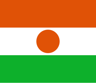
Niger or the Niger, officially the Republic of the Niger, is a landlocked country in West Africa named after the Niger River. Niger is bordered by Libya to the northeast, Chad to the east, Nigeria to the south, Benin to the southwest, Burkina Faso and Mali to the west, and Algeria to the northwest. Niger covers a land area of almost 1,270,000 km2 (490,000 sq mi), making it the largest country in West Africa. Over 80% of its land area lies in the Sahara Desert. The country's predominantly Islamic population of about 21 million live mostly in clusters in the far south and west of the country. The capital city is Niamey, located in Niger's southwest corner.
Allela is a village and rural commune in Niger.
Barmou is a village and rural commune in Niger.
Bosso is a village and rural commune in Niger. As of 2011, the commune had a total population of 52,177 people. It lies on the Nigerian border.
Doguerawa is a village and rural commune in Niger.
Dungass is a village and rural commune in Niger.
Falwel is a village and rural commune in Niger.
Gaffati is a village and rural commune in Niger.
Gazaoua is a village and rural commune in Niger.
Kirtachi is a village and rural commune in Niger.
Korgom is a village and rural commune in Niger.
N'Dounga is a village and rural commune in Niger.
N'Gonga is a village and rural commune in Niger.
Sabon-Guida is a village and rural commune in Niger.
Sinder, sometimes formerly spelled Zinder, is a village and rural commune in Niger.
Tabalak is a village and rural commune in Niger.
Tajae is a village and rural commune in Niger.
Tirmini is a village and rural commune in Niger.
Torodi is a small town and a rural commune in Niger. As a rural center, Torodi hosts a large weekly market and the seat of local tribal authority (canton). Torodi is in the Say Department of the Tillaberi Region, which surrounds the national capital, Niamey. Say Department, with its capital at the large Niger River town of Say, abuts Niamey to the southwest and across the river to the west. The town of Torodi lies about 60 km due west of the city of Say and 50 km east of the border with Burkina Faso. Torodi itself lies on a tributary of the Niger, the Gourbi river.
Tsernaoua is a village and rural commune in Niger.
Youri, Niger is a village and rural commune in Niger.
This Niger location article is a stub. You can help Wikipedia by expanding it. |
Coordinates: 13°48′N5°06′E / 13.800°N 5.100°E
A geographic coordinate system is a coordinate system that enables every location on Earth to be specified by a set of numbers, letters or symbols. The coordinates are often chosen such that one of the numbers represents a vertical position and two or three of the numbers represent a horizontal position; alternatively, a geographic position may be expressed in a combined three-dimensional Cartesian vector. A common choice of coordinates is latitude, longitude and elevation. To specify a location on a plane requires a map projection.